
Through My Lens: January Afternoon
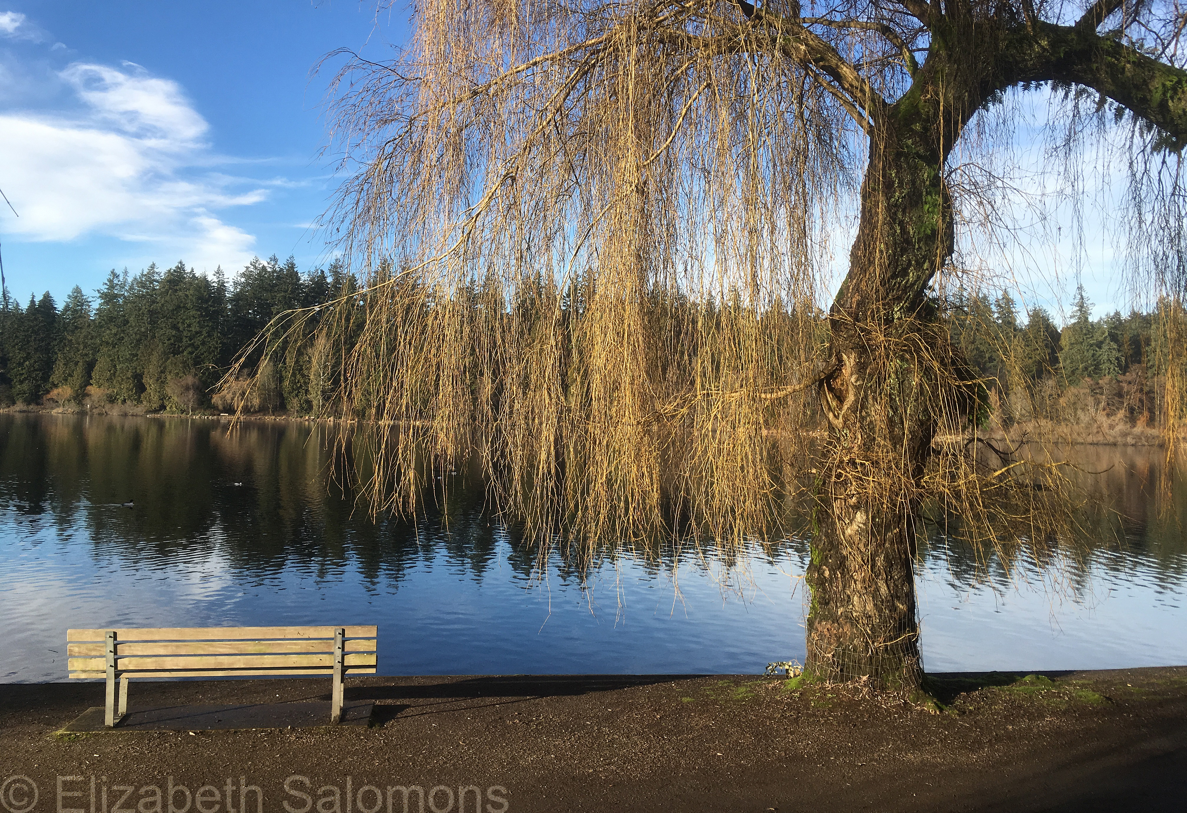
I was going through old photos and came across this one, taken on a sunny January afternoon some years ago. That’s Lost Lagoon in Stanley Park.
Through My Lens: Beech Tree

We are well and truly into the season where we start paying attention to the trees around us, and what will be eventually be some pretty spectacular colours.
Until then, here’s a beech tree I photographed last weekend in Stanley Park. Also pretty spectacular, even though its leaves haven’t yet turned.
Danger: Thin Ice
We had our week of winter this past week and we got it all: polar vortex, Arctic outflow, and 28 centimetres of snow.
That’s the most snow we’ve had in one go since 1996, but the sad reality is any amount of snow pretty much shuts down the city and makes the national news.
And the rest of Canada laughs.
The sustained colder temperatures made for some thin ice conditions. This is Lost Lagoon. And yes, the kids were playing pond hockey at the other end of the lagoon the day before the snow fell. I like my ice a little thicker, but I’m sure it made for some lasting memories for those kids who did get out on the ice.

Through My Lens: Golden Maple on Lost Lagoon

It’s been a while since I’ve posted a photo of our fall colours. And so, here’s one that I took a couple of weeks ago.
My West End
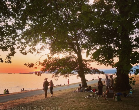
Last August, I had my cat-sitters over one evening for a picnic dinner to thank them for watching over my fur babies while I was away in Alberta. As soon as they arrived, we gathered up the dinner and some beach blankets and headed to the end of my street.
The end of my street is a grassy, treed spot between two beaches, never crowded but with a perfect view of the sunset. As a backyard, it’s great — even though I share it with the entire neighbourhood. At one point during the evening, I looked around at the dozens of people enjoying their own picnics, and marvelled at how much I love where I live, and that, even after living here for a quarter of a century, I have yet to tire of it.
Yup, you read that right. Twenty-five years ago today, I moved into my first apartment in the West End. And as long as I’ve been writing and posting on this blog, I’ve been sharing photos and stories about my home. It’s why I called the blog There and Back Again.
Because I always come back.
In honour of this momentous anniversary, here are some of my favourite, previously unposted, photos of my West End.


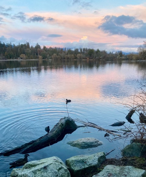
Through My Lens: Reflections

Here’s another photo of Lost Lagoon that I took some time ago. It’s a favourite of mine; the clouds reflected in the water remind me of a Dutch landscape painting.
Through My Lens: In the Pink
Did you know that three days ago was Blue Monday? Apparently it’s the most depressing Monday of the year in the Northern Hemisphere.
I can believe it. But yesterday, when the sun (finally) came out and I got myself over to Lost Lagoon, all I saw was pink. I took this photo a few minutes after the sun went down.
Snow Golf
All right. Let’s get the obligatory first-snow-of-the-season post out of the way. Here’s a photo I took a week ago today.

Yup, we went from summer to winter in less than three weeks. First the rains came in a series of atmospheric rivers, and then the first bad windstorm of the season. Trees stressed from the drought and still in full foliage came down by the thousands, pulling power lines down with them. At the height of the storm, more than 300,000 people were without power.
After all that, an Arctic outflow blanketed much of the province for the better part of a week. Vancouver’s dusting of snow on Monday night a week ago was its earliest snowfall in decades.
Just so I’m not writing about our weather every single week, I put off posting this photo until today. That’s because I knew I wanted to acknowledge the one-year anniversary of the catastrophic floods and mudslides that ravaged British Columbia. There’s been a lot of local media coverage about it the past few days because, well, it was pretty traumatic. A lot of people are still in recovery mode.
Even the barge that came up on the rocks at the end of my street a year ago today is still there. In the end, it had to be dismantled and taken away bit by bit. A salvage team has been working on that momentous task since last summer. They’re almost done and I cannot lie: I’ll be glad when it’s gone.
Incidentally, although the Pitch & Putt at Stanley Park is open year-round (subject to conditions), it was closed the day I took the above photo. But obviously that did not stop the die-hard golfers you see in my photo.
Then again, Vancouverites are known to never let the weather stop them from doing what they love best.

Through My Lens: In the Weeds
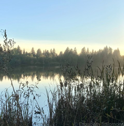
Here’s one last photo from our spectacularly warm fall, which I took just two weeks ago.
For obvious reasons, I’m calling this one “in the weeds.”
Through My Lens: Delphiniums

Summer has finally arrived in Vancouver. Better late than never, I say. We had our first hot stretch this past week and I tell you, it was glorious.
Two nights ago, I headed over to the Stanley Park Rose Garden because I knew the roses would be in full bloom. And they were. So beautiful.
But what really grabbed my attention were these delphiniums. I could not get over the vivid blues and purples.
Stunning.
