
Getting Around Serifos
Serifos is not a large island — only 10 kilometres across at any given point — and I had a few options for getting around.
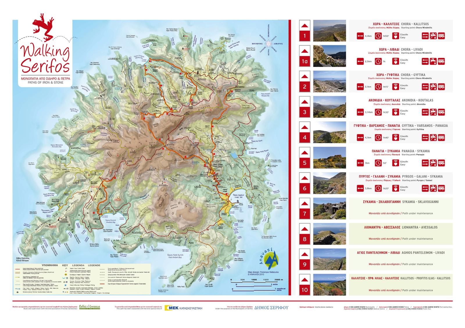
One choice was to rent either a car or scooter in Livadi. There is basically one road encircling the entire island, and your biggest decision is whether to go clockwise or counterclockwise.
When I told my home-exchanger I was going to hire a car for a day or two, she offered to loan me hers. I dubbed it the Purple Raison (for obvious reasons) and used it to get to a monastery on another side of the island, as well as some of the beaches.
To be honest, though, I was perfectly happy to return the car and go back to my usual way of exploring: on foot or, occasionally, by boarding a bus.
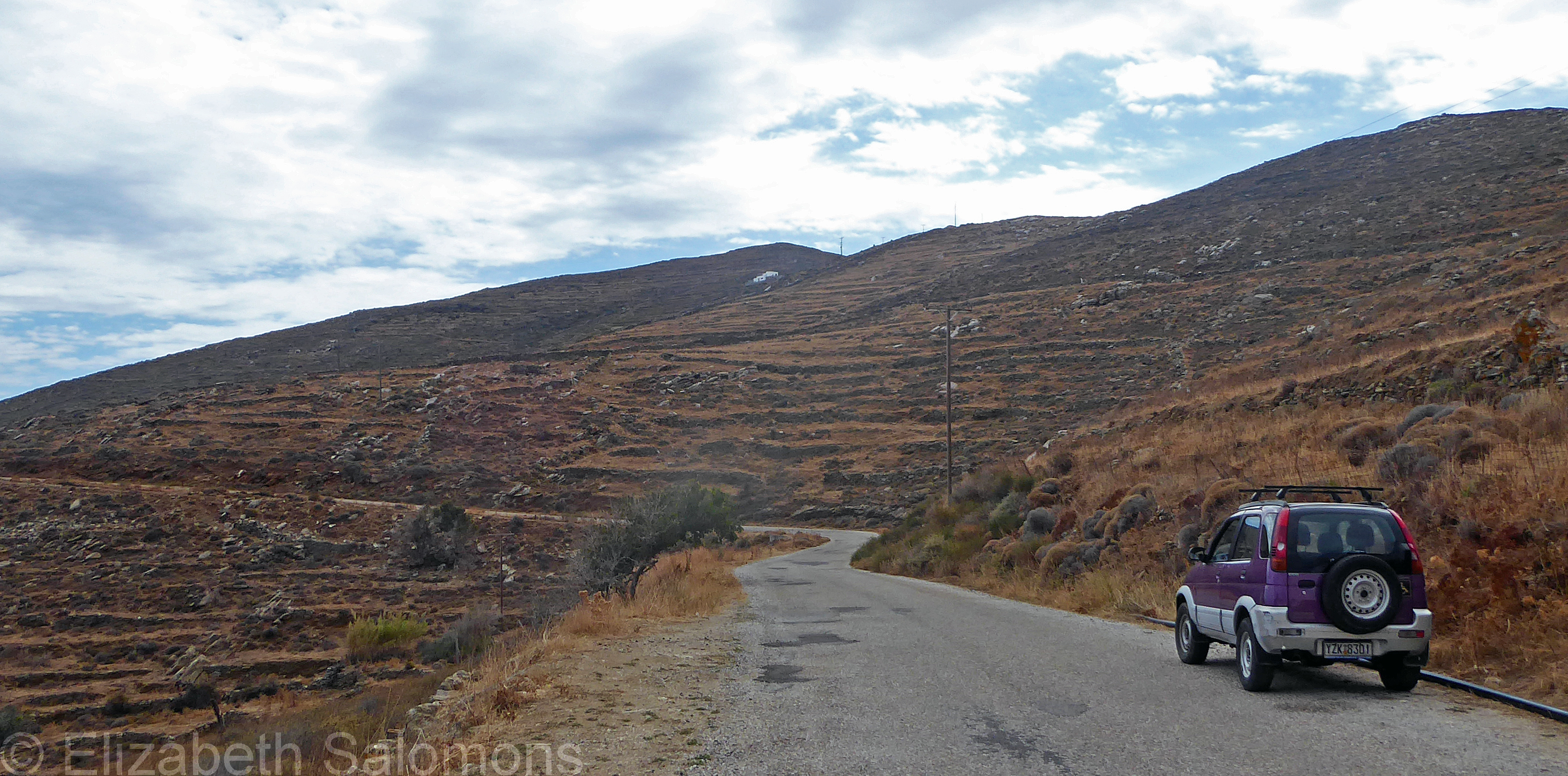
The bus that runs between Livadi and the Chora goes once an hour in either direction. It was never full and you pay the driver your 2 euros when you board. There’s no way to signal your stop, however; you simply make your way to the front of the bus as it gets close to where you want to be let off.
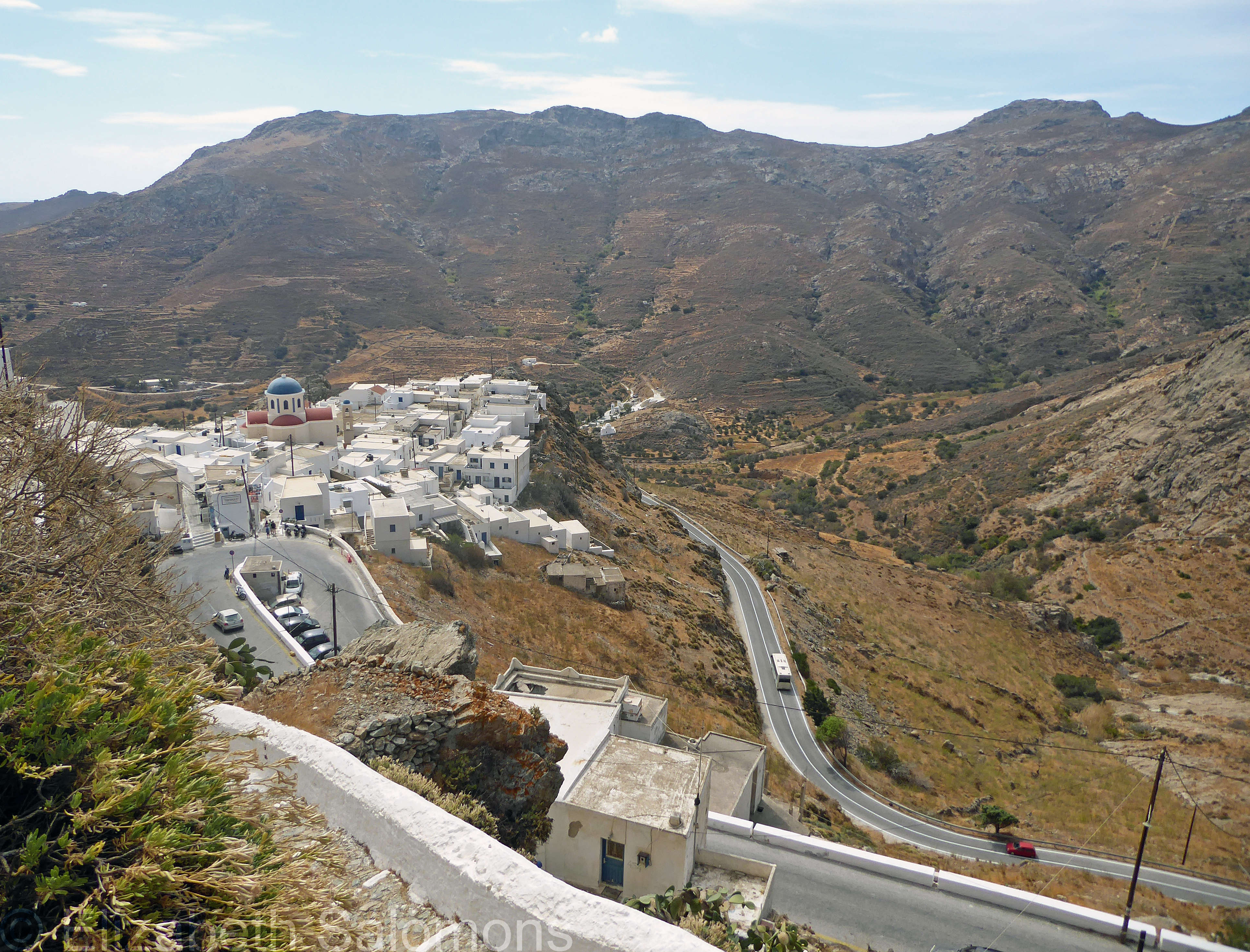
That Livadi–Chora bus switched to its winter schedule while I was on Serifos — meaning its last run up to the Chora was in the middle of the afternoon. Apparently, the winter schedule is dictated by the school run, not the tourists. My last few days on Serifos, if I happened to still be in Livadi in late afternoon, my only option was to walk up the old donkey path.
One day, I walked from my home in the Chora to Paralia Psili Ammos, and then, when I’d had my fill of the beach, over to Livadi where I caught the bus up to the Chora.
I didn’t get to every corner of the island during my two weeks on Serifos because, as I’m fond of saying, I always like to leave something to do to ensure a return visit. There are some 80 kilometres of hiking trails on Serifos, and I look forward to exploring more of them when I return to Serifos.
From Vancouver to Serifos
When I told people I was going to spend two weeks on a Greek island, their reaction was always, “Nice!” But when I told them I was going to Serifos, their reaction was always, “Where?”
Like most Canadians, they had never heard of the place. Nor had I, until I got a home exchange offer I couldn’t refuse.
Serifos is in the Cyclades, an island group in the Aegean Sea — the part of the Mediterranean that lies between Greece and Turkey.
It’s also a bit of a trek from here to there. First, a long-haul flight from Vancouver to Athens (via Heathrow), then a taxi ride from my Athens hotel to the Port of Piraeus, and, finally, a catamaran fast ferry to Serifos.
The fast ferries that ply the Aegean are nothing like our BC Ferries. Because they are fast ferries, there are no outer decks and my assigned seat was in the bowel of the vessel, nowhere near a window.

The port at Serifos, too, is nothing like the highly automated ferry docks that line the coast of BC. The ferry comes alongside the concrete pier for just a few minutes; there’s no dawdling when offboarding as a foot passenger.

But once I disembarked, it was a short walk to where my home exchange partner was waiting with her car. And not long after that, we were pulled over on the main road that goes between the port of Serifos to the Chora.
We got out of the car, I grabbed my bags, and she pointed up to a white house with green trim.
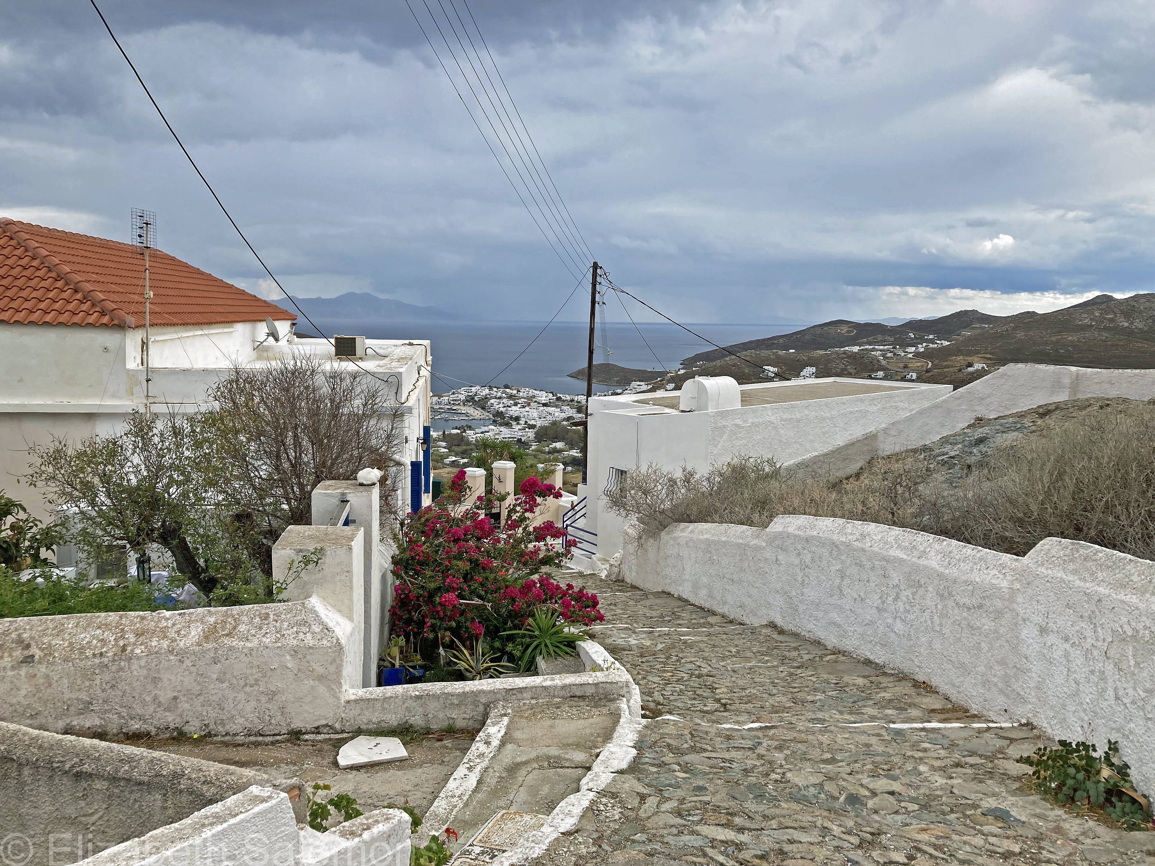
“See the solar panels on the roof?” she asked. I nodded. She had an appointment to get to, so we said goodbye and I made my way up the donkey path to my new (temporary) home.

It was a typical Cyclades house: small and square, white on the outside, cool on the inside, painted door and shutters.

I was delighted by the welcoming committee.

A couple of hours later, I had decompressed from my journey, unpacked, and was wondering what to do next when my home exchanger messaged me. She was on her way back to Livadi — that was the name of the town by the port. Did I want a ride?

Yes, please.
When she asked where she could drop me, I said I hadn’t eaten since breakfast. She stopped the car in front of a restaurant she liked.
“Go sit at one of the tables by the water,” she said. “They will come to you.”

And so I enjoyed my first meal of many on Serifos, overlooking an idyllic scene and marvelling at how long it had taken me to get here, literally and figuratively.
And relishing the thought that I had two whole weeks to explore the place.
Through My Lens: Ships and Foliage at Sunset

I’ve been a bit neglectful about posting lately. Because summer. (Who wants to be sitting at their computer when you can be outdoors?)
This is a favourite photo of mine; I took it as I walked along the seawall one warm August evening some years ago.
Salish Heron
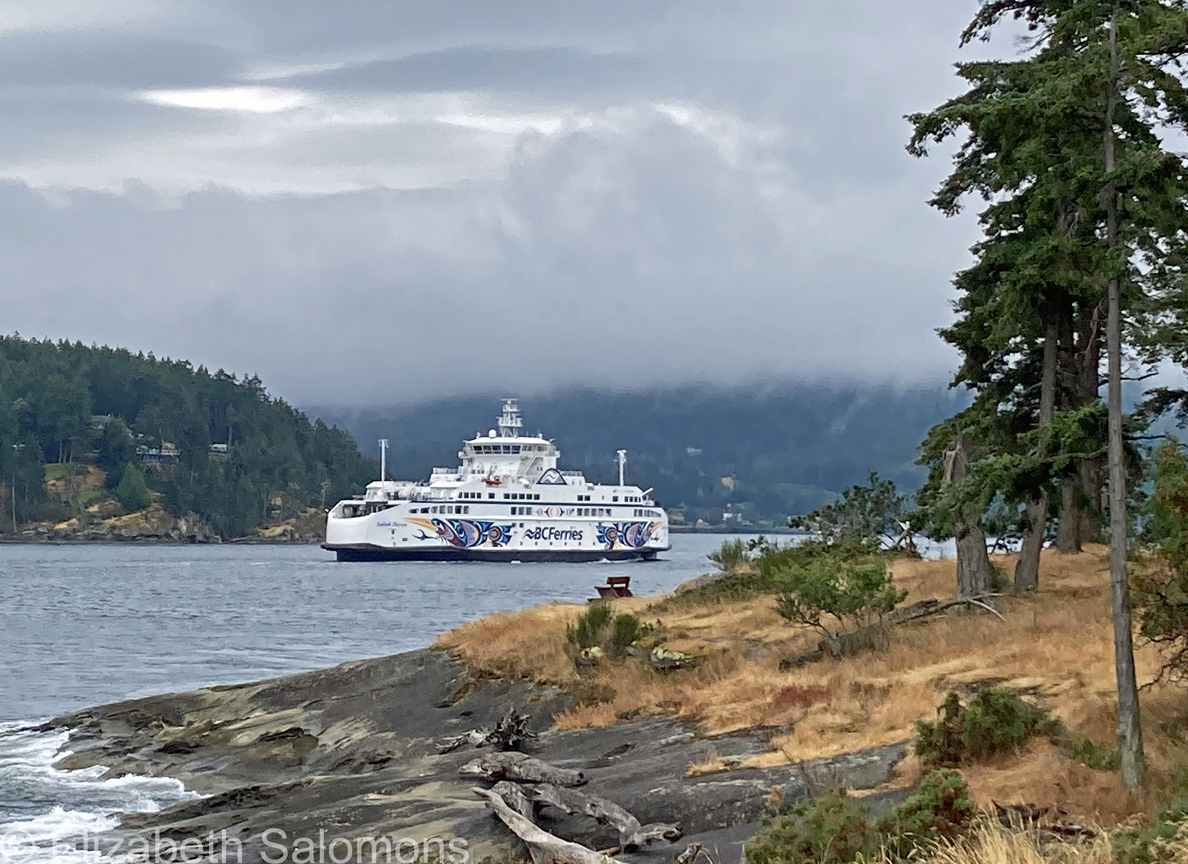
Time for my obligatory summer post about touring the Salish Sea on a BC ferry. I took this photo last month from the southern tip of Galiano Island. That’s the Salish Heron entering Active Pass.
Like the other Salish-Class vessels, the ferry is covered in original Coast Salish artwork inside and out. Penelakut First Nation artist Maynard Johnny Jr. was the artist for the Salish Heron.
Salish Eagle

My latest BC Ferry ride — and my third of the summer — was on this boat, the Salish Eagle, which took me to and from Galiano Island just over a month ago.
Three of these Salish-Class vessels came into service in 2017 and a fourth one last year. Built in Gdańsk, Poland, they are the first ships in BC Ferries’ fleet to run on liquefied natural gas, thereby reducing their emissions. Compact compared to the bigger boats that sail between Vancouver and Vancouver Island, the Salish-Class vessels go to and from the Southern Gulf Islands and between the Sunshine Coast and Vancouver Island. They carry up to 600 passengers and crew and 138 cars, and I absolutely love sailing on them.
Each Salish-Class vessel has original Coast Salish artwork adorning its interiors and exteriors. John Marston of the Stz’uminus First Nation is the one who designed the artwork you see on the Salish Eagle.
Through My Lens: Sidney by the Sea

Summer has only just started and already I’ve had a number of ferry rides.
My first was a quick hop over to Sidney to have lunch with a friend. Sidney is located on the Saanich Peninsula of Vancouver Island and is considered a suburb of Victoria. It has a lovely waterfront you can stroll along (see above photo), a handful of touristy-type shops (that all seemed to close early), and quite a few places to have lunch (all of which were very busy despite it being a weekday). It took us three tries before we found a place that didn’t have a half-hour wait, although I suspect the wait might have been more about staffing shortages than about there being no empty tables.
It doesn’t feel like summer, to me, until I’ve been on a BC ferry. The trip from Tsawwassen to Swartz Bay takes you through Active Pass, one of the most stunning places on the planet, in my opinion. I could not stop gushing about how beautiful my morning’s ferry ride had been to our server at the pub where my friend and I had lunch. She gave me such an odd look that I realized either I need to get out more, or she has never lived anywhere else and still takes her surroundings for granted.
I sure don’t.
Oh, the Weather Outside Is Frightful
Oooh boy. Christmas travel is chaotic at best, but this year is turning out to be a real doozy. On top of today being the busiest travel day of the year, as per usual, the entire country from coast to coast to coast is being walloped by storms.
Here in Vancouver, it’s our third storm since Sunday. Bridges are closed, some lines of the Skytrain aren’t running, and this afternoon I waded through a week’s worth of snow in a futile attempt to get groceries. (Given Vancouver’s minimal snow removal budget, our residential side streets do not get cleared.)
Half of the flights out of Vancouver since Sunday have been cancelled. And as soon as one major Canadian airport is a mess, there’s a ripple effect on all other major airports in the country because none of the planes and flight crews are where they’re supposed to be. Two young people related to me spent most of Tuesday at YVR, hoping against hope their flight to Alberta would go. It did not, and they left instead by train this afternoon, hoping to get home to their parents by Christmas Eve. I told them that taking a train through the Rockies was a rite of passage; I didn’t have the heart to tell them that VIA Rail never runs on time.
Locally, BC Ferries has cancelled multiple sailings, not only due to the inclement weather, but because of frozen pipes and staff not being able to get to the terminals. Yesterday, the BC government held an impromptu news conference, and the minister with the most unwieldy portfolio title ever — Emergency Management and Climate Readiness — urged everyone to stay off the roads except in case of emergency.
That it is the first Christmas since the start of the pandemic where people finally feel comfortable travelling seems a cruel irony. As the Yiddish proverb goes, “We plan, God laughs.”
All I can say is: I wish everyone travelling mercies, good health, and a very, merry Christmas. Goodness knows, we deserve one.
Supply Chain Issues
Supply chain issues seem to be a fact of life these days. Whether it was the lack of flour and eggs in our grocery stores back in March 2020, the recent shortage of infant formula in the United States, or (my latest issue) having to wait up to two months for a backorder of my preferred brand of cat food — all these things make us stop and think, “Wait a minute. What’s going on here?”
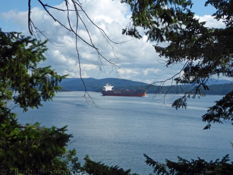
I learned on my last visit to Galiano Island that freighters like to park themselves just off the northern tip of the island while waiting for an empty berth at the Port of Vancouver. English Bay always has a number of waiting freighters as well, but when the bay is full, those ships have to look elsewhere for a place to anchor and wait. Vancouver is Canada’s largest and busiest port, with 3000 ships arriving every year. That’s a lot of ships and an awful lot of waiting time.
But while on Galiano again last weekend, I was surprised to learn that often these ships are waiting for what seems like an awfully long time. The container ship in this next photo? It was sitting off the north end of the island for three weeks.
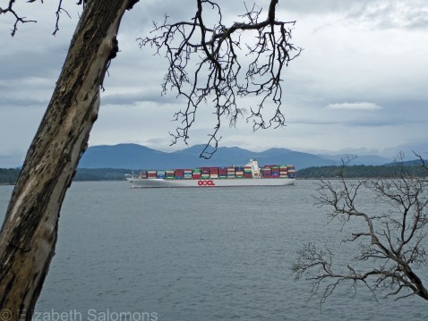
I can’t see any way that a three-week delay to offload a fully loaded container ship from Asia doesn’t add to our supply chain problems. Not to mention the cost of goods.
Or the seafarers stuck on board. Waiting.
The Beginning of the End?

Look who’s back!
Yesterday, Vancouver welcomed its first cruise ship in 891 days. Holland America’s Koningsdam stopped for a day at Canada Place, after spending Saturday in Victoria. If ever there was a sign that we are past the pandemic, I’m thinking this is it.
Except we’re not past it. Not really. A sixth wave is on its way and those of us who are immune-compromised or work in health care or have friends or family who are immune-compromised or work in health care or are not yet eligible for vaccines (think babies) know there are still lots of risks. There has been an awful lot of talk about how we have to learn how to live with Covid, which doesn’t seem to give much consideration to those still at high risk of dying of Covid.
That aside, tourism is a billion-dollar industry in Vancouver, and those of us who work in tourism and hospitality welcome the news that our city is once again a safe destination for anyone who wants to visit. The Port of Vancouver has offered shore power to cruise ships since 2009, which means that 60 percent of the ships that dock here can run on lower-emission electrical power while in port instead of their diesel-powered auxiliary engines.
While I was taking this photo, a so-called Freedom Rally was gathering behind me to protest vaccines. I’m not sure what their issue is at this point since all of BC’s remaining restrictions concerning Covid-19 were lifted last week.
As I watched the protestors for a moment, a young man walked past me, wearing a black sweatshirt with the word “Ukraine” in large blue and yellow letters. The irony of the moment made my head spin.
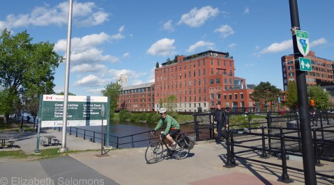
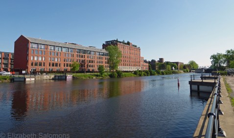
Lachine Canal
After I had explored Vieux-Montréal to my heart’s content, I decided to walk the length of the Lachine Canal. This was solely to satisfy my curiosity about a canal I had read about when I was doing a degree in Canadian history (a long time ago) and editing history textbooks (much more recently).
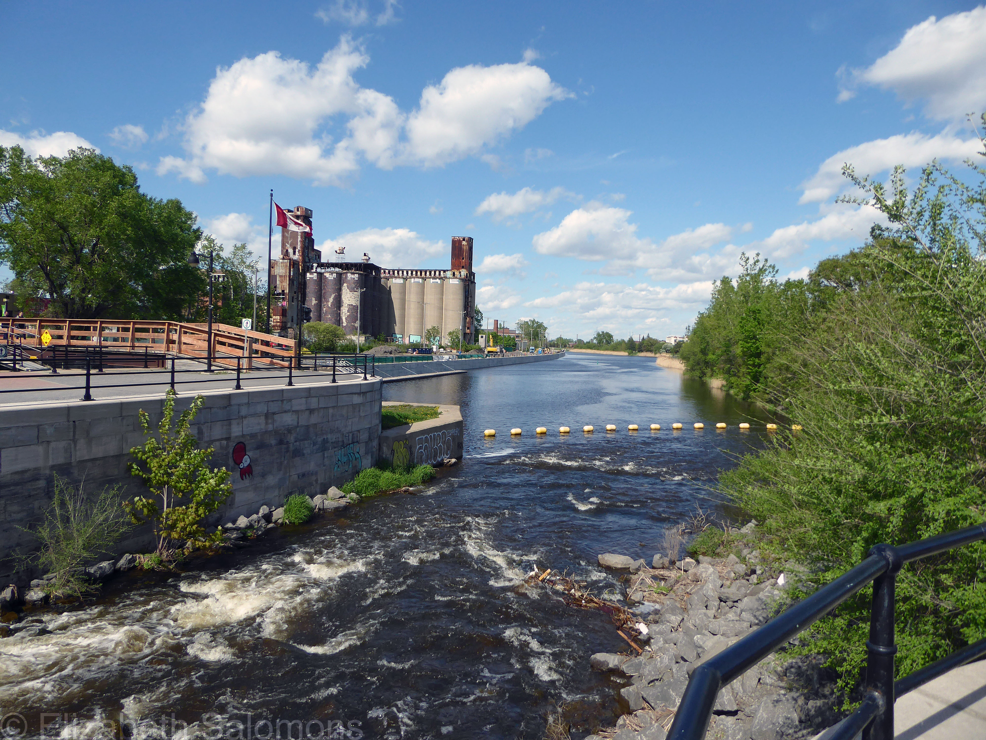
The Lachine Canal was built across the southwest part of the island of Montreal to allow ships to bypass the Lachine Rapids on the Saint Lawrence River. The name comes from the French for China (La Chine) and reflects the original goal of those early European explorers: to find a route across the continent and on to China.

Digging 14 kilometres of canal and building seven locks took four years. Most of the work, completed in 1825, was done by Irish immigrants. After the canal was widened and deepened in the 1840s, its entire length became the centre of Montreal’s industry, and the city became the centre of Canada’s manufacturing and trade. Montreal soon quadrupled in size and remained Canada’s largest city until the 1970s.
Eventually though, after the opening of the Saint Lawrence Seaway in 1959 that could accommodate larger ships, the canal lost its significance. It was closed to shipping in 1970.
It reopened to pleasure boats in 2002 and a bike path lining the canal was also completed. The Lachine Canal was declared a National Historic Site in 1996.
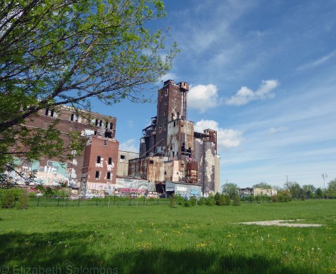
The warehouses and factories that line the canal have been converted to residential lofts and condos.
I wanted to walk the Lachine Canal from one end to the other, but after taking the Metro to the end of the line, my starting point was somewhere around its mid-point. As I walked all the way back towards Vieux-Montréal, I realized a better option might have been to rent a bike in the Old Port area and cycle as far as possible before turning around.

Which means I already have my first activity planned for when I return to Montreal.
