
From Fira to Oia
Every major trip I’ve taken has that one memorable day that stands head and shoulders above the rest. For Greece, it was my second day on Santorini, when I walked from Fira to Oia.
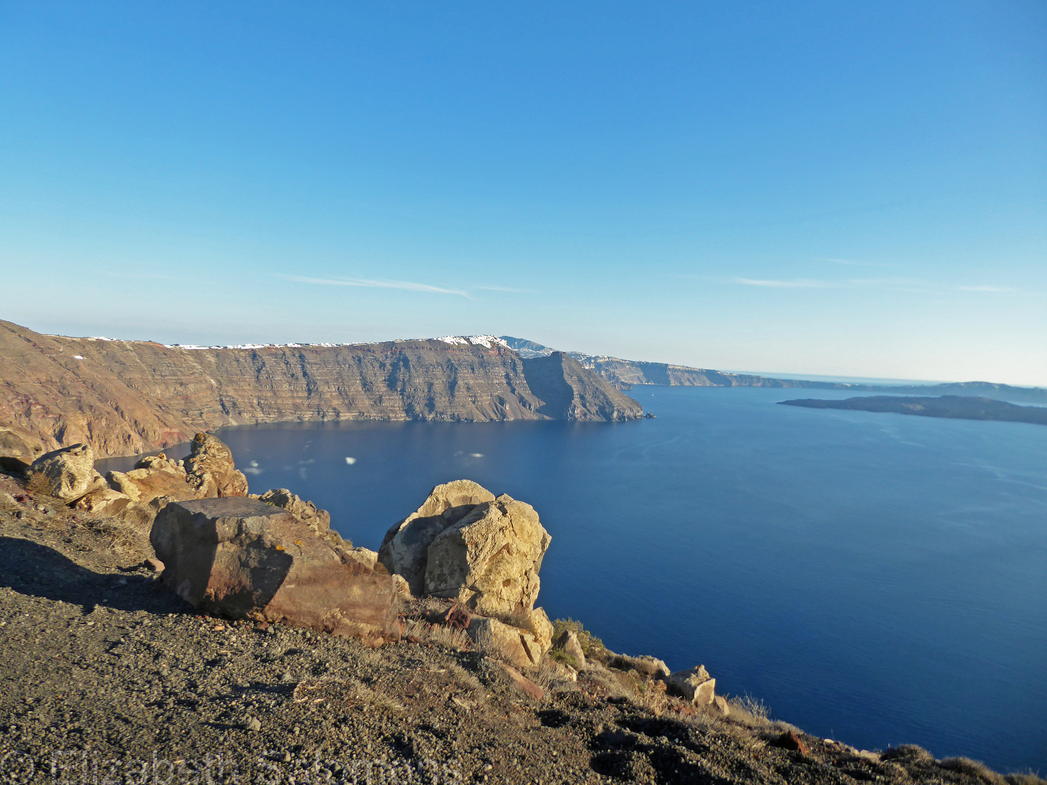
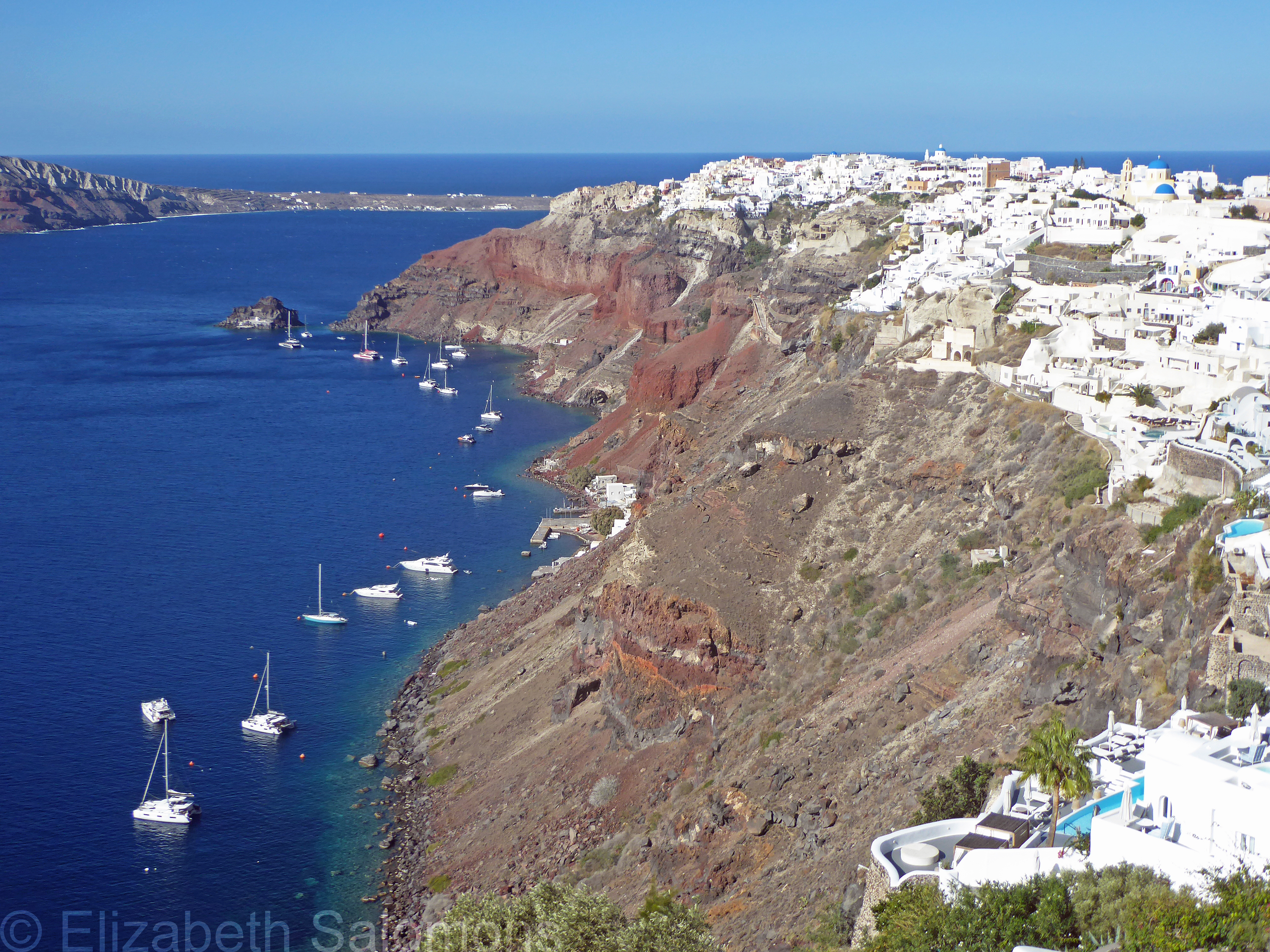
Some call the Fira-to-Oia walk one of the most spectacular short hikes anywhere. I spent my childhood summers in the Rockies, so I wouldn’t go that far, but it truly is beautiful. That’s because the entire route follows Santorini’s clifftop, offering stunning views of the caldera from start to finish.
I was advised to take the bus to my starting point and walk back, rather than trying to board an overcrowded bus at the end of the day. So, since I was staying in Oia, I jumped on the bus to Fira where I spent the morning taking photos. After enjoying a leisurely lunch overlooking the caldera, I started out. It was around 2 pm — not advisable in the heat of summer, but no problem in October. With a distance of 10.5 kilometres, the walk can take anywhere from two to five hours, depending on your pace and how often you stop.
The first bit, from Fira to Firostefani to Imerovigli, is the steepest part, but it’s not long. It’s difficult to tell where one village ends and the next one starts as the path is lined with hotels, shops, and restaurants.
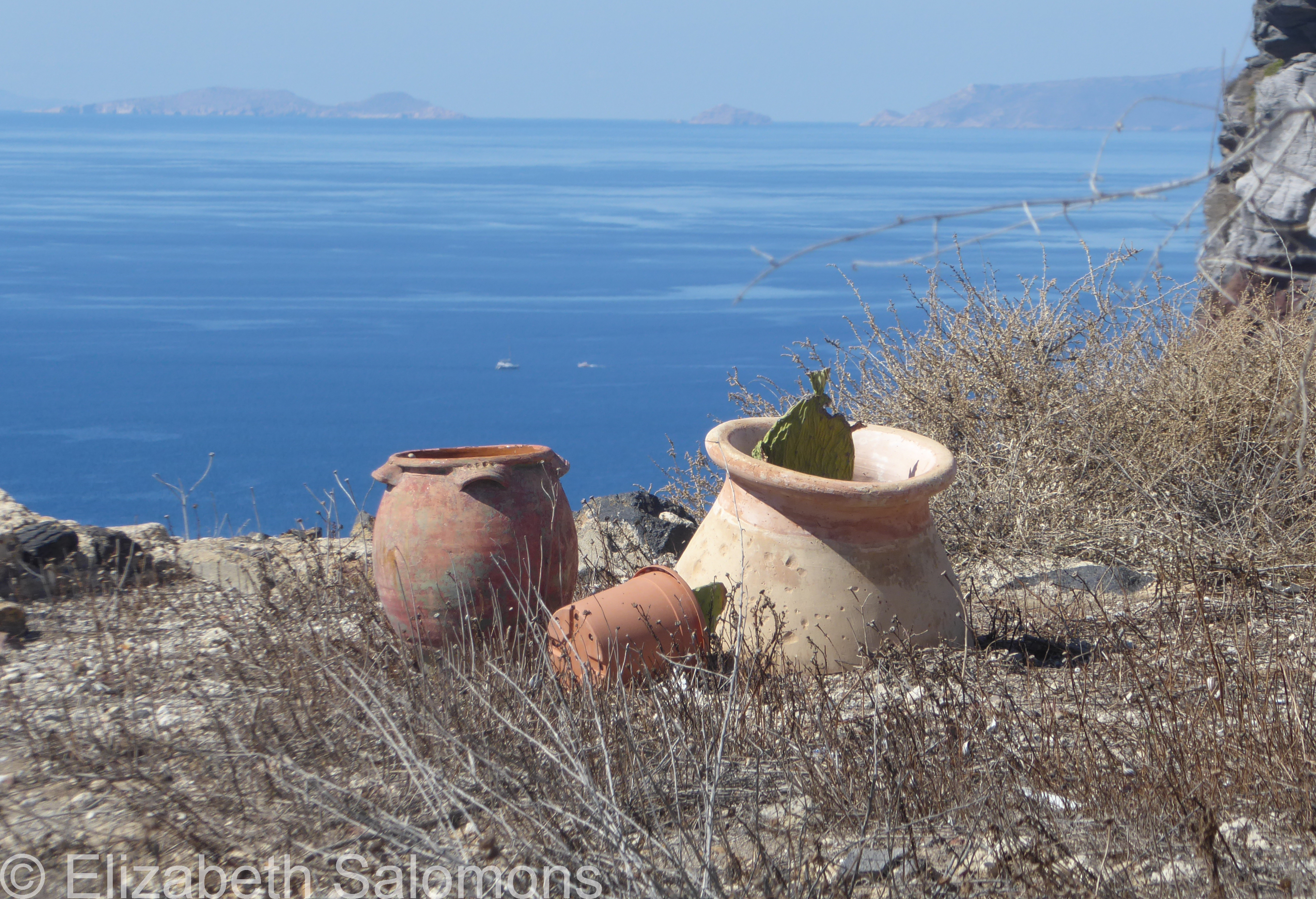
Then comes a longer, quieter stretch. On my left was the caldera, and on my right, hotel after hotel and villa after villa. Each ocean-facing suite had a private pool or hot tub and a million-dollar view.
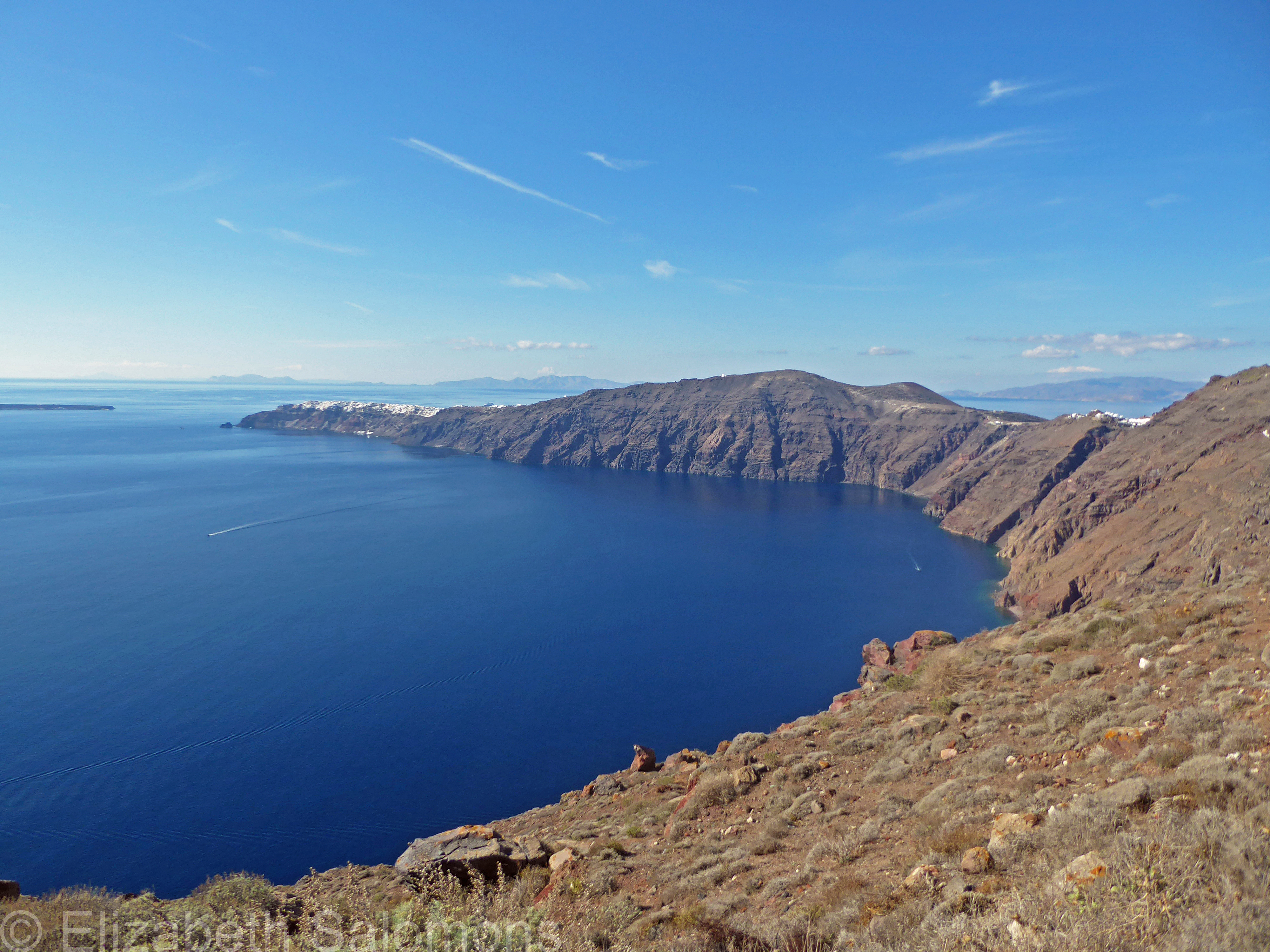
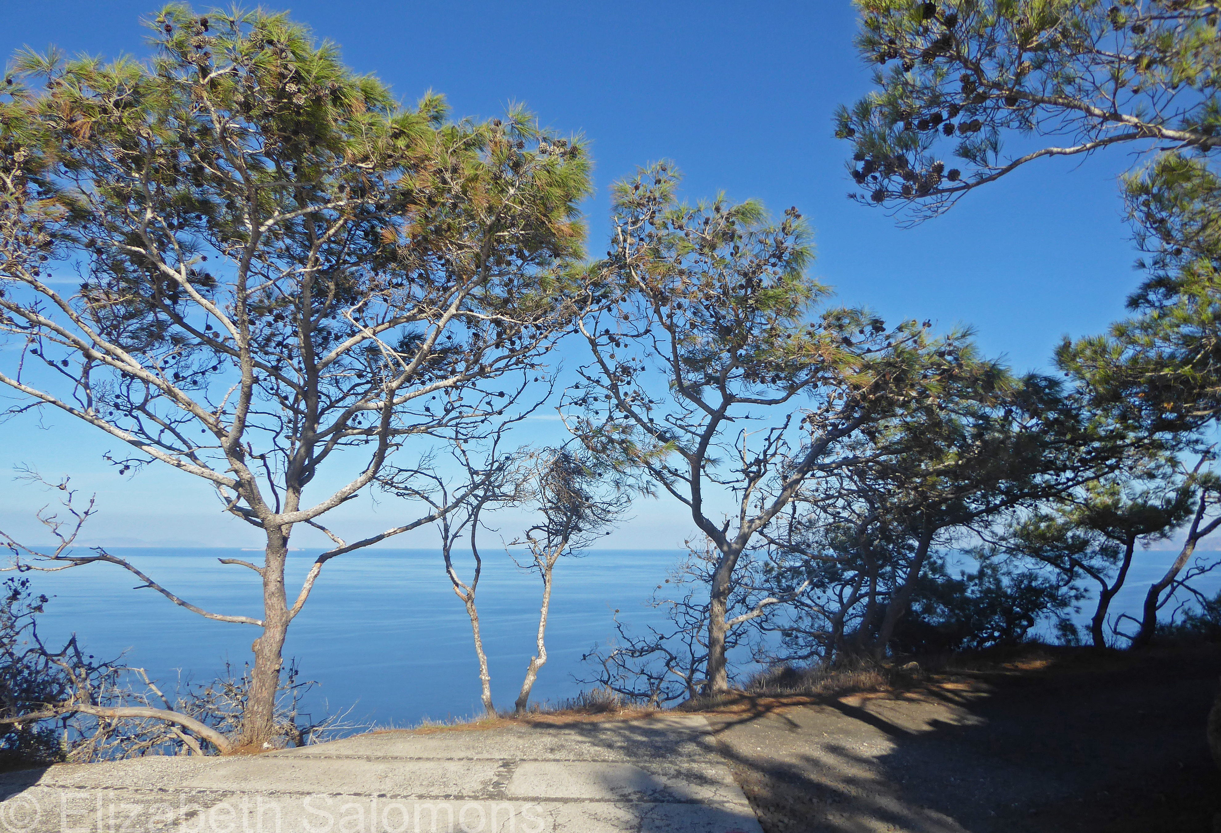
Eventually, you come to a monastery and begin a long, slow descent on a rustic, more natural path. Here, it’s best to have good walking shoes. (I was wearing runners.) My phone had run out of battery by this point, so I was guesstimating how far I had to go and carefully rationing the water I had bought in Firostefani.
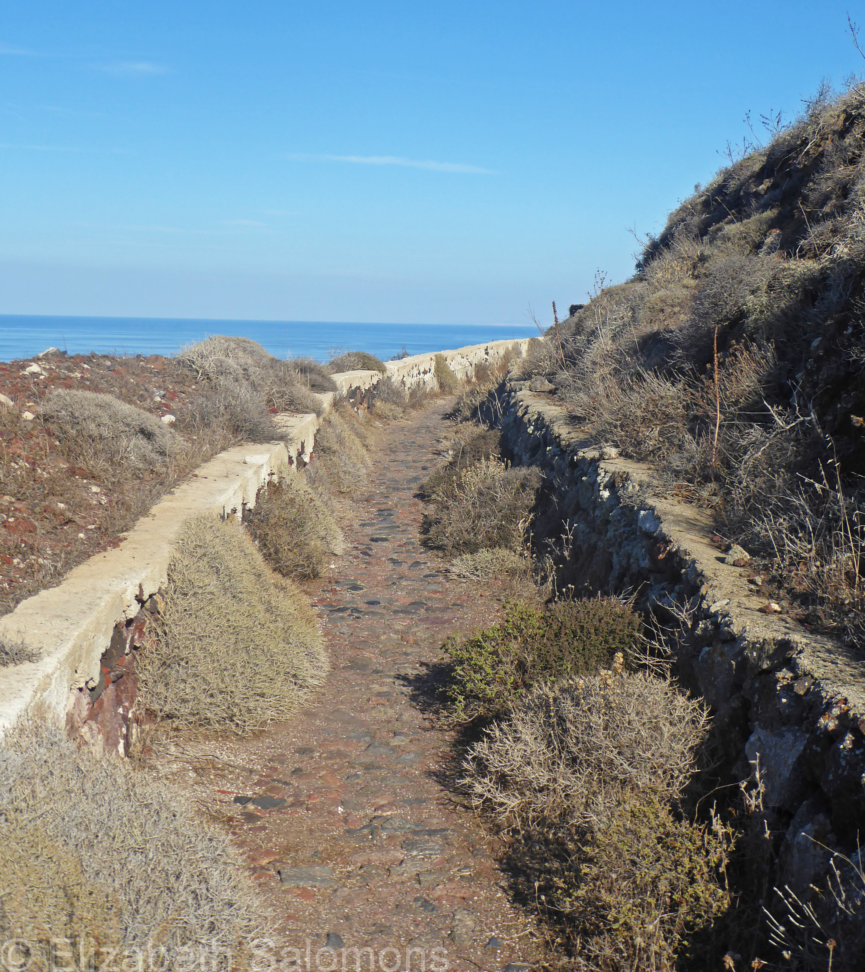
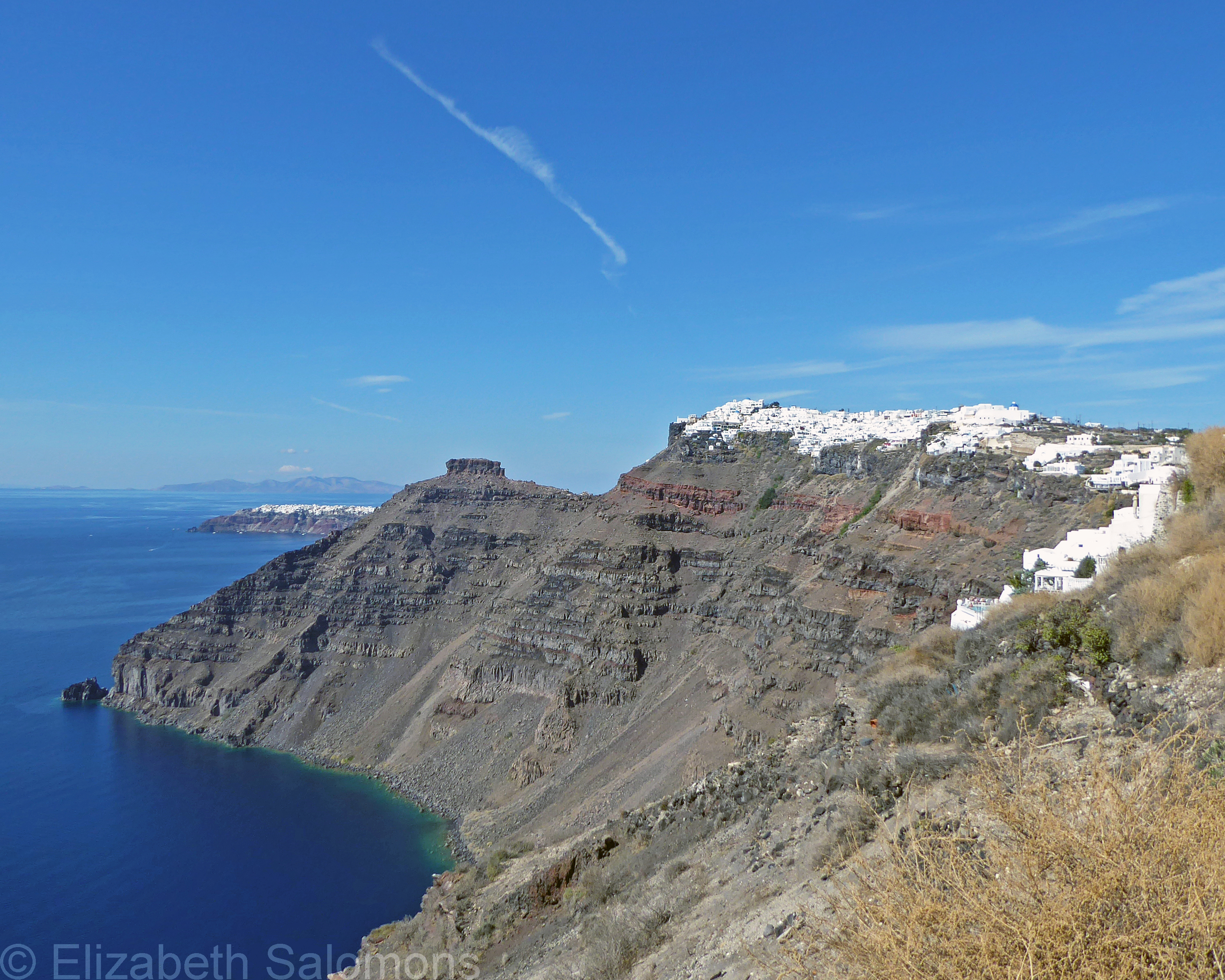
Thankfully, at the bottom of this hill I came across a shack selling cold beverages. Then came a short bit along the roadway, and a long, slow climb to another church overlooking the caldera.
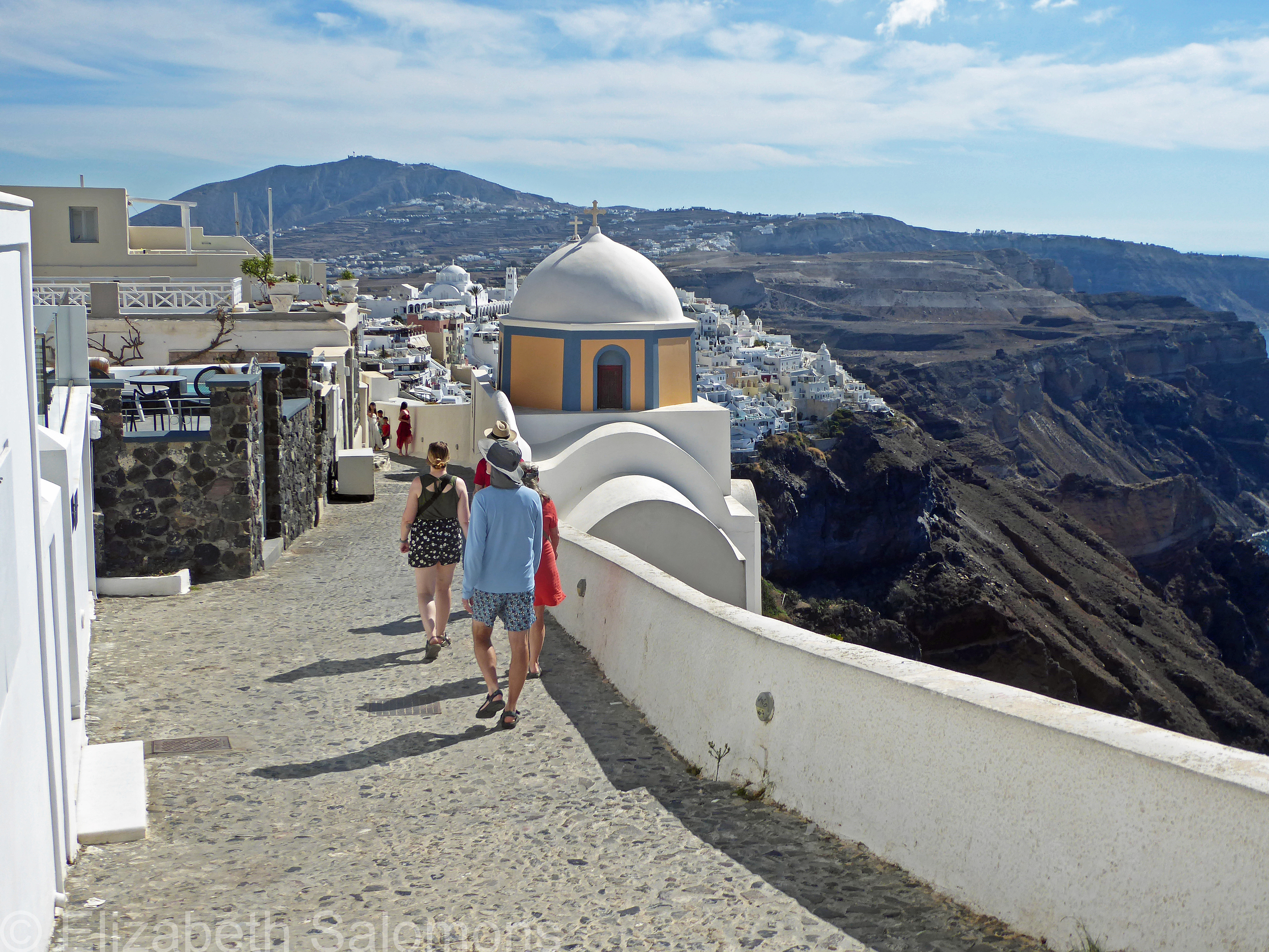
From here, I continued on a trail that I thought would be on the caldera side of the clifftop, but it took me pretty much straight down to the main road into Oia where I had a good 20-minute walk along a not-so-pretty sidewalk — an unfortunate outcome of not having a working phone at that point. But the road led me straight to my hotel, where I collapsed in my room around 6:30 pm, so it was all good.
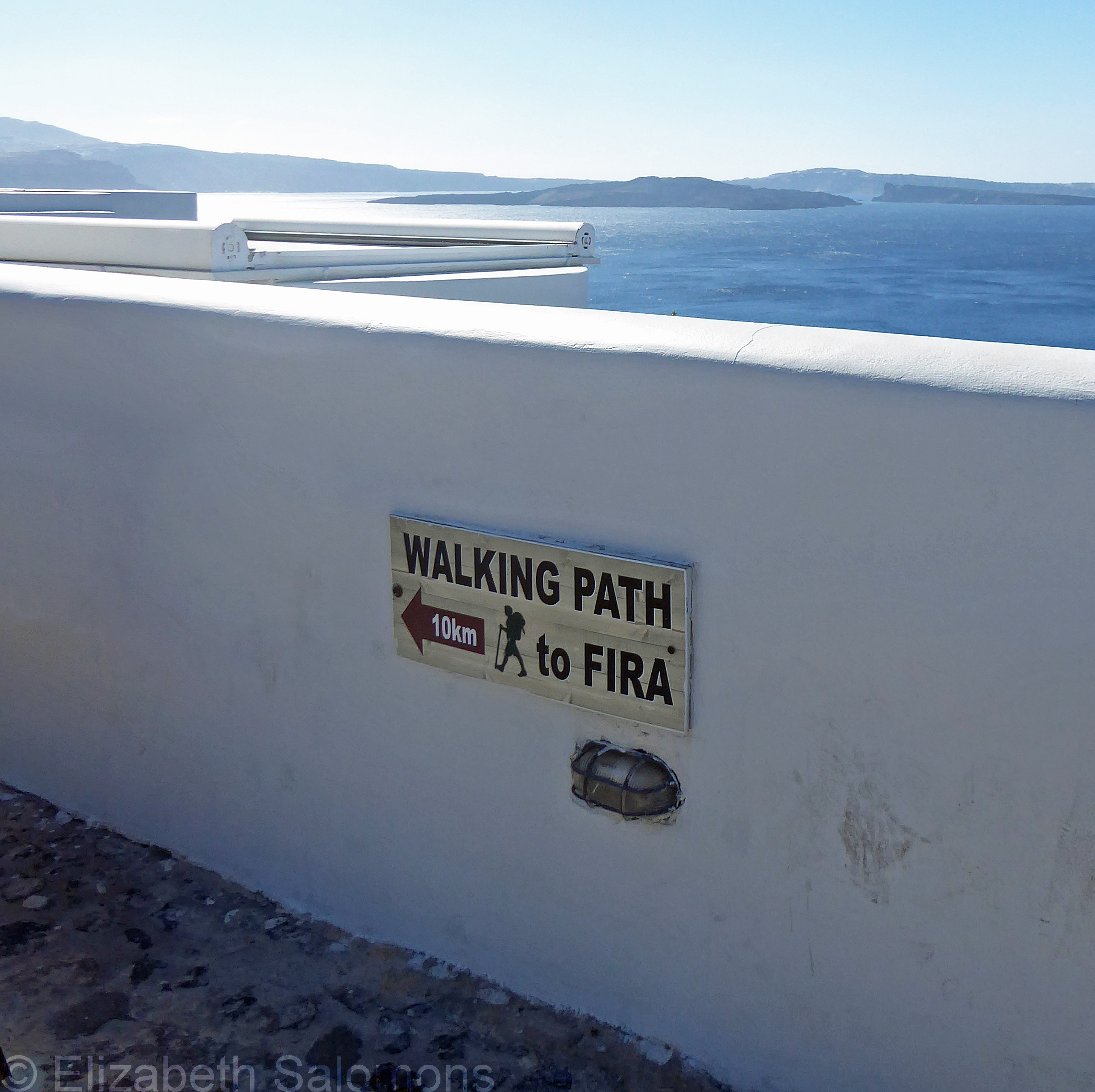
Since the trail to Fira ended directly across the road from my hotel, the next morning I walked up the trail part way to see what I had missed.
I don’t expect I’ll ever get back to Santorini, but a bit of advice if you go and decide to do the Fira-to-Oia walk: ensure you have a proper map or working phone so you don’t end up on a roadway like I did, and carry more water than you think you’ll need.
Even in October.
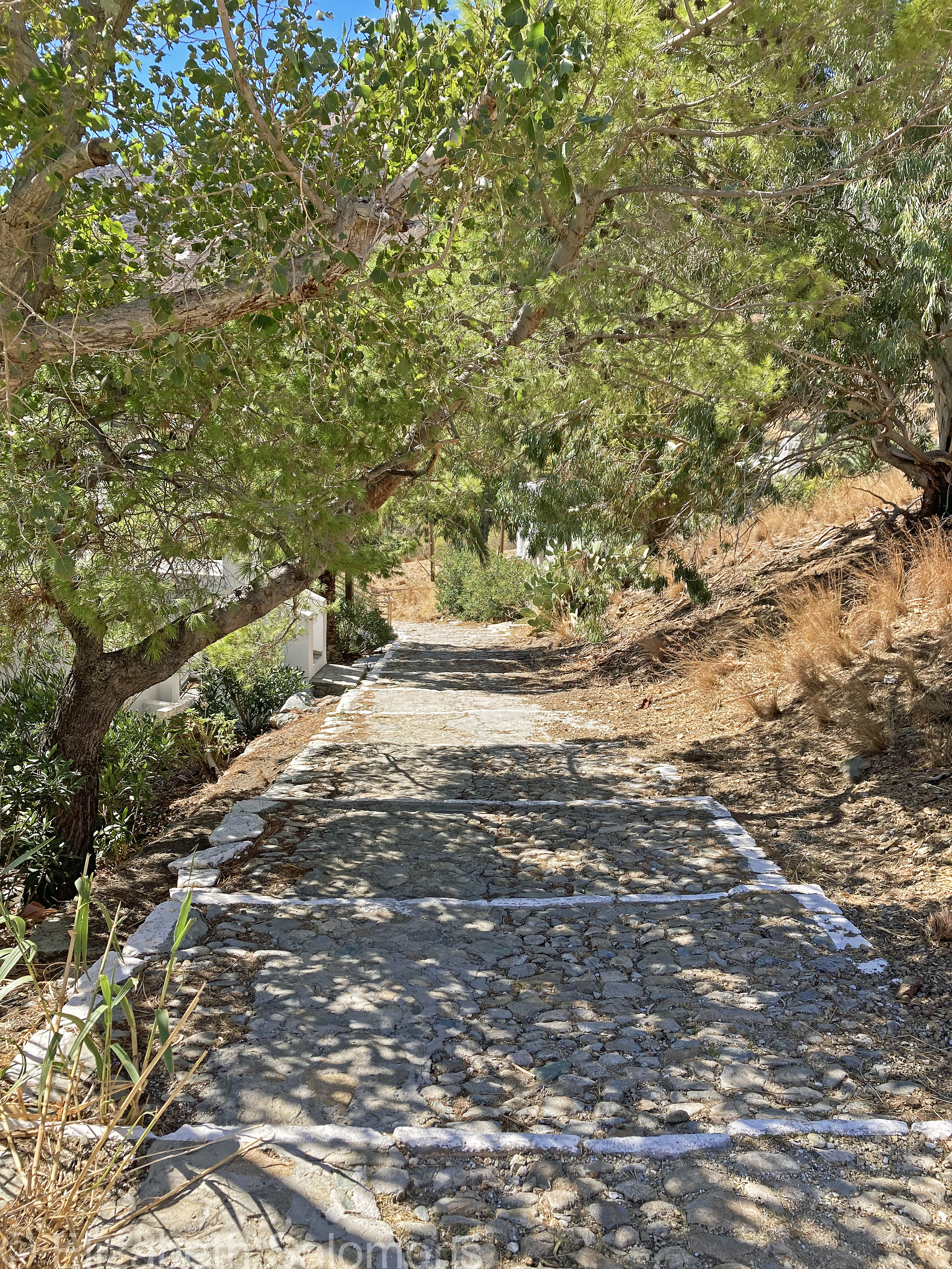
Getting Around Serifos
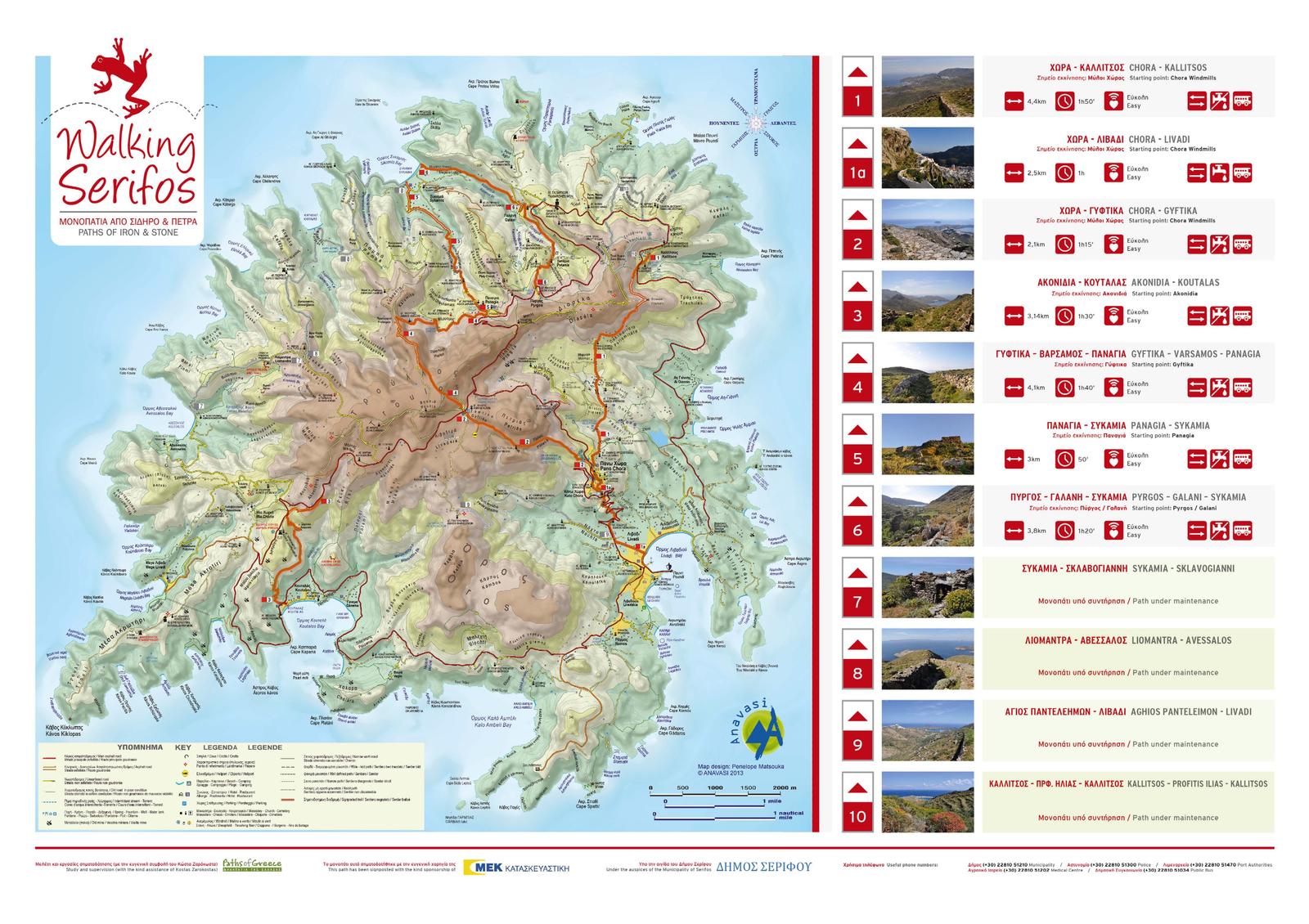
Serifos is not a large island — only 10 kilometres across at any given point — and I had a few options for getting around.
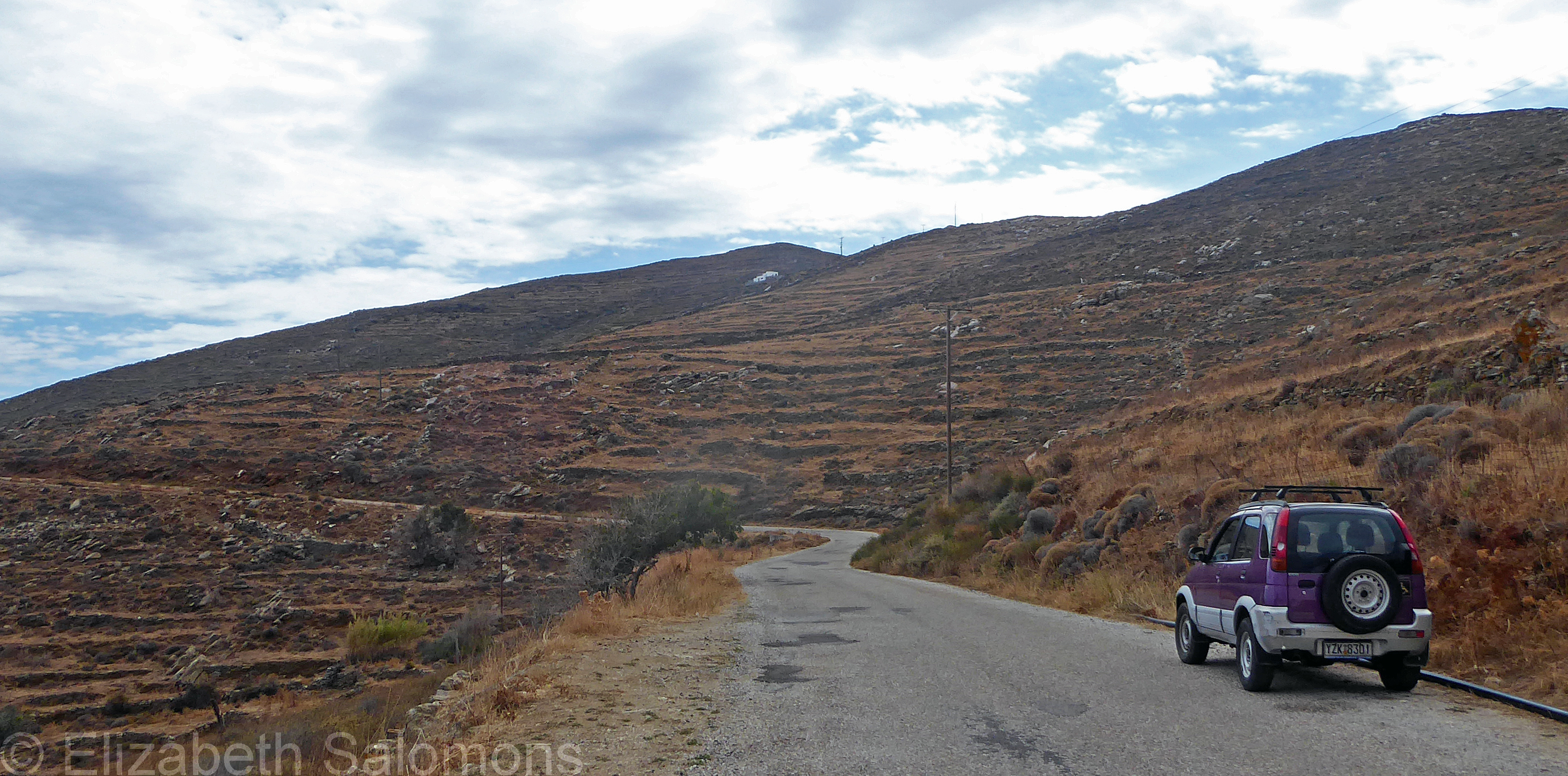
One choice was to rent either a car or scooter in Livadi. There is basically one road encircling the entire island, and your biggest decision is whether to go clockwise or counterclockwise.
When I told my home-exchanger I was going to hire a car for a day or two, she offered to loan me hers. I dubbed it the Purple Raison (for obvious reasons) and used it to get to a monastery on another side of the island, as well as some of the beaches.
To be honest, though, I was perfectly happy to return the car and go back to my usual way of exploring: on foot or, occasionally, by boarding a bus.
The bus that runs between Livadi and the Chora goes once an hour in either direction. It was never full and you pay the driver your 2 euros when you board. There’s no way to signal your stop, however; you simply make your way to the front of the bus as it gets close to where you want to be let off.
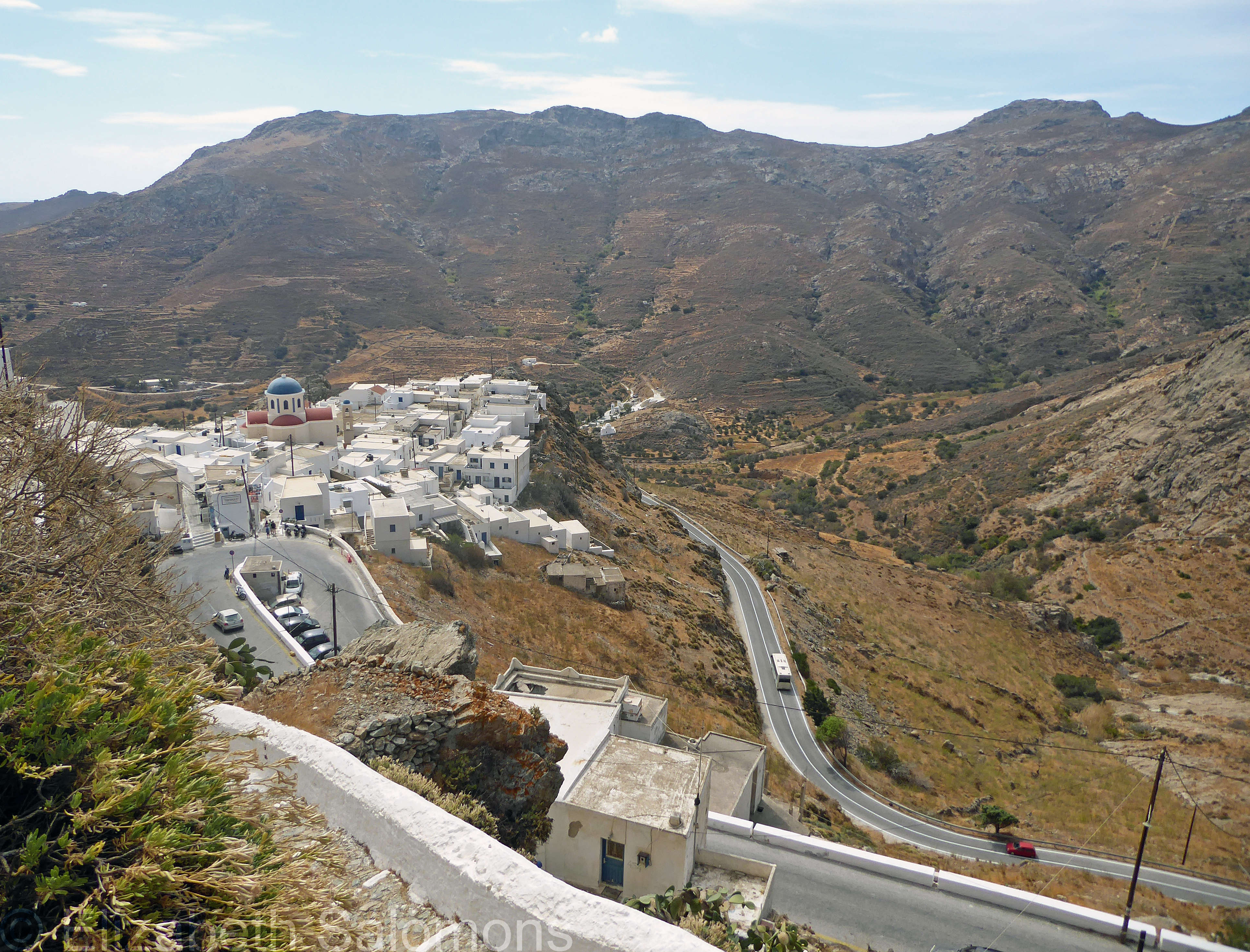
That Livadi–Chora bus switched to its winter schedule while I was on Serifos — meaning its last run up to the Chora was in the middle of the afternoon. Apparently, the winter schedule is dictated by the school run, not the tourists. My last few days on Serifos, if I happened to still be in Livadi in late afternoon, my only option was to walk up the old donkey path.
One day, I walked from my home in the Chora to Paralia Psili Ammos, and then, when I’d had my fill of the beach, over to Livadi where I caught the bus up to the Chora.
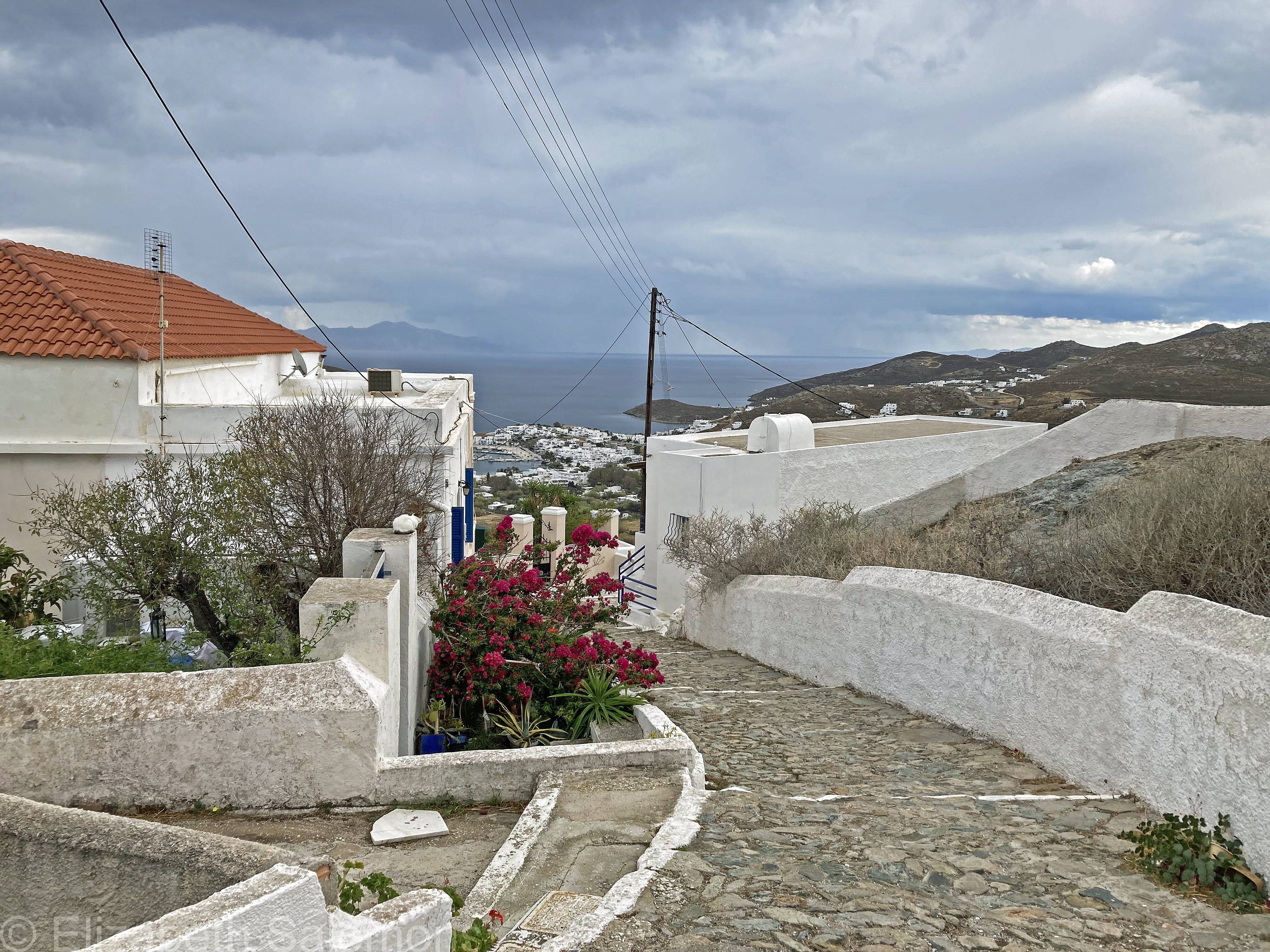
I didn’t get to every corner of the island during my two weeks on Serifos because, as I’m fond of saying, I always like to leave something to do to ensure a return visit. There are some 80 kilometres of hiking trails on Serifos, and I look forward to exploring more of them when I return to Serifos.
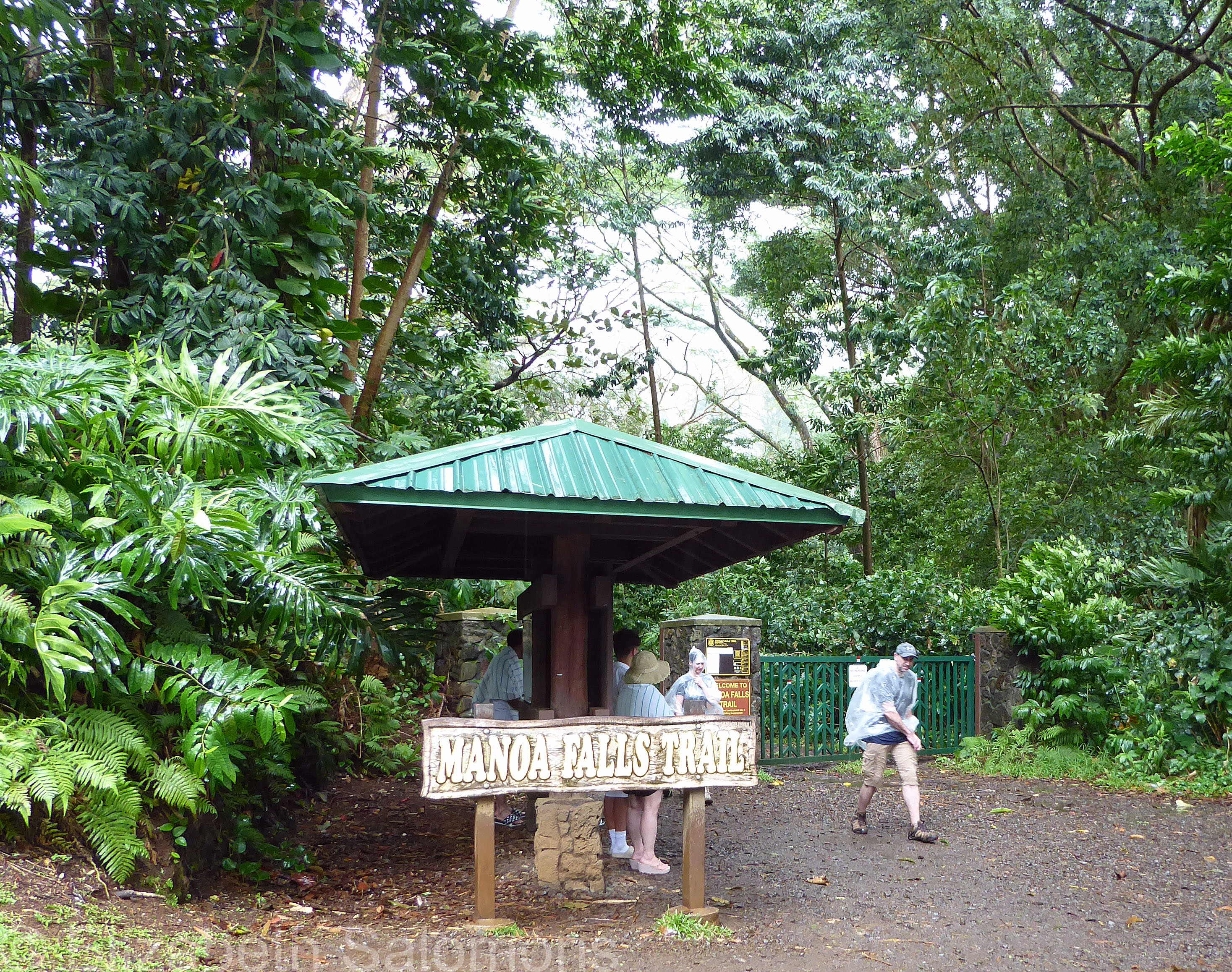
Manoa Falls
In spite of the beauty of Lanikai Beach just down the street from us, my sister and I were determined to thoroughly explore Oahu and not spend all our time on the beach.
First up? Hiking Manoa Falls.
And this is where we realized that visiting Hawaii during the rainy season means … it’s gonna rain. (In other words, the top on our Mustang convertible was up far more than it was down.)
No matter. What’s a little moisture for two Vancouverites?
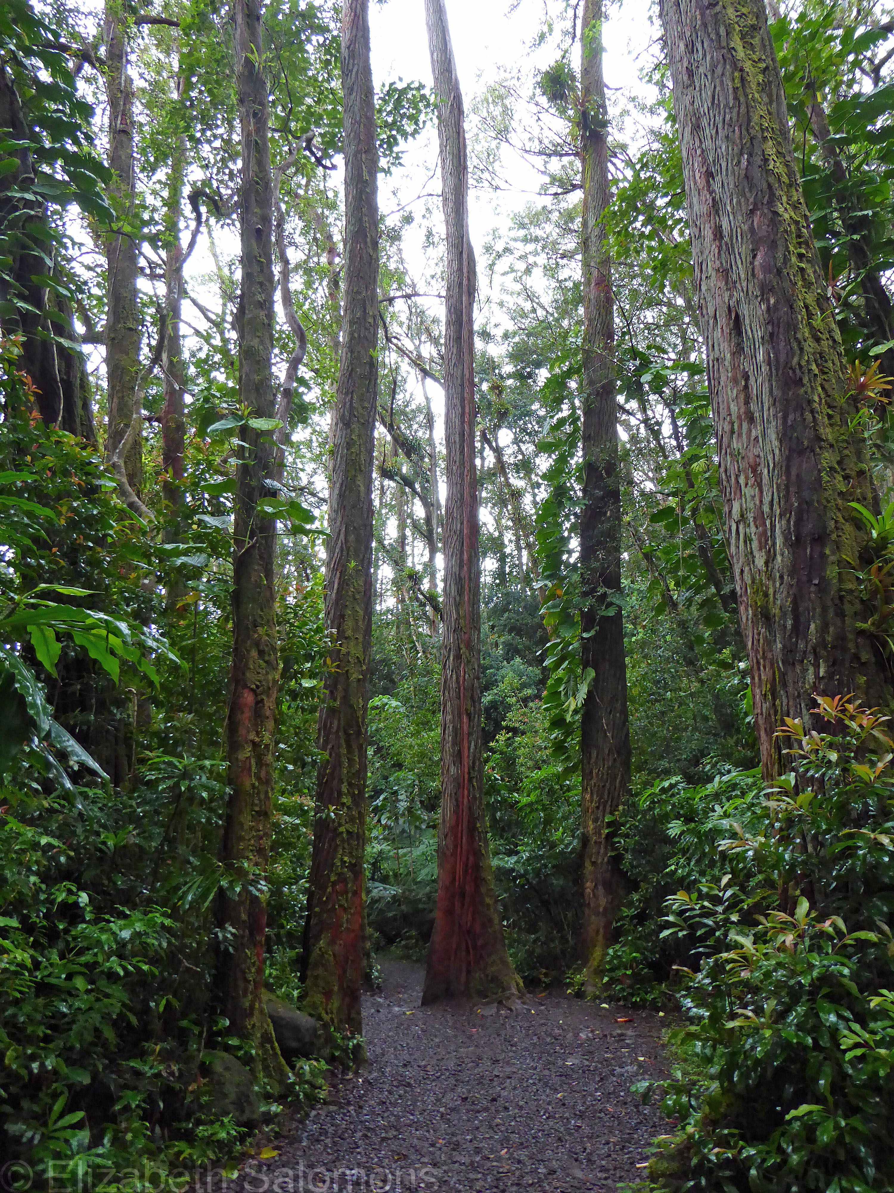
The trailhead of Manoa Falls Trail is reached by driving uphill through the suburbs of Honolulu. From the parking lot, it’s a short hike to the 45-metre-high falls.
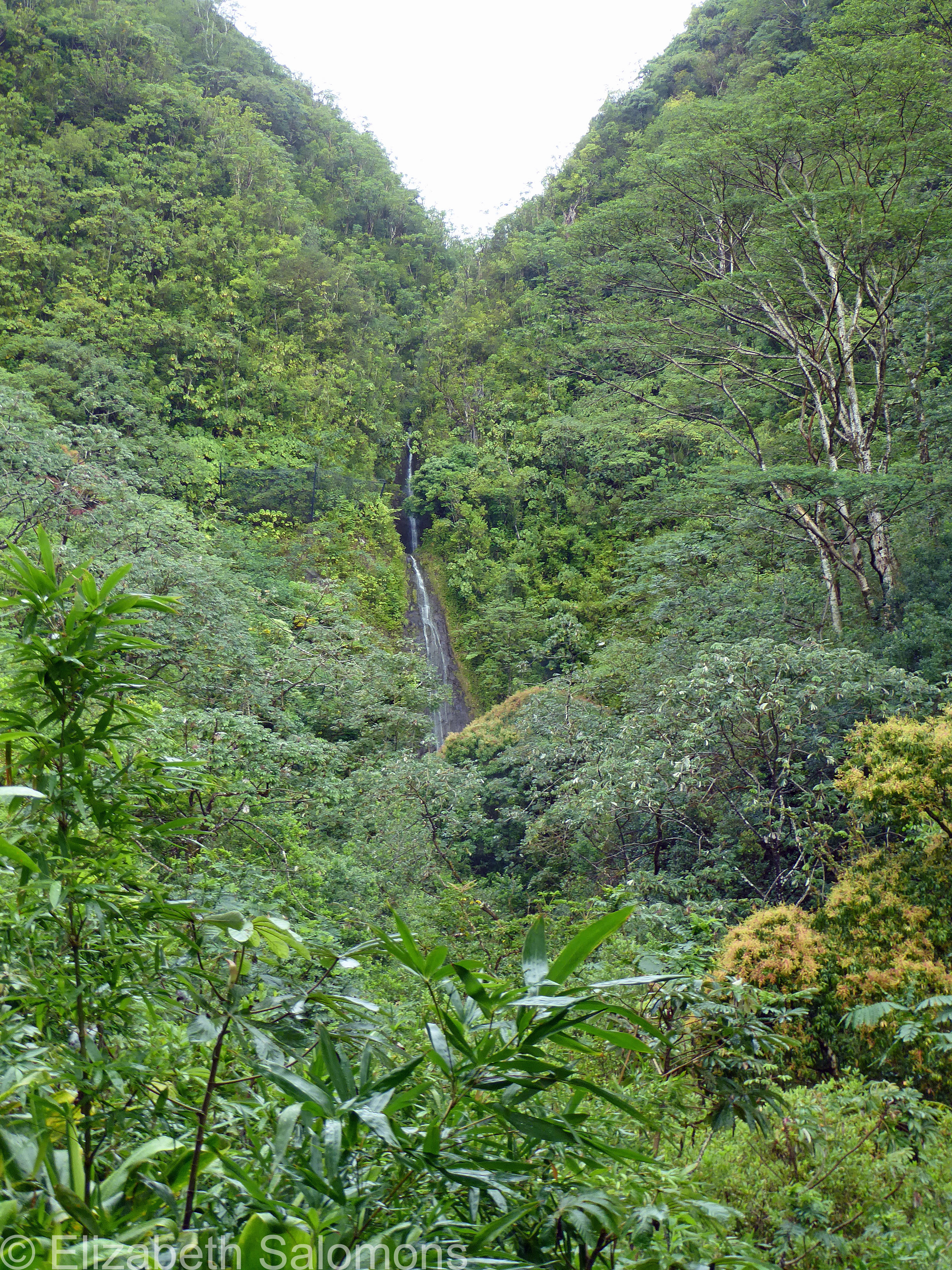
The trail is rocky and damp, but not at all difficult if you are sure-footed and wearing proper footwear. It doesn’t take long to reach the falls themselves.

Along the way, we got our first good look at the tropical rainforest that makes up Oahu. Think Jurassic Park — parts of which were filmed in this valley.

As you will see in my subsequent posts, the geology and botany of the Hawaiian Islands are stunning. It impressed me on my first ever visit to Oahu, and it was just as amazing to me on my most recent visit.
Elizabeth Lake
Who of us knew walking would become a thing when this pandemic first hit? Not me. Such a simple act, which has been my balm in Gilead these past nineteen months.
And yet, who of us by this time are not bored to tears with their neighbourhood, having explored every corner of it?
Even me — and I live next door to one of Canada’s most spectacular urban parks.
And so, on this Thanksgiving I am grateful that the stars have aligned and I have a (temporary) change of scenery. I’m in Central Alberta for some weeks, which at the moment is stunning in all its fall glory. There are lots of trails and walks to discover, too. Last Sunday, I spent the afternoon walking around Elizabeth Lake, in the centre of Lacombe.
Here’s some of what I saw.


Lakes in the Clouds

As has been the case for so many of us, one of the outcomes of this pandemic was me having to adjust my travel plans for 2020. Obviously, postponing a holiday is about as far down on the scale of hardships as you can go during this crazy year, so I really don’t want to give the impression that I am complaining.
But it did mean that the one year I finally decided to spend a longer chunk of time visiting my extended family in Alberta did not happen. Hanging out with at-risk relatives or family who need to be extra cautious because they work in health care would not have been smart.
Instead, I once again made my semi-annual trip to Alberta a quick one, with a whole lot of driving to get there, a few select physically distanced visits once I arrived, and then a whole lot of driving to get back home.
But the long drive was worth it. Seriously. The scenery between Vancouver and Red Deer is so varied; I personally think it rates up there as one of the most scenic road trips on the planet.
And on my way home, I also had one glorious day in Banff.

Who knew Banff was at its best in the fall? If I could guarantee great weather every year, I’d take all my mountain vacations in September.
Since I had only the one day, I planned it carefully. The 7 km hike up to Lake Agnes Teahouse is maximum bang for minimal effort and is a hike I used to do as a kid with my family when we spent our summers camping in the Rockies.

Plus, the trailhead is at Lake Louise, easily one of the most photographed lakes in all of Canada.
The hike up to Lake Agnes starts off with a long steady climb through the forest above Lake Louise, with a couple of spectacular peek-a-boo views of the lake far below. Then comes a series of switchbacks until you reach Mirror Lake. Looming over it is the Beehive.

While stopping to catch my breath, I ducked as a Clark’s Nutcracker skimmed by just inches above my head and took its perch on a tree branch nearby. Only a second later, I overhead a father and son near me lamenting the lack of wildlife.

Look up, I wanted to say. (But I didn’t.)
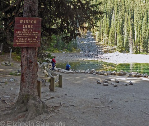
A kilometre past Mirror Lake is Lake Agnes and its famous teahouse. The lake was named after Lady Agnes MacDonald, wife of Canada’s first prime minister, who visited the lake in 1886. The tea house has been in operation since 1905.

By this point, I’d climbed 400 metres and was pretty much done, but those who have energy to burn can climb the Beehive for a bird’s eye view of all three lakes — Lake Agnes, Mirror Lake, and Lake Louise — that make up the Lakes in the Clouds.
As I drove away from Banff National Park the next morning, the clouds were rolling in and the rain was starting to fall. I had timed my one-day vacation perfectly. And as far as following the directions of my provincial health officer (“fewer faces, bigger spaces”), I had done all right by that too.

Through My Lens: Lost Lake Trail

Whoosh!
And there goes another month.
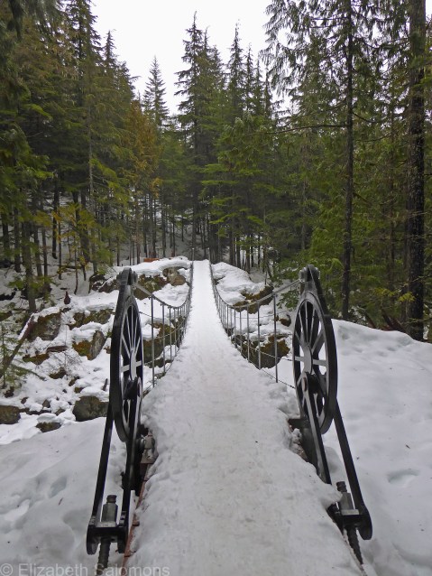
I took this photo on what turned out to be the highlight of my month: a weekend in Whistler. It snowed pretty much the entire time we were there, and my friend and I pretty much walked out our door with our snowshoes on and were upon this scene within minutes.
Magical.
Whistler Train Wreck
And … as quickly as it arrived, the snow is gone (although there is talk of more to come).
But enough about our wacky winter weather. Let me tell you about my first ever winter day hike. A bunch of weekends ago, I was hanging out in Whistler with a bunch of friends. Our plan was to do some snowshoeing, but we had just one problem.
There wasn’t nearly enough snow. (I told you it’s been a wacky winter.)
So the showshoes got left in the car, and we proceeded to trek through the woods in our winter boots.
The hike we chose was a relatively flat and short (3 km) walk to the Whistler Train Wreck. I had heard about this hike only a year or two ago, and had put it on my list of hikes to do, but hadn’t yet had the chance.

The Whistler Train Wreck consists of a bunch of boxcars scattered through the forest by the Cheakamus River. Not that long ago, the only way you could get to the site was by walking illegally along the railway tracks. But train conductors don’t much like that and would report you if they saw you so that the police were waiting for you as you exited the woods.
In 2016, a suspension bridge was built over the Cheakamus River and what used to be an unlawful ramble along the tracks is now a quick and easy hike connecting to the much longer Sea to Sky Trail. The trailhead is on the road to Cheakamus Crossing, a new subdivision of Whistler that served as the Athlete’s Village during the 2010 Olympics.
And how did a train wreck end up in the middle of a forest, you ask? A lumber train heading south from Lillooet derailed here in 1956. The seven damaged boxcars were dragged clear of the tracks by local loggers hired by the train’s owner, the Pacific Great Eastern Railway. Left scattered among the trees in the forest, they’ve remained there ever since.
The sight of mangled boxcars in the forest is a little surreal, to say the least. In winter, even more so.
Here, take a look.
Wandering Through the Lake District
I wandered lonely as a cloud
That floats on high o’er vales and hills,
When all at once I saw a crowd,
A host, of golden daffodils;
Beside the lake, beneath the trees,
Fluttering and dancing in the breeze.
—William Wordsworth
The photo of daffodils I posted the other week had me thinking back to my lovely ramble through the hills of England’s Lake District. It was a sunny, autumn afternoon a couple of decades ago, and although it had been many years since I had studied English romantic poetry, William Wordsworth’s poem, “I Wandered Lonely as a Cloud,” was firmly imprinted on my brain.
Likely because I was wandering. And alone. And in the middle of the Lake District (aka Wordsworth’s backyard). I believe I took this photo above Rydal Water on my walk from Dove Cottage to Rydal Mount.

I had arrived in Windermere around dusk the evening before and started off that morning intending to walk to Ambleside. All over England are public footpaths, known as right of ways, where anyone can walk, even if the land is private. The delightful thing about these footpaths is you can take a bus or train to the start of the trail, do your walk, and then hop on another bus or train to get to where you need to be.
To my memory, the paths are well marked. However, I was soon confused and turned around and, well, lost. I asked another walker for directions, showing him my tiny hand-drawn map bought that morning at the Windermere Tourist Information Centre for 20 pence. To his credit, he did not laugh, but he immediately pulled out his full-size Ordnance Survey map — at which point my map felt woefully inadequate and I felt like a silly tourist.
This gentleman set me straight, but it was not long before I was once again lost. I gave up on that path and made my way back to the road where I knew I could catch a bus to Ambleside.
After lunch, I tried another footpath and this time successfully found my way from one of Wordsworth’s former homes (Dove Cottage) to another (Rydal Mount). In the end, it all worked out for the better because by cutting short my morning walk I had more time for my afternoon walk — a walk so beautiful it turned out to be one of the most memorable walks of my life.
A walk so beautiful I started reciting poetry to myself. And, believe me, I’m not the reciting-poetry type.
Several of the English Romantic poets lived in the Lake District, so they are also known as the Lake poets. And the Lake District is truly one of the most spectacular parts of England.
Because I was there in autumn — a lovely time of year, for sure — I saw no daffodils. But someday, one day, I hope to go back in April and see me a crowd of golden daffodils.

Canada 150: Cavell Glacier
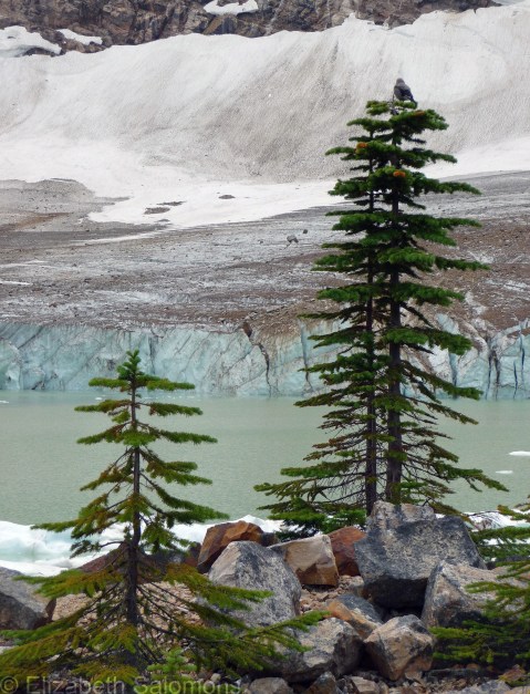
Cavell Glacier in Jasper National Park is one of the most easily accessed glaciers in all of Canada. It lies at the bottom of Mount Edith Cavell and can be reached by a short (less than 1 km) hike. Cavell Pond was formed from the glacier’s meltwater. It’s turquoise because of all the glacial silt suspended in the water.
I spent every summer of my childhood exploring the Rocky Mountains with my family. The mountains are a pretty spectacular playground for kids, but I don’t think I truly appreciated them until I returned on my own as an adult. Now, I don’t take them for granted. Ever.
If you’ve been to Banff or Jasper, you know what I’m talking about. If you haven’t, put the parks on your bucket list. You won’t regret it.
Through My Lens: Top of Sulphur Mountain

This view is from the top of Sulphur Mountain in Banff National Park. Take a deep breath: those are the Rocky Mountains you’re looking at.
There are two ways to get to the top of Sulphur Mountain: you can hike up or you can ride up. The hike up isn’t a long one (5.5 km), but it is all uphill (elevation gain of 650 m). The Banff Gondola is a lot easier and a lot quicker. It runs year round and takes you from the Banff Upper Hot Springs to the top of the mountain in just eight minutes. (Those hot springs, incidentally, are how Sulphur Mountain got its name.)
Once you’re at the top of Sulphur Mountain, you have a 360-degree view of the Rocky Mountains.
Dizzying, isn’t it?
I don’t want to overwhelm you, so I’m posting only a photo of the view to the east. That’s the town of Banff nestled around the diminutive Tunnel Mountain in the centre of the photo. Behind Tunnel Mountain is Cascade Mountain, and to the far right of the photo is Rundle Mountain.
