
Donkeys of Serifos
Of course, you can’t spend any amount of time in the Cyclades without encountering one or two donkeys.
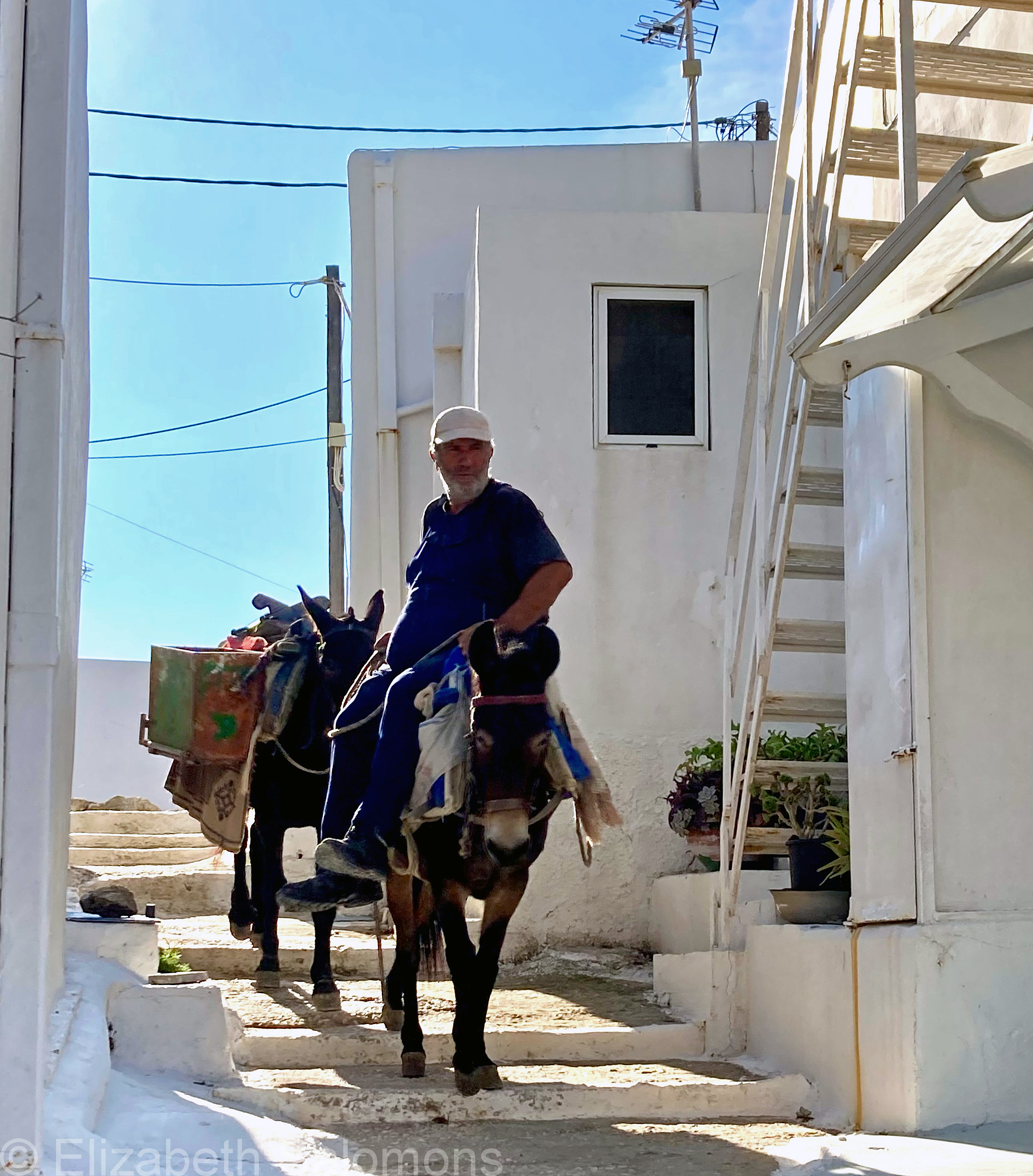
Donkeys have a long history as beasts of burden in the Mediterranean. And no wonder — they are sure-footed and able to easily navigate the narrow passageways of the Chora.
All they need for fuel are food and water. These two are drinking their fill at the tap just outside my door. I was all set to leave one morning when I realized they were blocking my way.
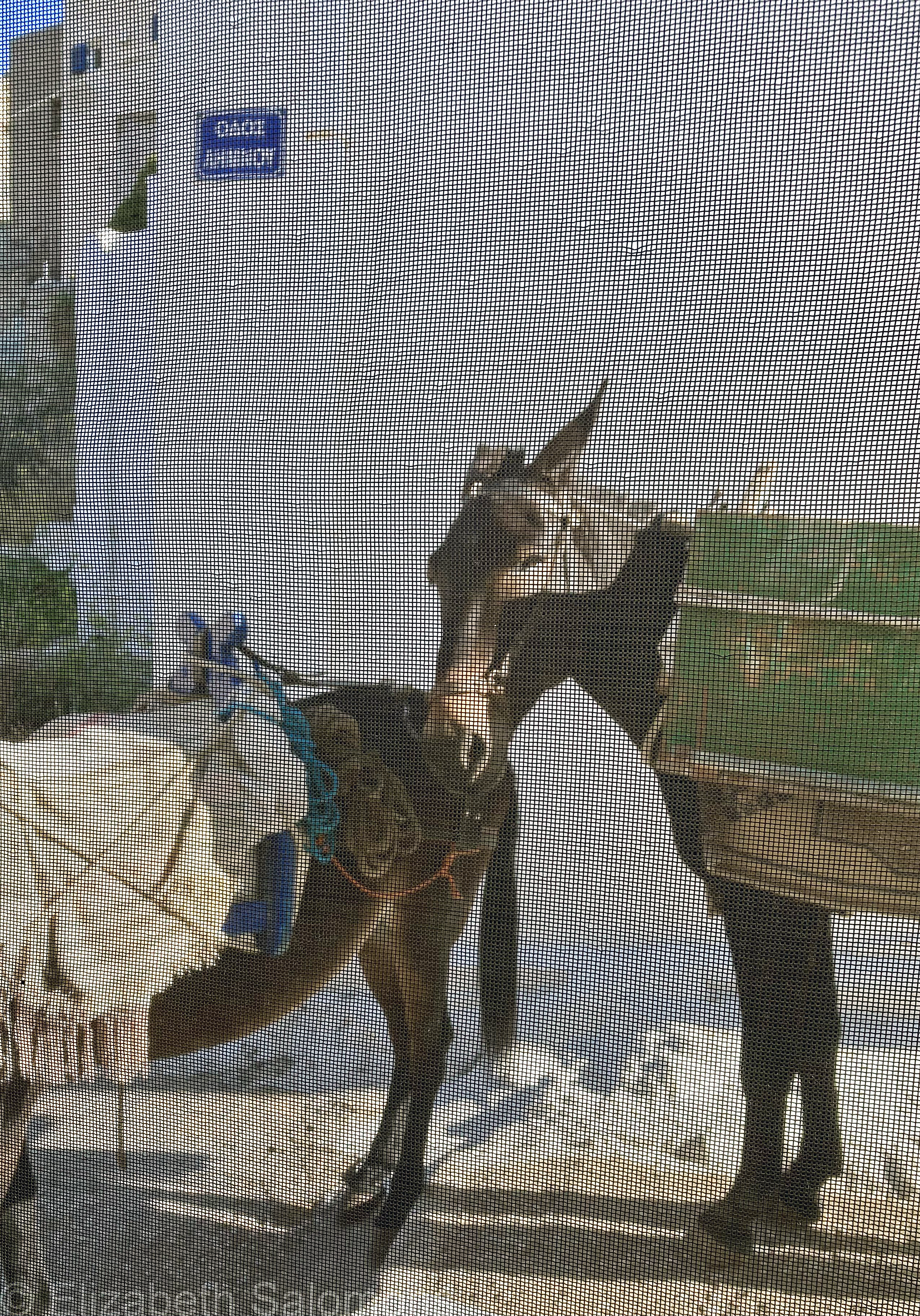
So I waited until they were sated and on their way.
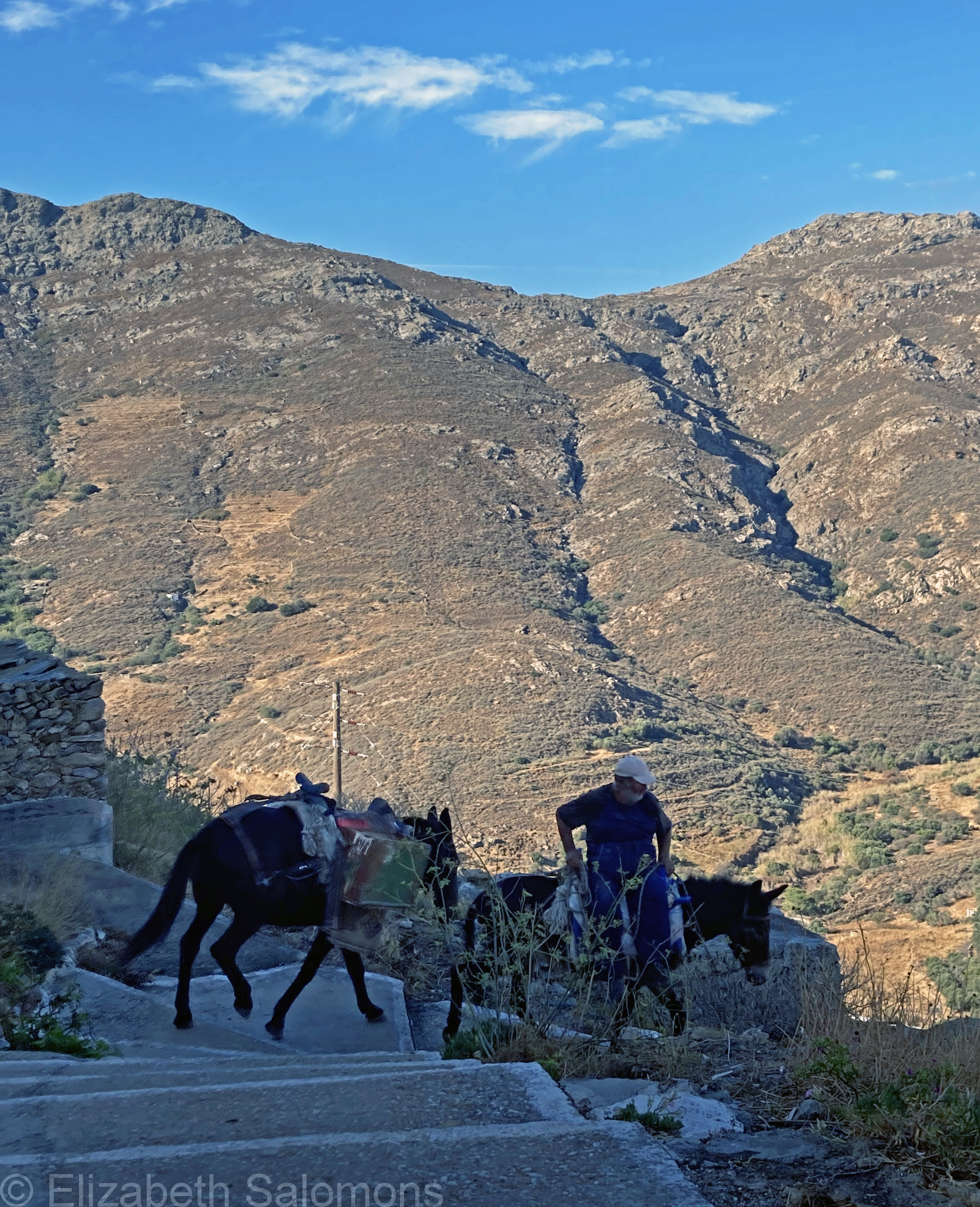
The man and his donkeys were hauling gravel from the road below my house to some unknown construction site above my house. And you know what I discovered?
There is no better way to remind yourself you are on vacation than watching others work.
Through My Lens: Ekklisia Christou
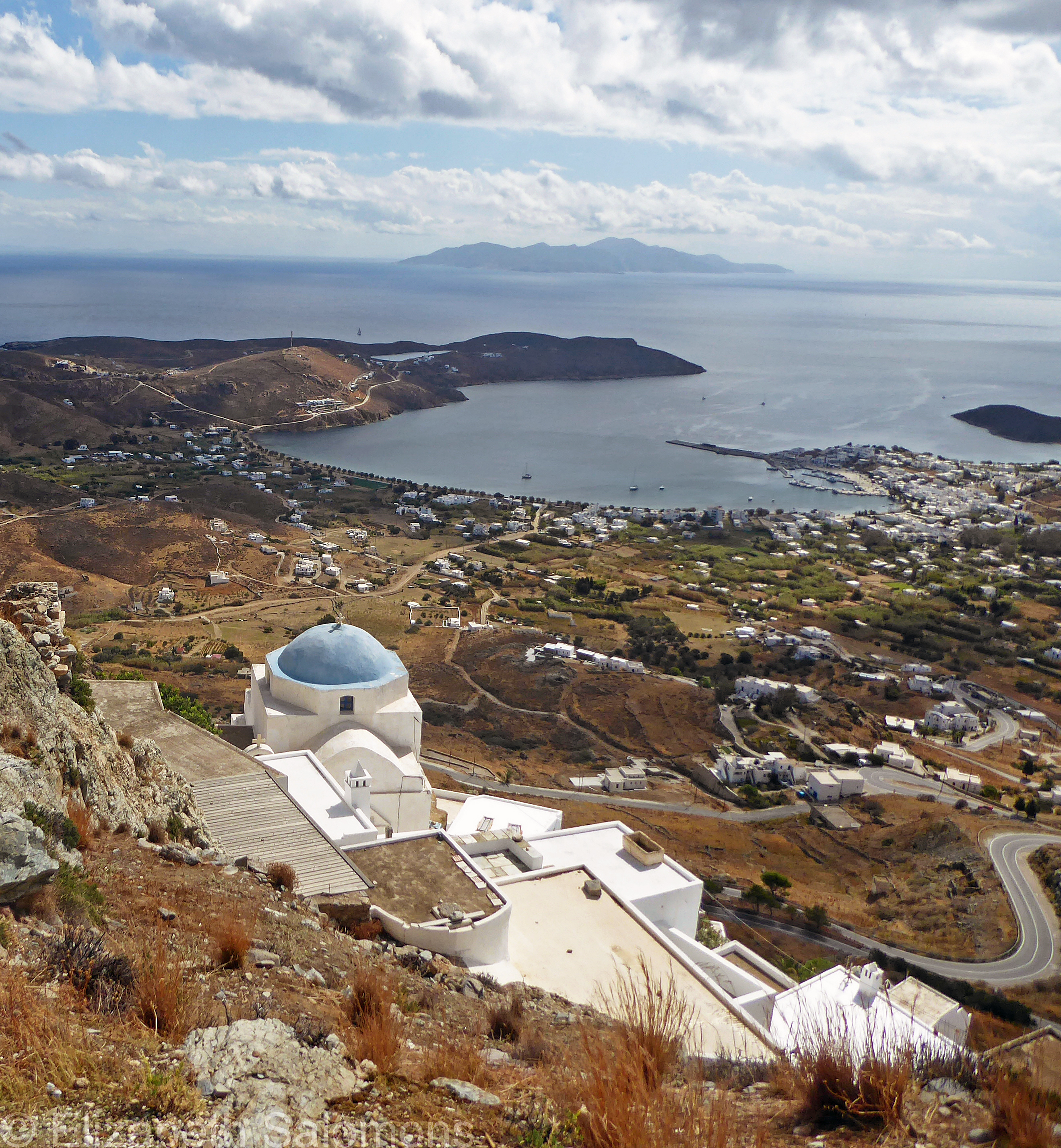
Ekklisia Christou (Church of Christ) is my photo choice for today, Palm Sunday. This small domed church is located just below Agios Konstantinos and to the right of Agia Varvara. Like all the churches at the top of the Chora, Ekklisia Christou gives you a fabulous panoramic view of Serifos and the Aegean Sea.
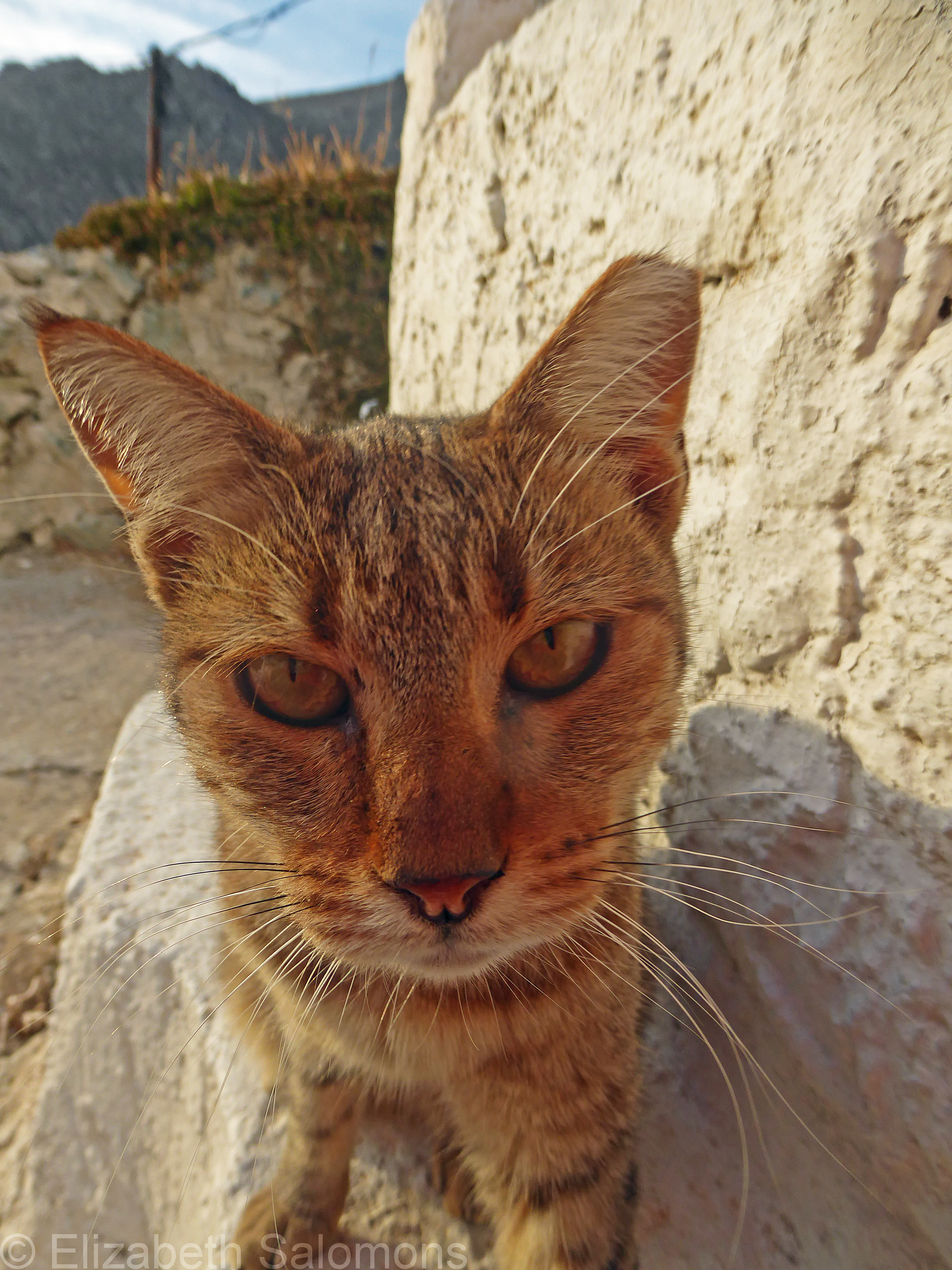
Cats of Serifos
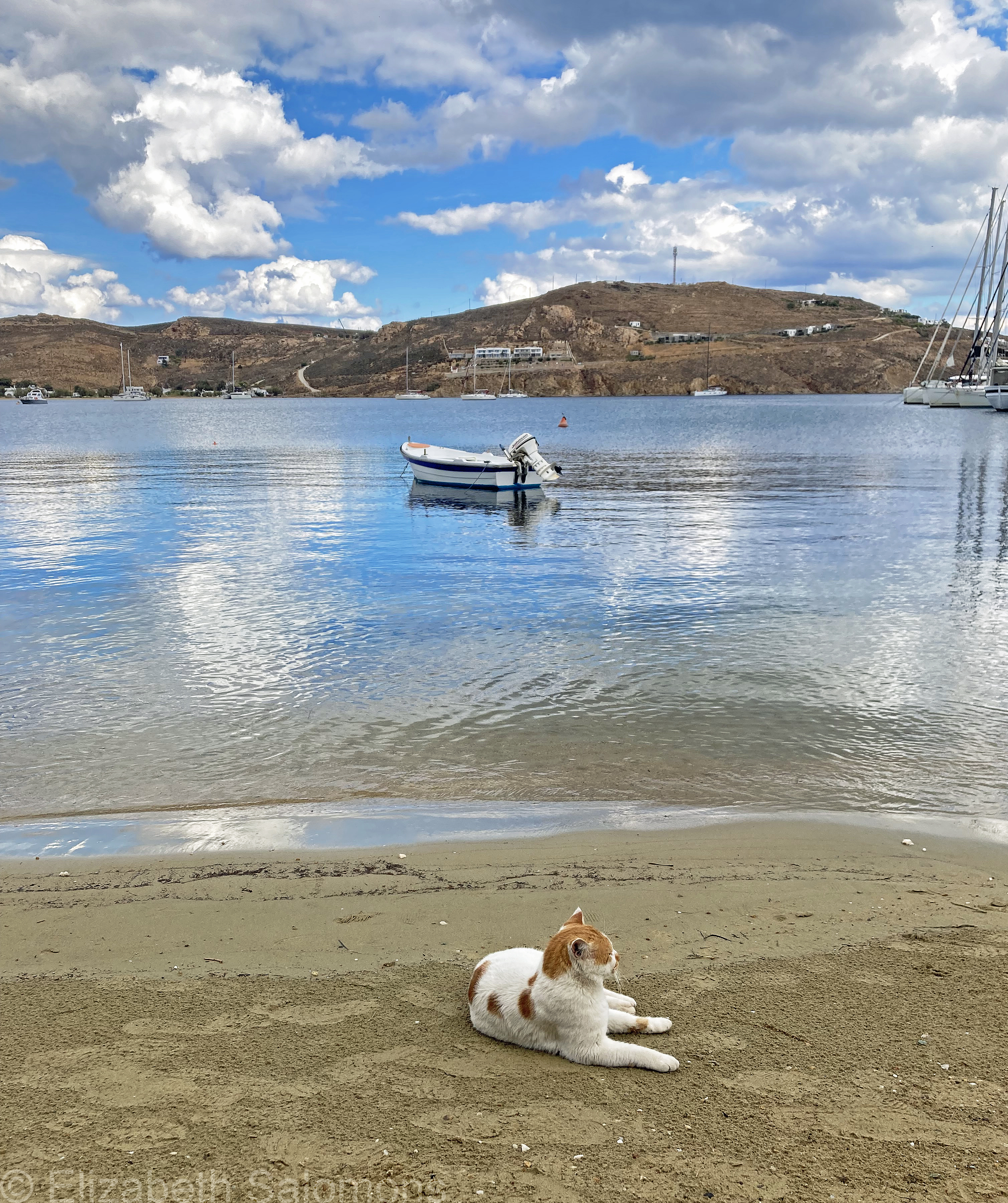
I now know why my home exchange partner did such a fabulous job taking care of my cats when she and her partner stayed in my Vancouver home.
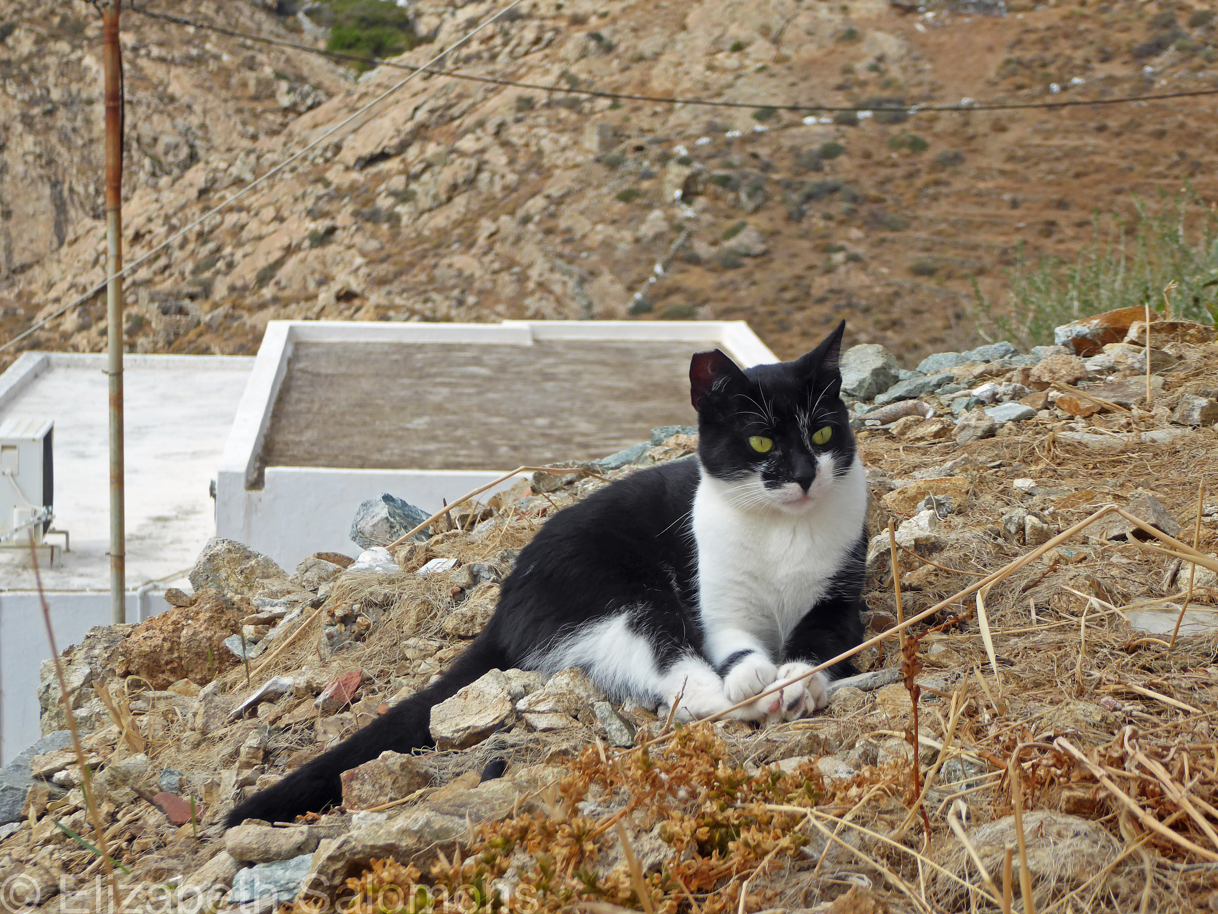
It’s because cats are as much a part of Serifos as whitewashed walls and blue domes.
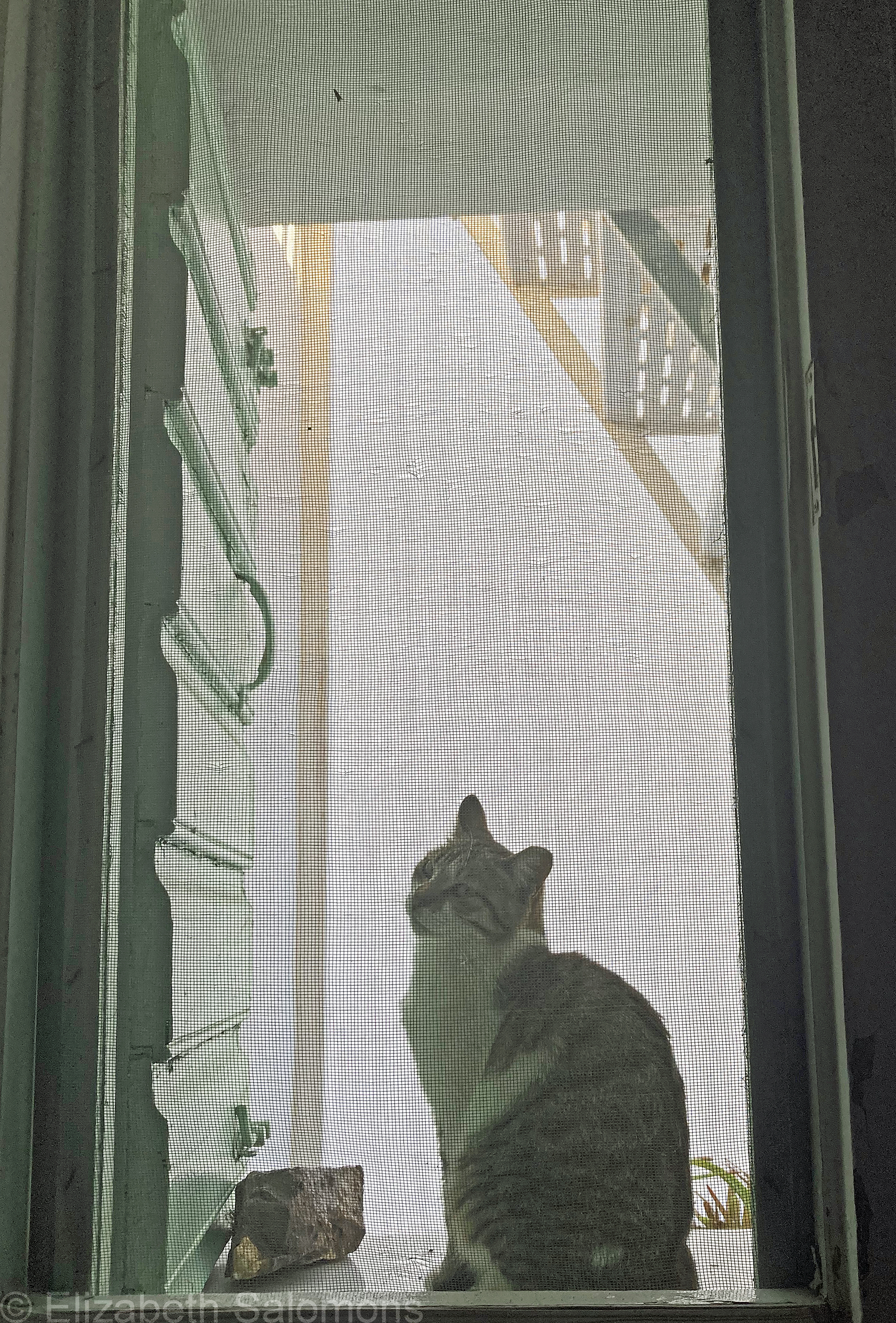
As far as I know, the cats of Serifos live completely outdoors and come and go as they please. But I wouldn’t call them feral. Or even strays.
They belong to everyone and to no one. “Community cats” is probably the best way of describing them.
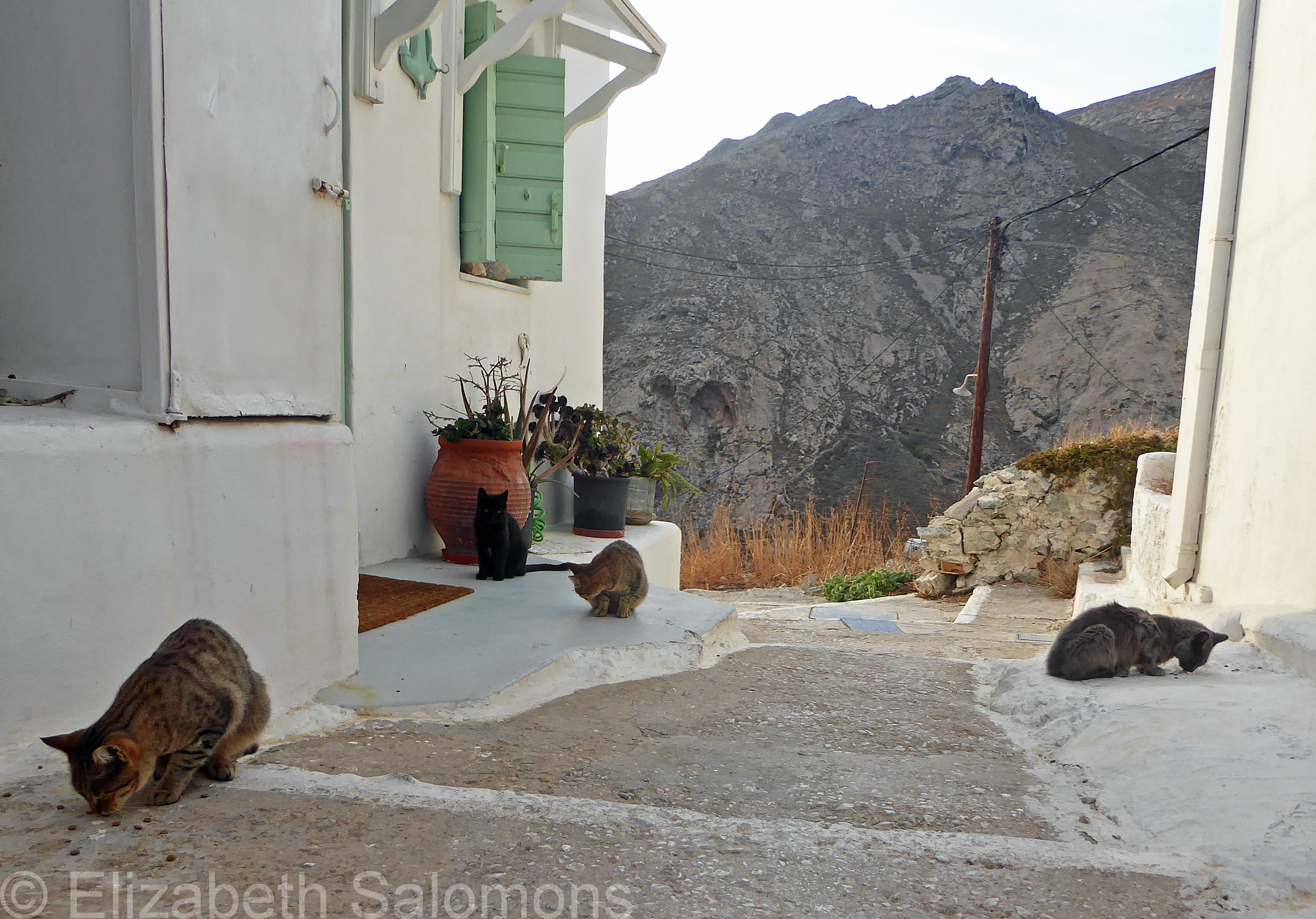
I fed my clan every morning and evening. The most I had at any one time was nine. Nine cats! (Isn’t that the name of a song?)
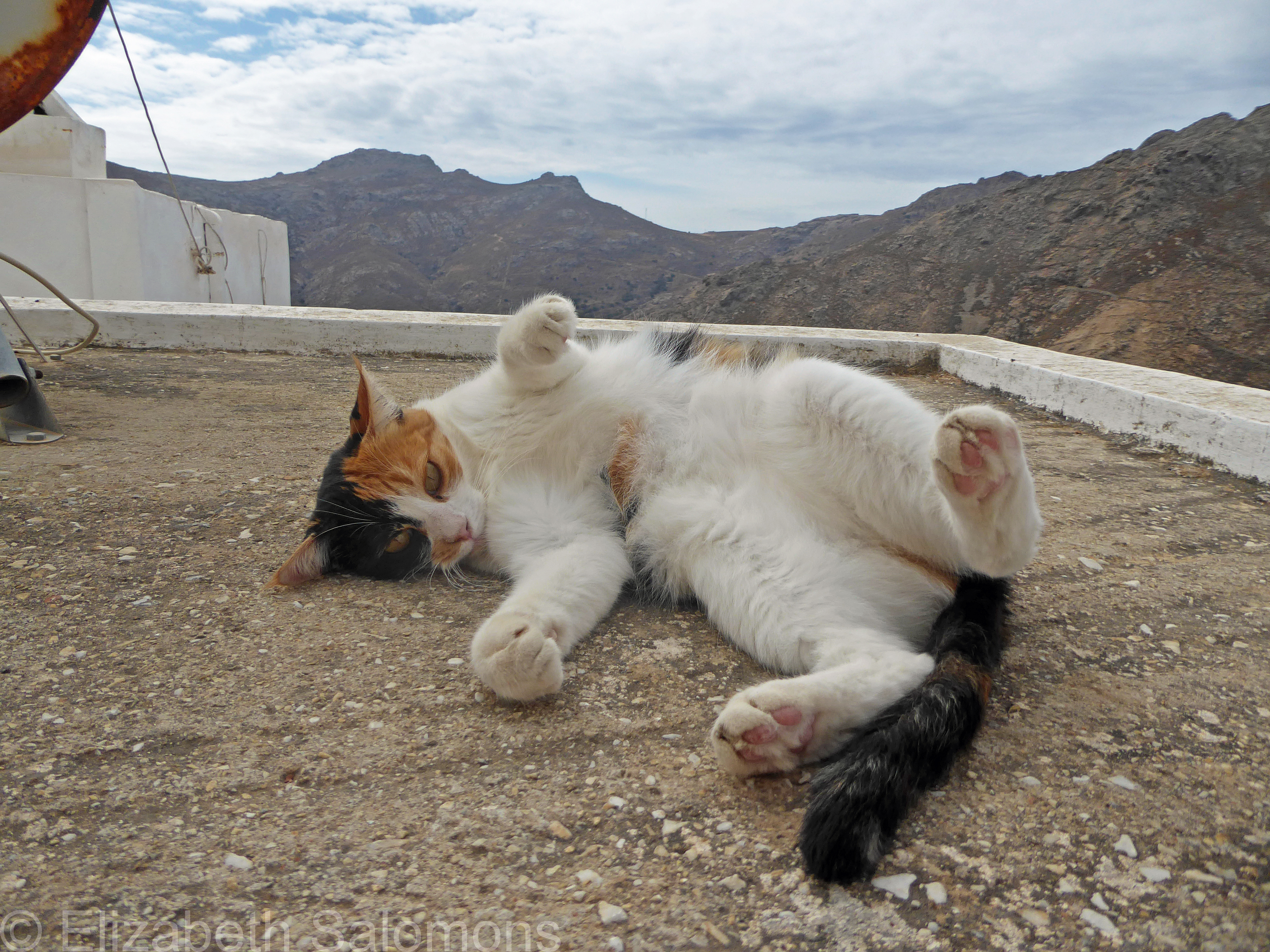
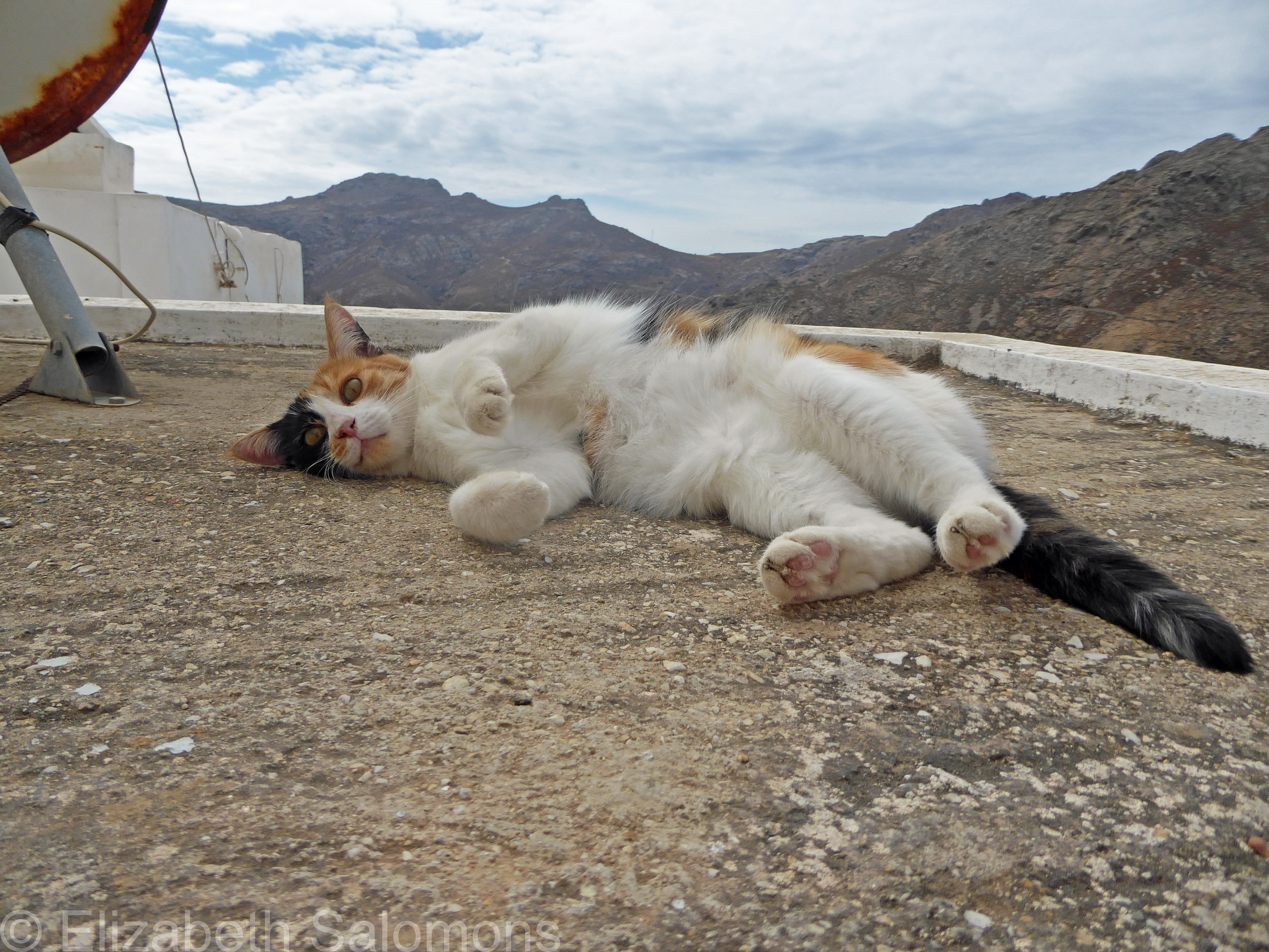
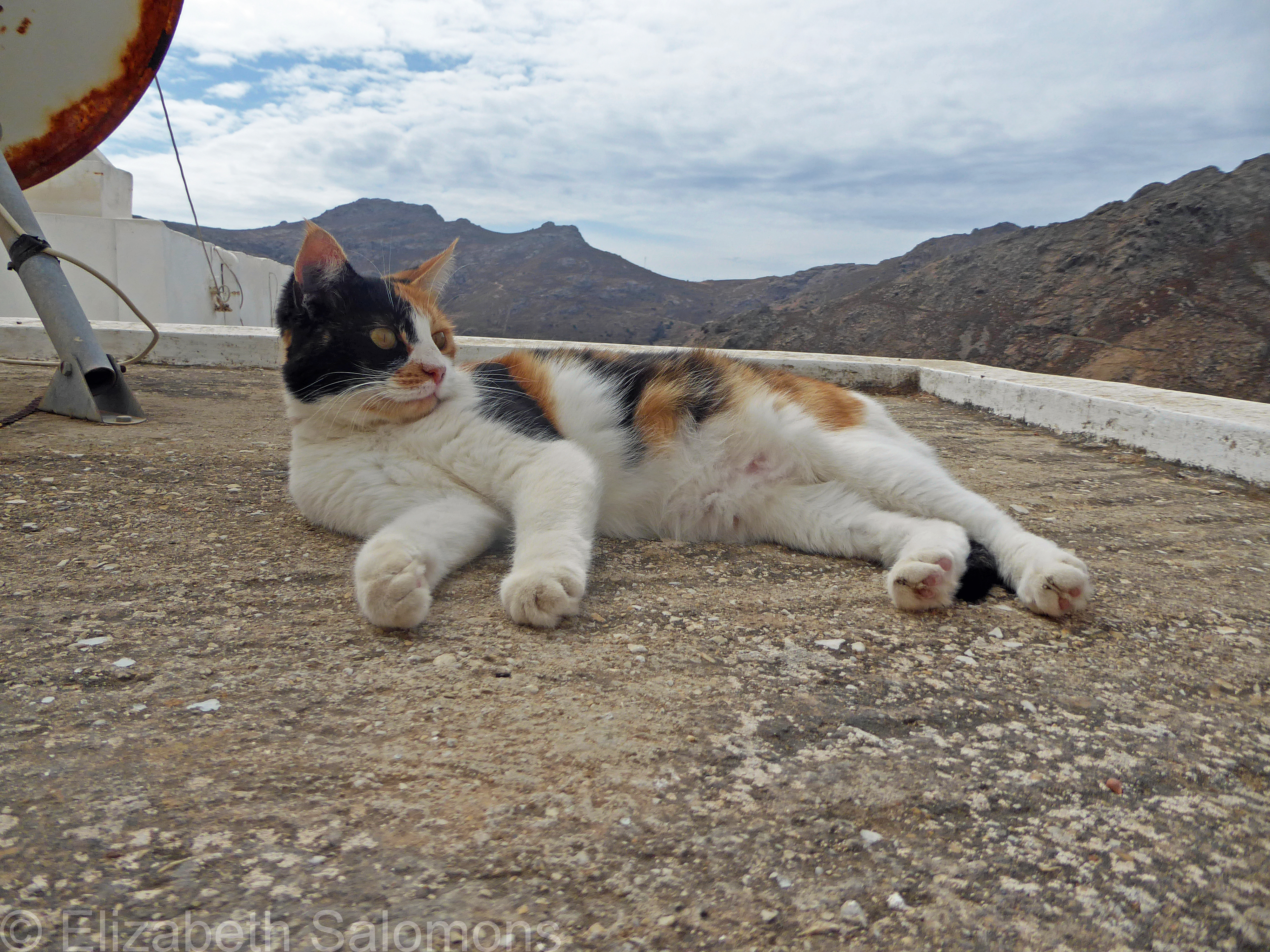
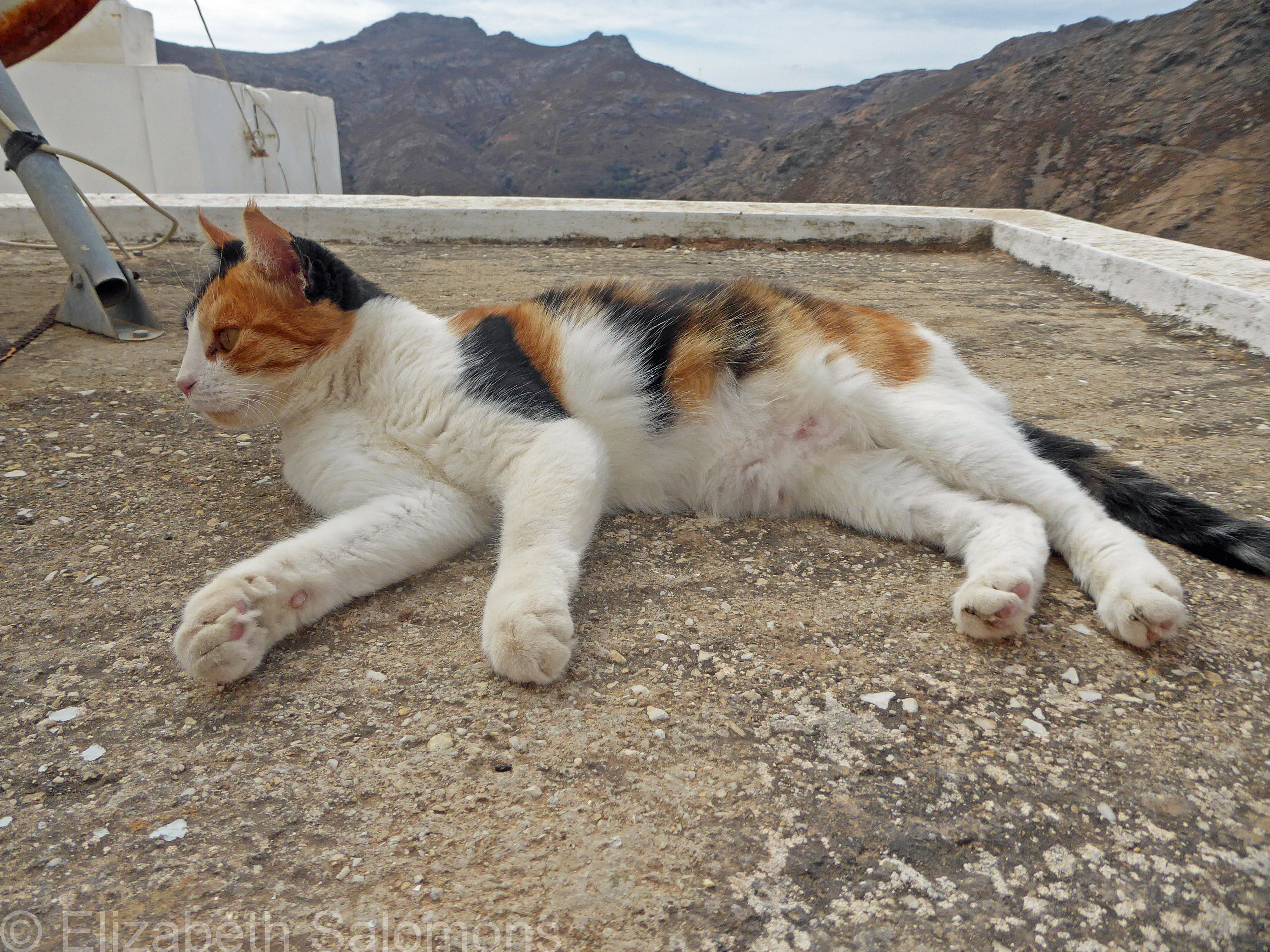
The cats of Serifos are small, but healthy and well fed (see above). I’m told the Aegean cat is a breed native to the Cyclades that developed naturally, without any human intervention.
Often on my wanderings through the Chora, I’d see little piles of kibble set out for the cats — I wasn’t the only one feeding them.
I loved how completely relaxed they looked and acted in their environment.
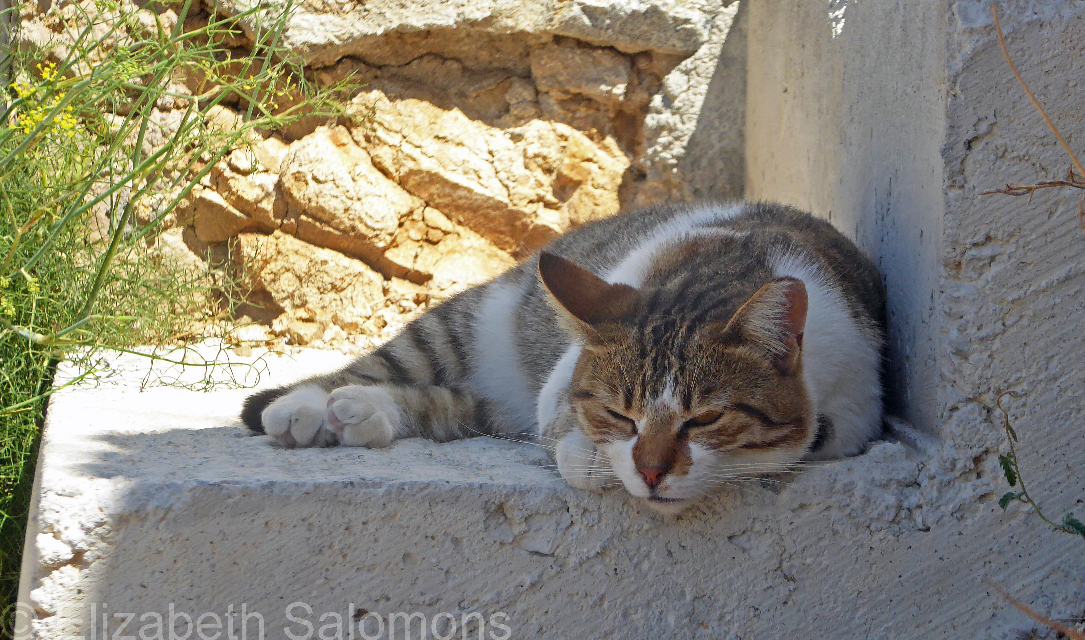
And they kept me good company while I was in my Grecian home.
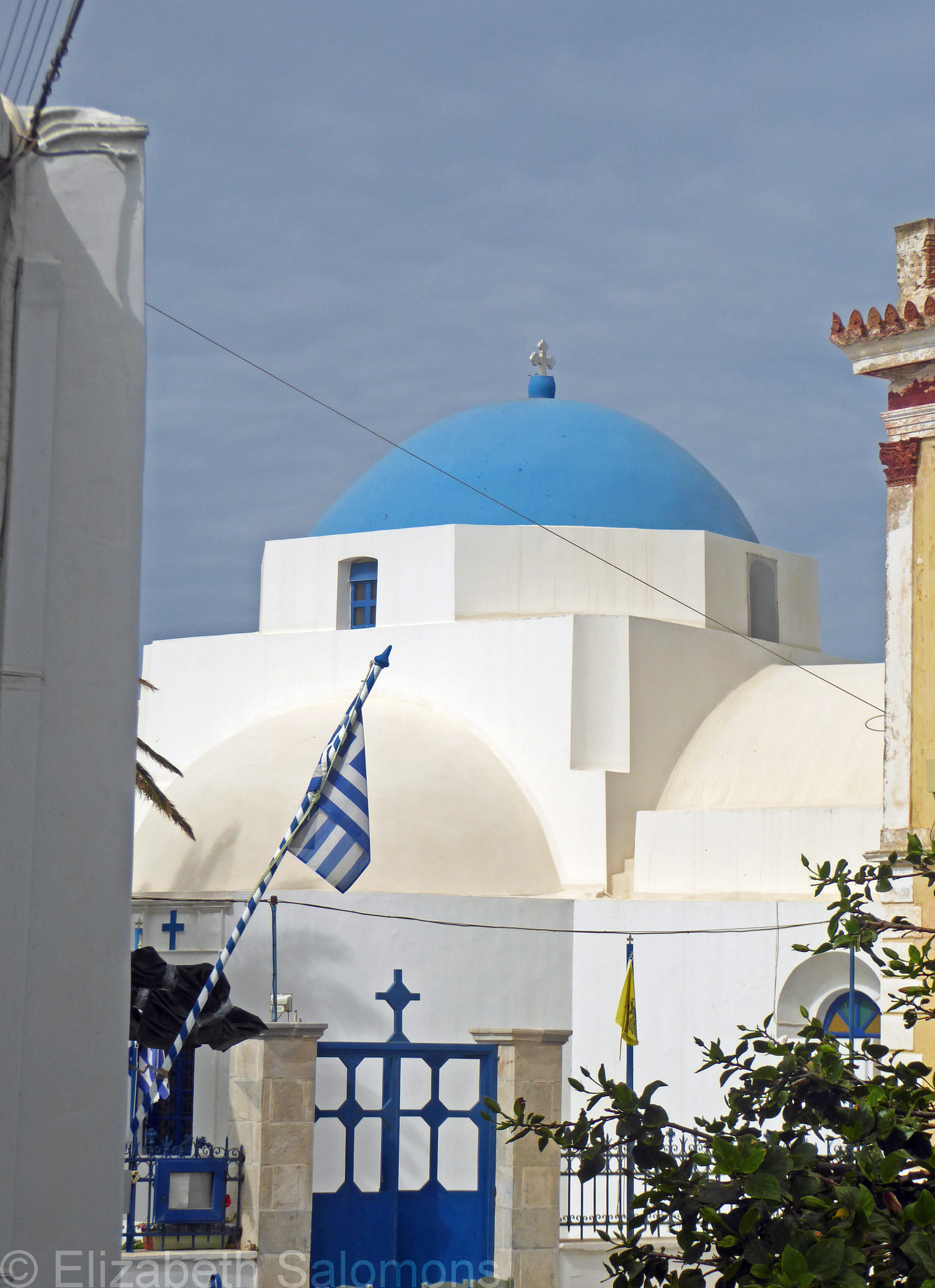
Through My Lens: Agia Varvara
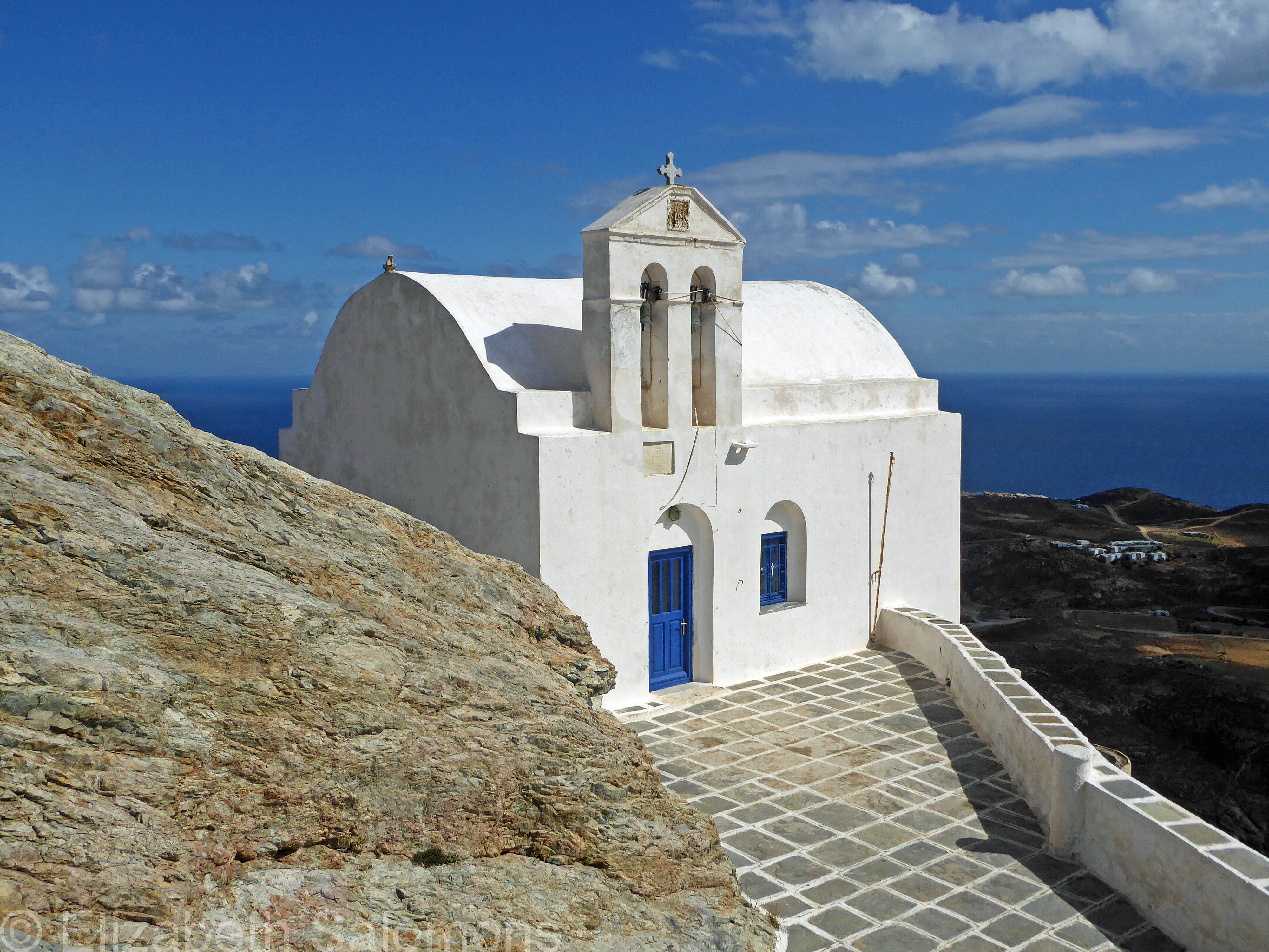
For today, the Fifth Sunday of Lent, here is a photo of the church of Agia Varvara (Saint Barbara). You come to it when you keep walking down the steps from where I took last week’s photo. It was built in the post-Byzantine era and renovated in the late nineteenth century.
Saint Barbara lived in the third century CE and is the patron saint of anyone working with explosives, including miners. For that reason, she was considered the patron saint of Serifos, which has a history of mining going back to Roman times that continued until as recently as 1965.
Through My Lens: Agios Konstantinos From the Back
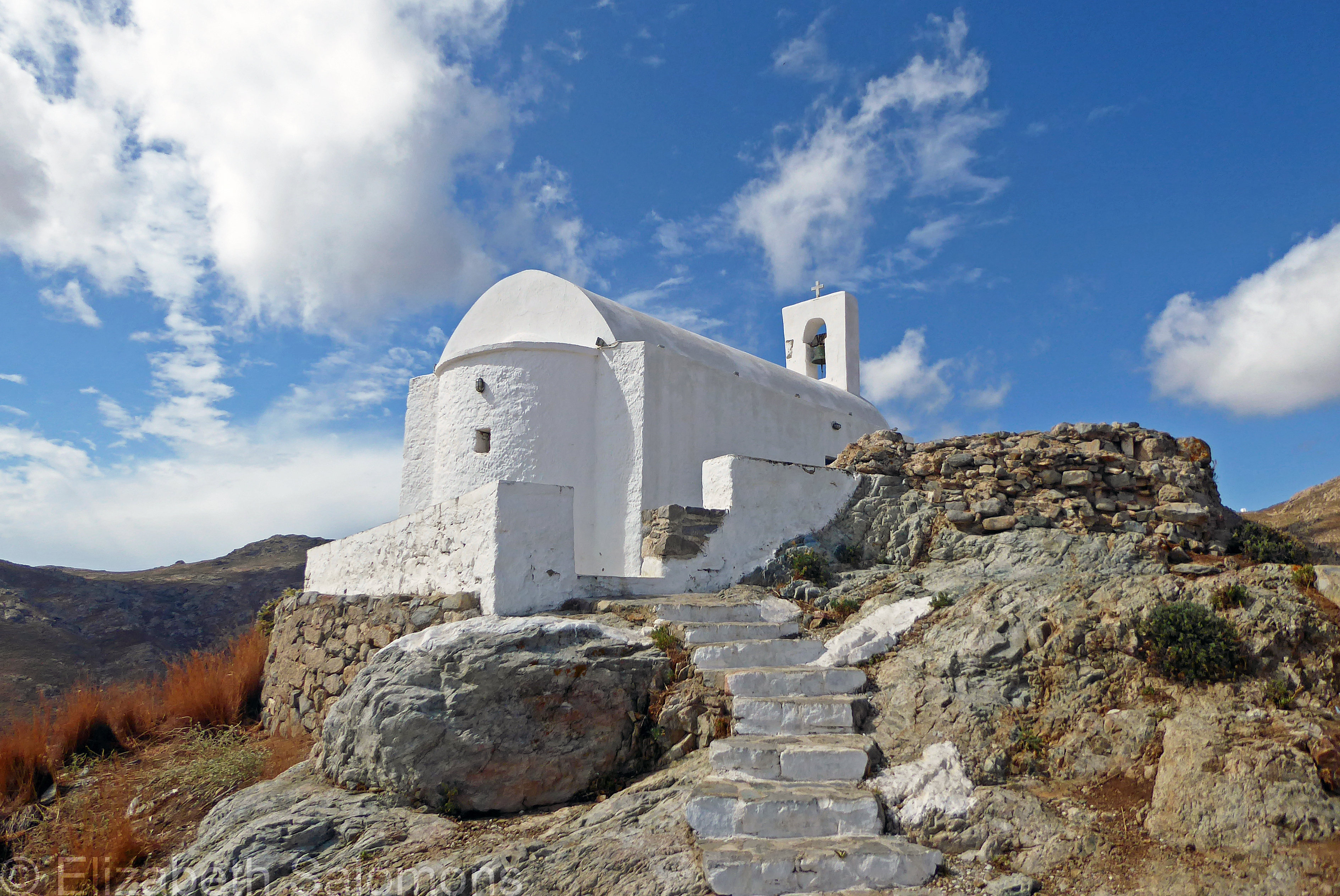
If you take a few steps from where I took last week’s photo, you have an excellent view of how the church of Agios Konstantinos was built on the ruins of the castle at the top of the Chora of Serifos. This view of Agios Konstantinos from the back is my photo choice for today, the Fourth Sunday of Lent.
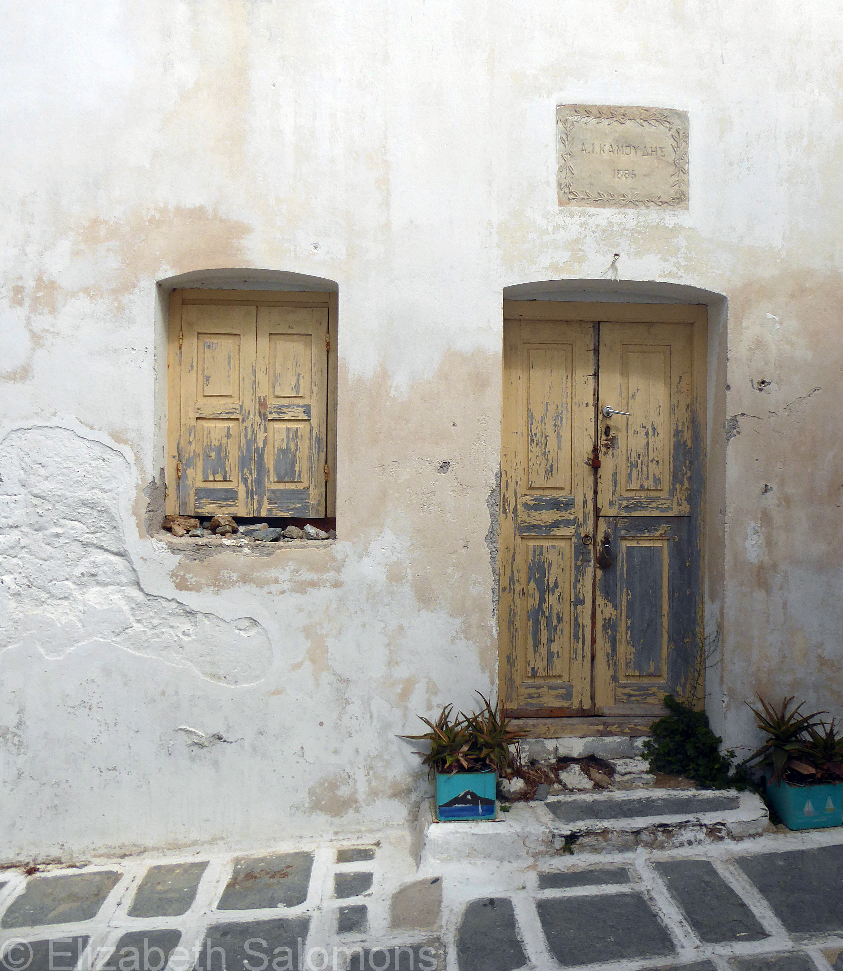
Doors and Windows of Serifos
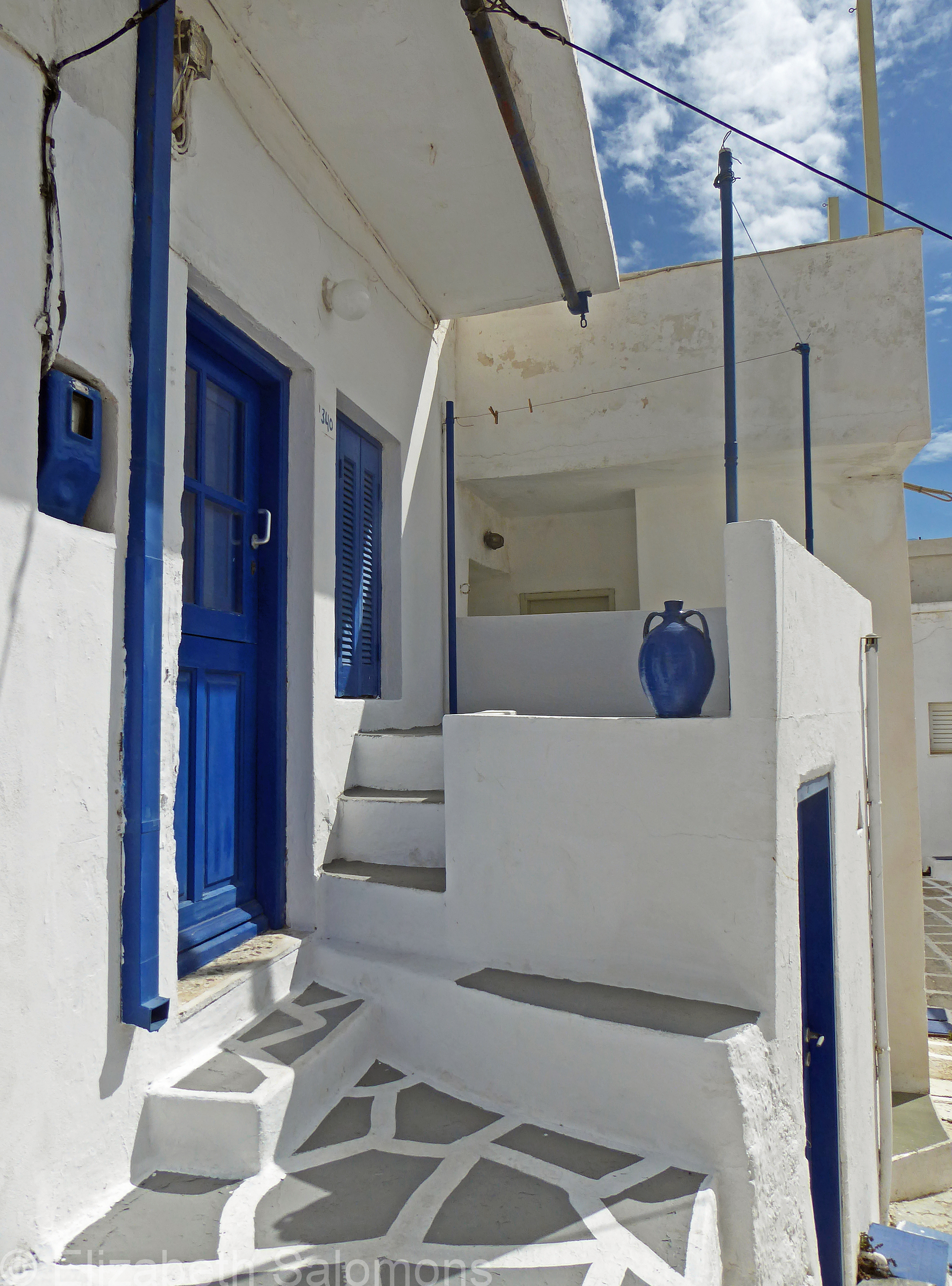
Naturally, I had far too many photos for my post about the Chora of Serifos, so here are some of the outtakes — most of them doors and windows.
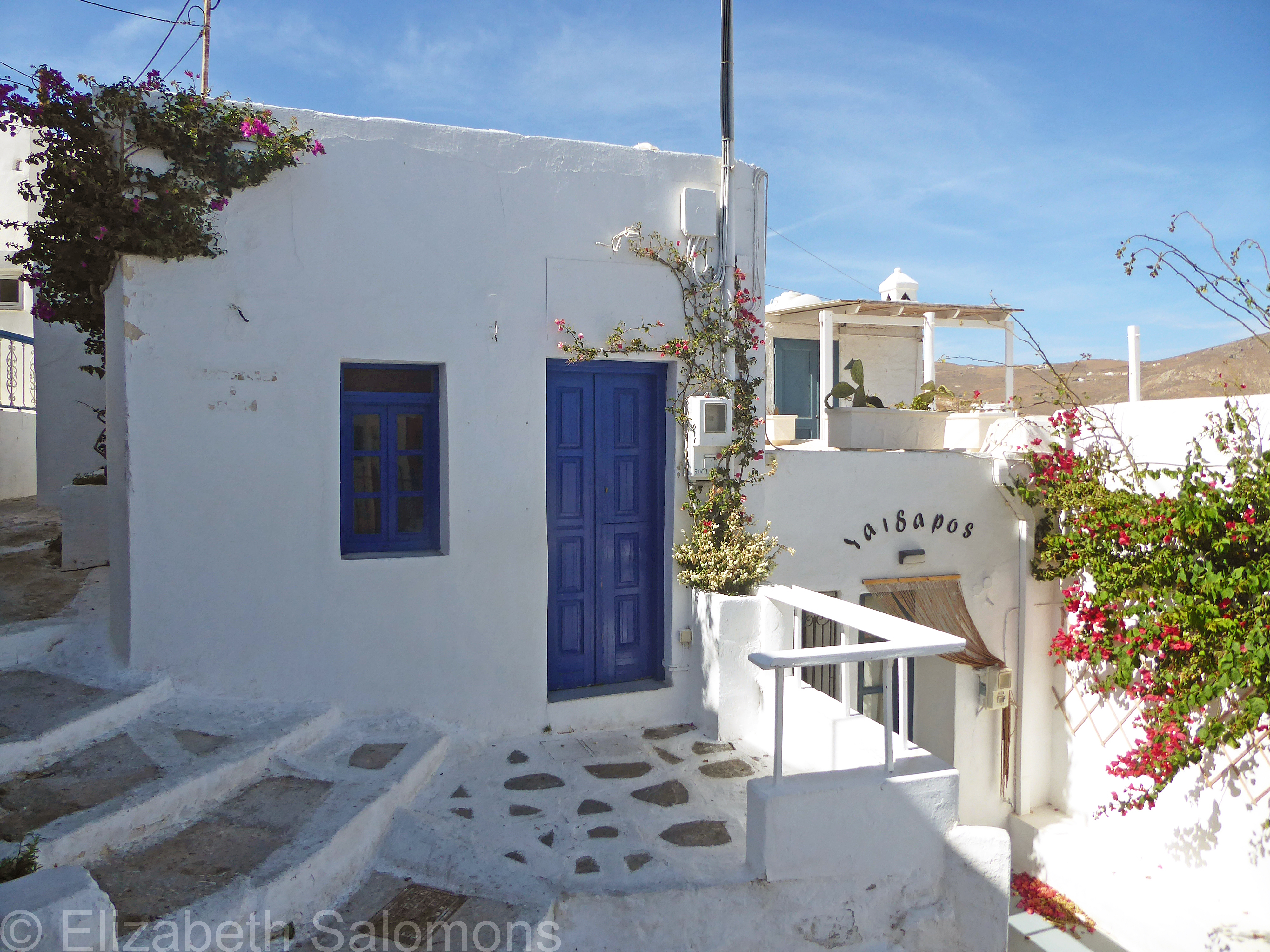
One might assume, as I did, that the colours of the Cycladic houses come from the Greek flag. Or from the colours of the Aegean Sea and the Grecian skies. But it turns out the blue-and-white colour scheme has a much more basic origin.
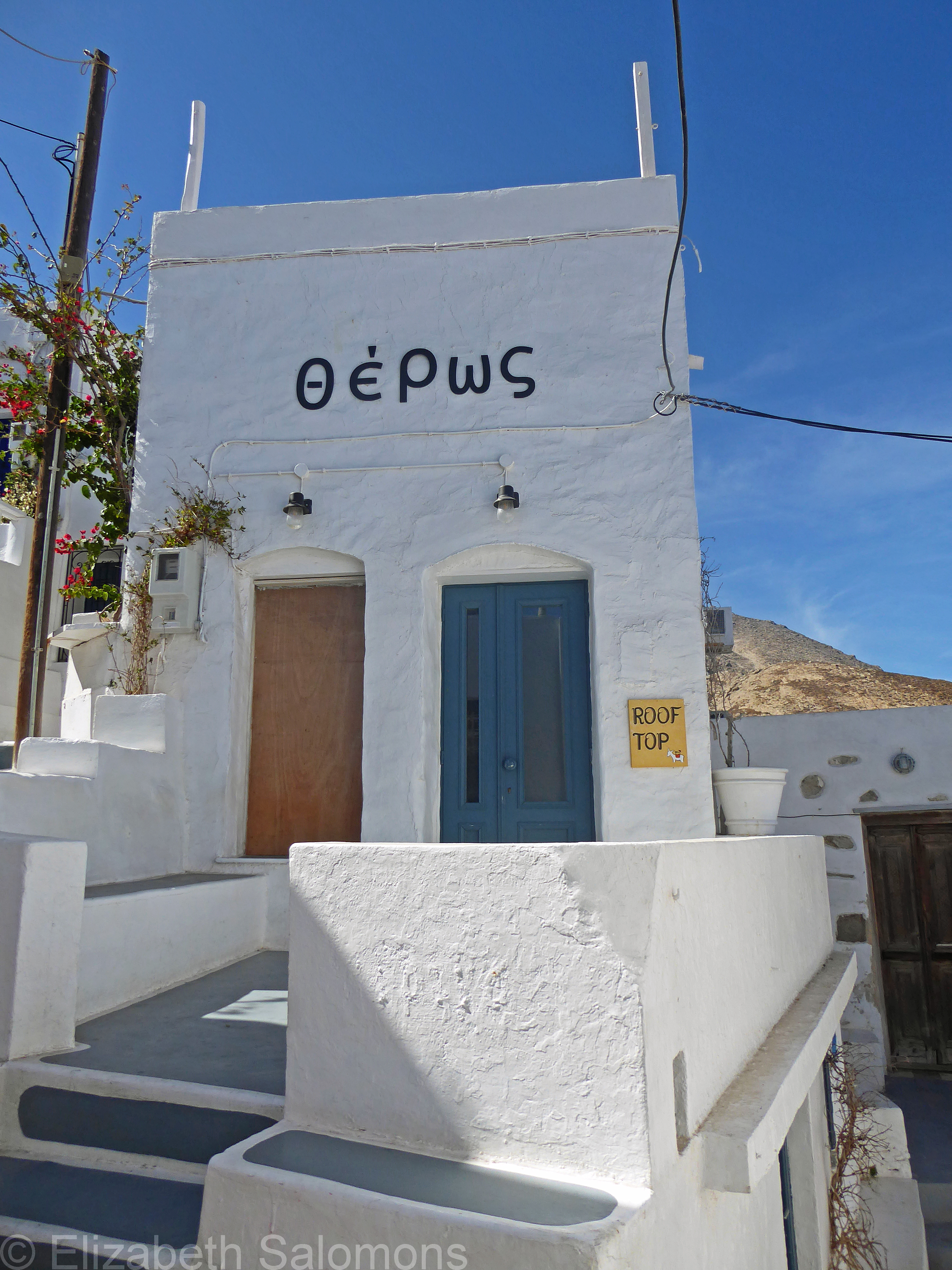
White is a practical choice, of course. Along with the thick stone walls and small windows, it helps the houses stay cool — an all-important consideration in the Mediterranean climate. But whitewash also contains limestone, a natural disinfectant, and during a cholera outbreak in 1938, it was ordered that whitewash be applied to all houses to help prevent the spread of the disease.
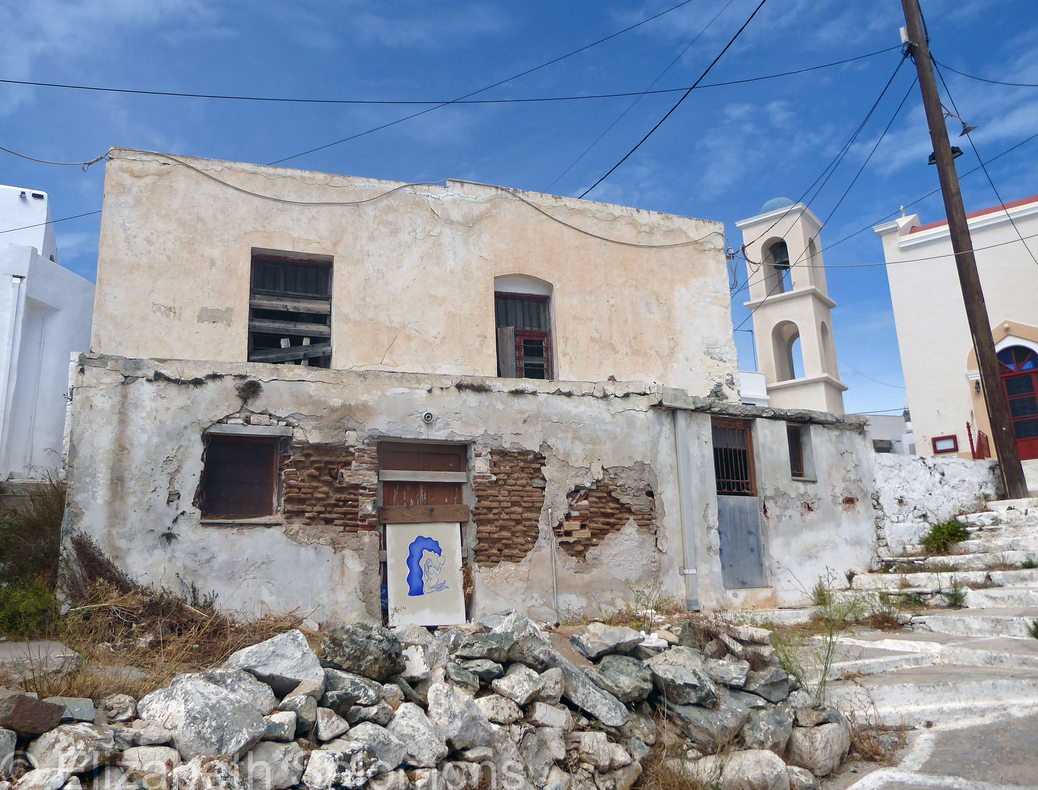
And blue? Turns out blue was the cheapest colour of paint available and after painting their boats, fishermen used any leftover paint on their houses.
Then, in 1967, the military dictatorship that ruled Greece at the time ordered all houses be painted blue and white because the colours were considered patriotic. White was linked to purity and independence (remember the uniforms of the Presidential Guard?). And, yes, blue represents the sea and the sky.
The colour scheme was made law in 1974. Those laws are no longer in place, but the blue and white colours have become so synonymous with the Greek islands that everyone keeps the traditional colours.
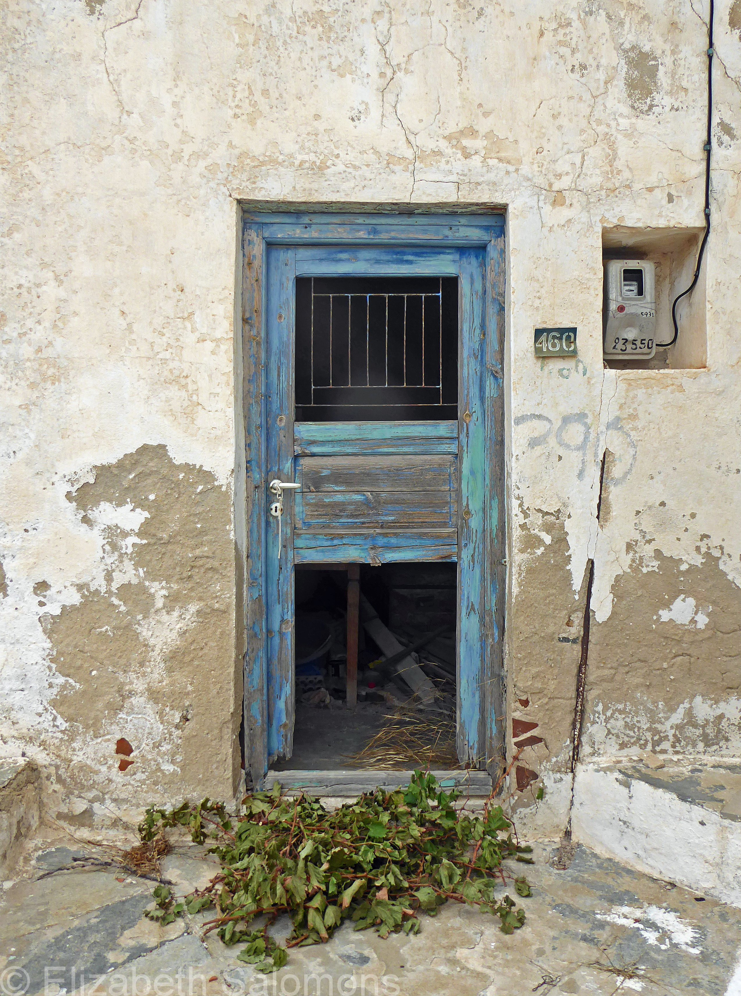
One final bit of trivia: many of the Greek islands were colonized by the Venetians and their influence can be seen in the construction of the doors and windows.


Through My Lens: Agios Konstantinos

For the Third Sunday of Lent, I’m posting a photo of the church of Agios Konstantinos. This small chapel was built almost two hundred years ago on the ruins of the castle built by Venetian traders back in the fifteenth century. Its location at the highest point of the Chora, about 250 metres above sea level, makes it the best spot for a panoramic view over Serifos.
Agios Konstantinos (Saint Constantine), also known as Constantine the Great, was Emperor of Rome from 306 to 337 CE, founder of Constantinople (now called Istanbul), and the first Roman emperor to convert to Christianity. He is credited with stopping the persecution of Christians and making the Christian faith the dominant religion of the Roman Empire.
Through My Lens: Agios Athanasios
Even an island as small as Serifos has a cathedral and that would be this church, the Cathedral of Agios Athanasios. Agios Athanasios (Saint Athanasios) was the twentieth Patriarch of Alexandria and a key figure at the First Council of Nicaea held in 325.
Built in 1820, the cathedral is located in Pano Piatsa (the main square) of the Pano Chora and is my photo choice for today, the Second Sunday of Lent.
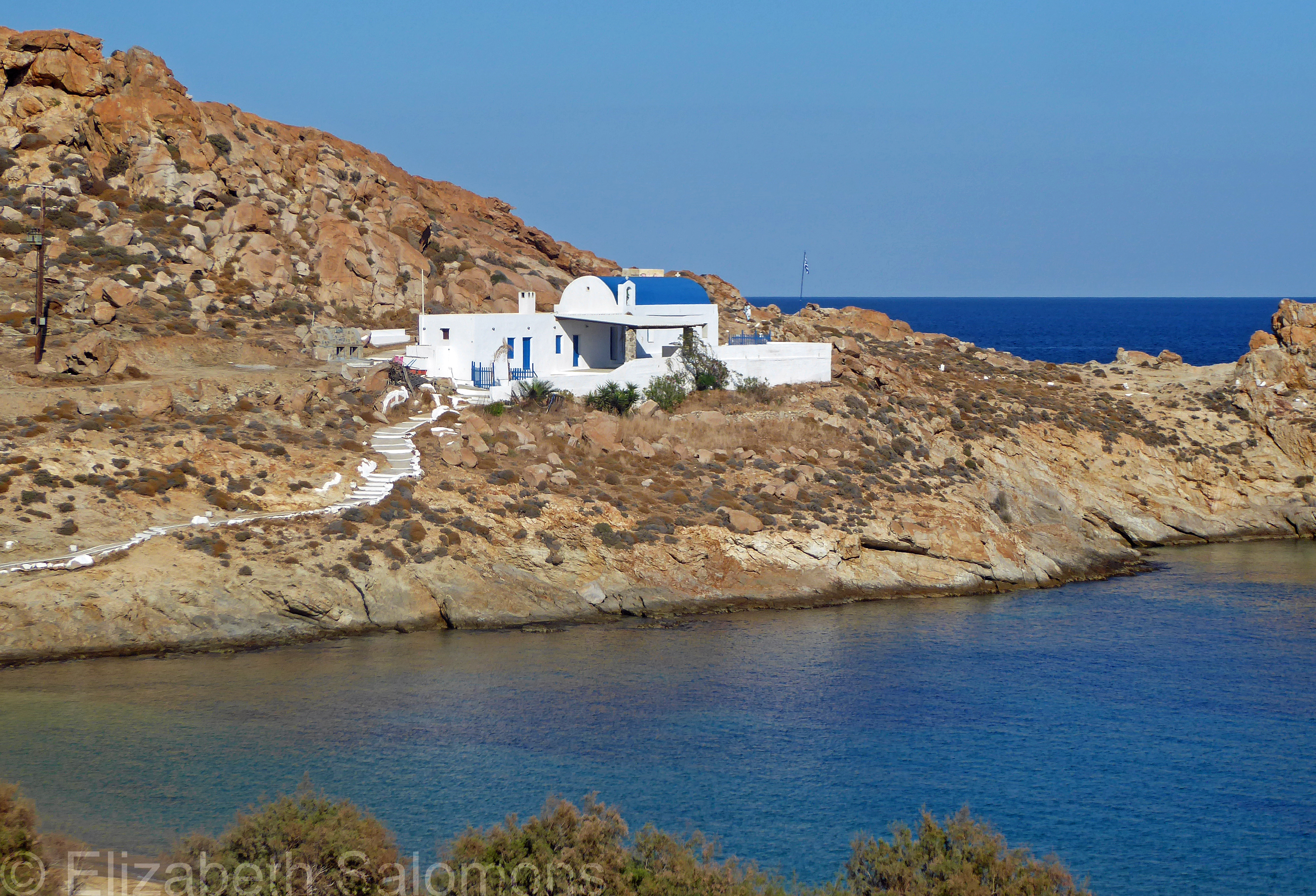
Through My Lens: Agios Sostis
When I asked my home exchange friend if there were more beaches or churches on Serifos, she laughed.
“Oh, churches,” she said. “Definitely!”
And so, needless to say, this year’s Lenten series will be all about the churches of Serifos.
For today, the First Sunday of Lent, here is a photo of Agios Sostis, which is the name of both the church and the beach. I spent two delightful afternoons lying on this beach, looking at this church located on a headland jutting out into the Aegean Sea. My second time here, we lazily watched as a wedding party made its way up that pathway to the chapel.
Agios Sozon (Saint Sozon) is known in Greece as Sostis. Born a shepherd, he was martyred around 300 CE and is celebrated every year on September 7. He is revered as a protector of fishermen, sailors, and anyone who travels by sea.
Panegyri on Serifos
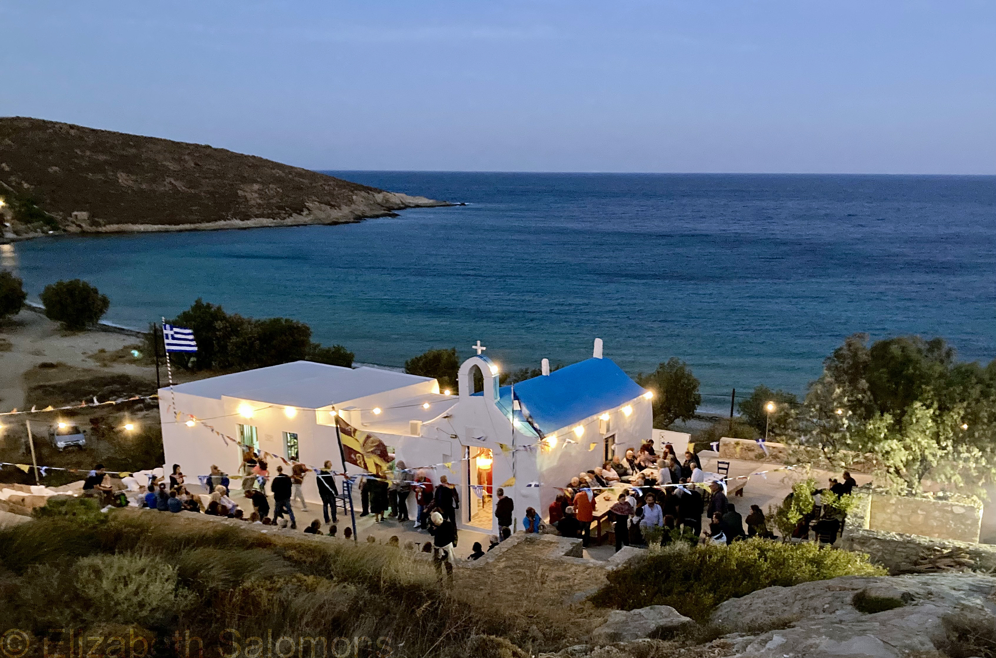
It hadn’t even been 24 hours since my arrival on Serifos and I was already on my way to a party. My home exchange partner had invited me to a panegyri.
Truth be told, I dithered about whether to go. Who would I talk to? How would I get home? That was the introvert in me talking. But the traveller in me was desperate to go. And in the end I went because I could hear in my head the voice of my dearest friend, saying, “What do you mean you didn’t go?”
Panegyria are a centuries-old tradition in Greece. The word comes from the Greek word pan (meaning all) + ageiro (meaning to gather). Originally, they were large gatherings dedicated to the worship of a deity, but, over time, they have shifted to celebrating Christian Orthodox saints.
Panegyria are especially common in rural communities and on the islands where local families take on the responsibility of maintaining and caring for the many small churches. As each saint’s day is celebrated, the family responsible for the church dedicated to that particular saint hosts a community feast, complete with live music and dancing.
Tourists are always welcome. On my first visit to a Greek island (decades ago, when I was travelling the European continent on a train pass), my friend and I ended up at three such festivals within four days.
The panegyri I attended on Serifos was at the church of Agios Ioannis (Saint John the Apostle). We were too late for the religious service, but made our way into the chapel anyways, just for a moment, where we left a donation and my home exchange partner lit a candle.
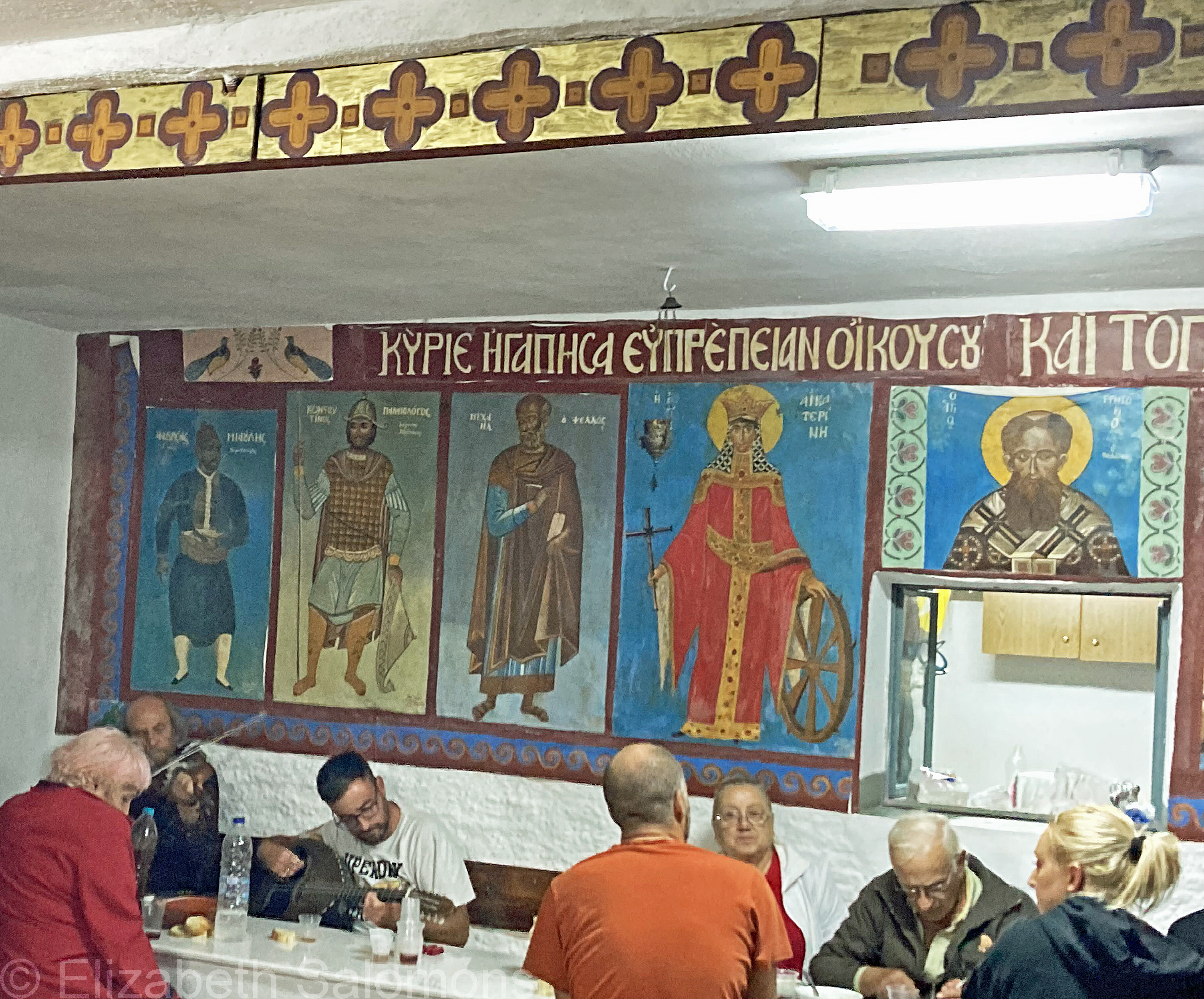
Outside was a table where everyone ate in shifts; my home exchange partner introduced me to her friends and we stood and chatted until it was our turn to eat. There was wine, potatoes, some kind of grilled meat, fava bean soup, and lots of bread. It was clearly a family affair with the men grilling the meat, the women running the kitchen, and the children serving the food.
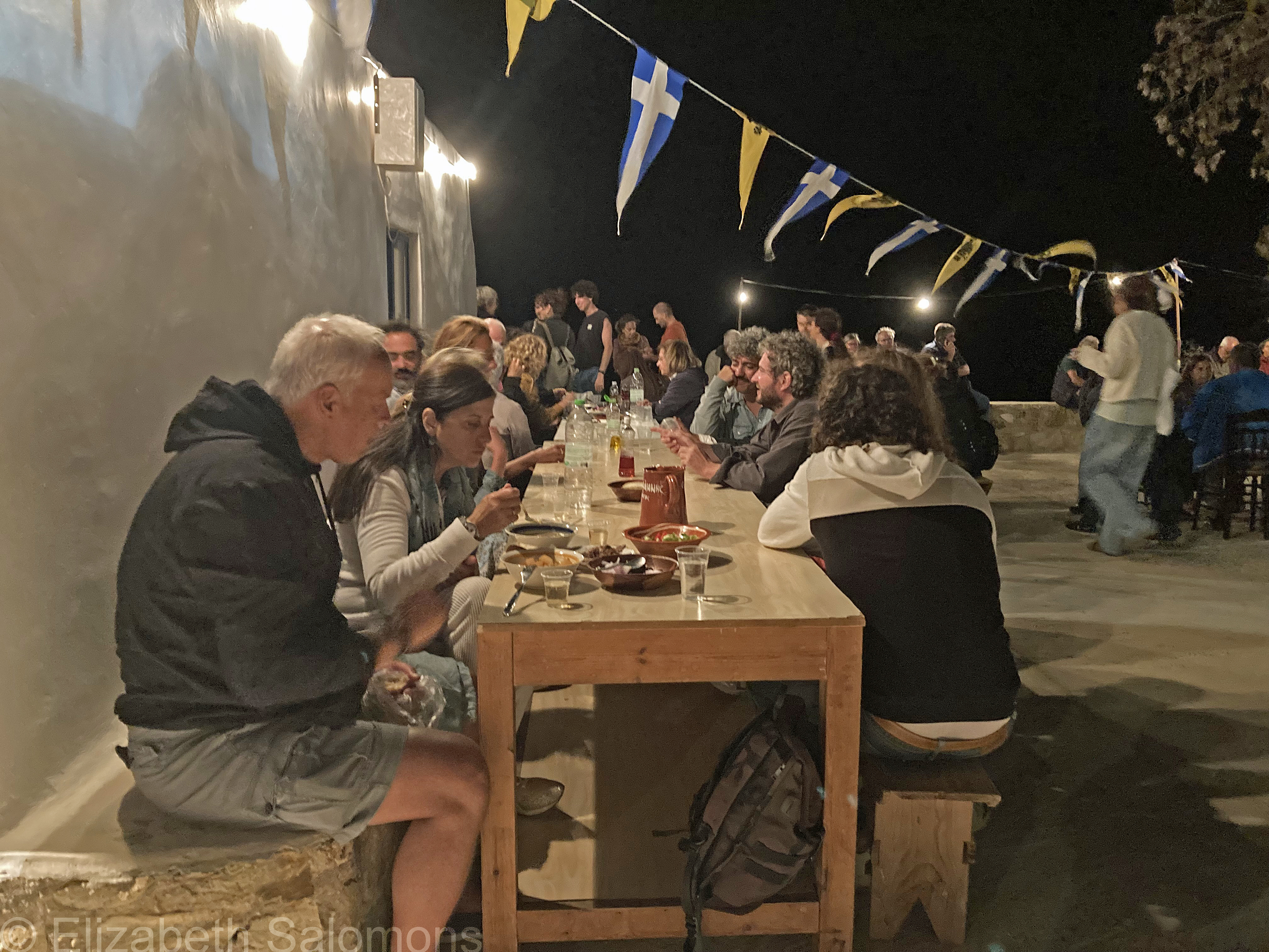
Eventually the music started up in the portion of the building next to the kitchen and we moved indoors to listen. Someone played a violin, another a bouzouki. The songs were long and when they ended, there was lots of applause. The musicians would rest for a bit, then the bouzouki player started picking out another tune and it would all start up again.
It was quite late when my home exchange partner turned to me and laughed at the fatigue she could clearly see on my face. She jumped up and said she would find me a ride home. And a few minutes later, as I walked up the hill to the main road with the Serbian couple who were willing to give me a lift (they were also staying in the Chora), a group of young women, clearly tourists, passed us on their way down. They thought they had missed the panegyri. I assured them they hadn’t, but they were alarmed that they couldn’t hear any music.
“The music is indoors,” I said. “Go on down, you can’t miss it.”
Nor had I — and I was so glad I hadn’t.
