
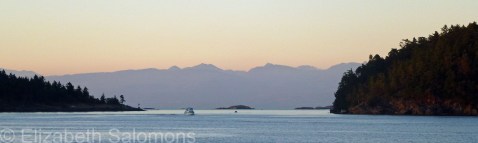
Through My Lens: Departure Bay
Here’s one last photo before we leave Vancouver Island. This is what you see from the ferry as it leaves Departure Bay on the Island for Horseshoe Bay in West Vancouver.
I never get tired of this view.
Through My Lens: Jets on the Taxiway
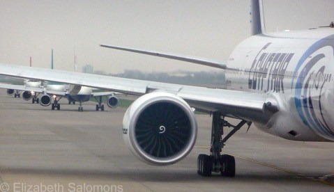
Eventually, and usually inevitably, the European vacation comes to an end ― and we come home.
The long journey goes much quicker if you can find something to amuse yourself with en route. Like I was here. I took this photo of jets lined up on the taxiway at London’s Heathrow Airport in March 2011.
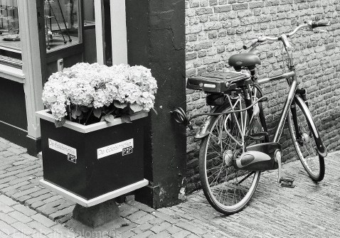
Through My Lens: De Fiets
Fiets is Dutch for “bike.” In the Netherlands, there are almost as many bikes as there are people.
Here’s one of them.
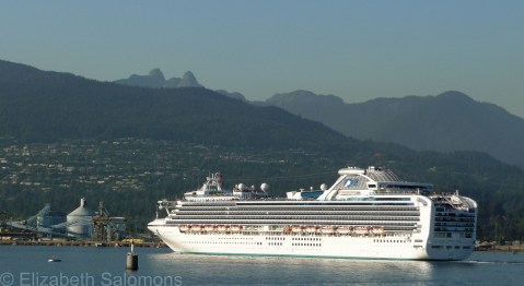
Through My Lens: Burrard Inlet

There’s always lots going on in Burrard Inlet. Not surprising, since it’s the location of Canada’s largest and busiest sea port.
In this photo, you can see one of those freighters that keep the port hopping. Behind the freighter, to the left, you can just make out three cruise ships docked at Canada Place. And playing chicken with the freighter is the SeaBus ― a passenger-only ferry that plies back and forth across the inlet carrying commuters from the North Shore to downtown Vancouver.
Like I said, lots going on.
Road Trip: Tamiami Trail & Overseas Highway No. 1
 Like most kids who grow up on this continent, my first travel adventures were road trips with my family during the summer holidays. Now, as an adult, road trips have become few and far between.
So, for that reason, I was excited to include a coast-to-coast road trip on my recent visit to Florida. Coast to coast? Yup. That would be from the Gulf Coast to the Atlantic Ocean.
Now, there are two ways to get from Tampa (on the Gulf Coast) to Miami (on the Atlantic Ocean). The quick and fast way is over the interstate (I-75). There’s also the more scenic route: the Tamiami Trail (that’s Tampa → Miami). Guess which route I took?
The Tamiami Trail cuts right through the middle of the Everglades. My intent was to stop here and there and do a bit of looking around, maybe take a walk or short hike through the swamp.
It didn’t happen. Because it rained. A lot. All the way from Fort Myers to Homestead, in fact.
So instead I saw a lot of this.

And my motivation to stop and get out of my rental car and do some exploring dwindled the farther I got from Tampa and the closer I got to the Florida Keys.
What I did do was make a mental note to one day come back with my tent and sleeping bag and leave myself enough time to stop over for a couple of nights. Camping in a swamp ― how cool would that be? I was impressed enough with what I did manage to see between swipes of my windshield wipers to know I would enjoy a closer look at the United States’ largest subtropical wilderness.
Enough about what I didn’t see in the Everglades.
I am happy to report that the weather cooperated once I got into the Florida Keys. The sun shone for the entire drive and the temperature hovered around 80°F for my entire visit. As evidenced by the next photo.

The Florida Keys is an archipelago of more than 1700 islands (called “keys”) strung like a broken string of pearls below the Florida peninsula. Forty three of the keys are connected by the Overseas Highway No. 1 ― a 200-km length of roads and causeways stitched together by bridges. A lot of bridges. A lot of long bridges. This one here is called the Seven-Mile Bridge. I learned that it’s exactly seven miles long by carefully watching my odometer.

Every key has a name. Some are well known (Key Largo, Key West), some are pretty original (Teatable Key, Bahia Honda Key, Sugarloaf Key), and some, well, it seems like they ran out of inspiration (No Name Key).
The keys vary in size and development. The bigger ones are lined with roadside diners, restaurants, and motels, and the odd strip mall; the lack of big box stores and fast food chains made it feel like I had stepped back in time about 40 years. Other keys are so small they have only a few houses, and no commercial development at all. The smallest keys are completely undeveloped.
As you drive along the Overseas Highway, you are never far from the water. In addition to the street address, directions are given as “Mile Marker [fill in a number],” Bayside or Oceanside (with Key West being Mile 0). So, MM 59 Bayside faces Florida Bay, and MM 73 Oceanside faces the Atlantic Ocean. Nifty, huh?


The Florida Keys is known as a destination for fishing, snorkeling, and diving ― none of which I do ― but if you are looking for an idea for your next road trip, I can highly recommend a drive along the Overseas Highway. As road trips go, it’s pretty spectacular.


Queen of Nanaimo
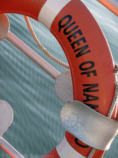
I can’t leave off my tour of the Gulf Islands without posting a photo taken on a BC ferry. That’s because, for me, half the fun of a Gulf Island getaway is getting there.
The Queen of Nanaimo is the workhorse of the Gulf Islands. The ship is almost 50 years old, but it’s the one that does the daily milk run from Tsawwassen to Galiano to Mayne to Pender to Salt Spring and back again.
Almost a month ago, during this season’s first wind storm, the Queen of Nanaimo was blown off course and ran aground near Mayne Island. It sustained enough damage to be put in dry dock for two weeks, which meant that Gulf Island residents wanting to travel to Vancouver had a six-hour detour over Swartz Bay on Vancouver Island.
BC Ferries are the Gulf Islands’ highway and it’s easy to take them for granted ― until sailings are cancelled and you want to get from here to there.
Golden Gate Bridge
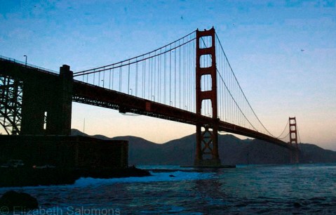
The first time I saw the Golden Gate Bridge, I was in a plane. Only its two towers were visible; the rest of the bridge was hidden in the fog. I found out later that fog is a common weather phenomenon in San Francisco and the two towers of the Golden Gate Bridge are often as much as you ever see of it from an airplane.
I didn’t get any closer to the bridge that time ― or see anything of the city ― as I was merely on a stop-over on my way to somewhere else.
The second time I saw the Golden Gate Bridge, I was in a car driving over it. I’d been visiting a friend in the Sonoma Valley and, after a couple days of touring wineries and wine-tasting, we decided we should spend a day in San Francisco. When you drive from the Sonoma Valley to San Francisco, you enter the city by crossing over the Golden Gate Bridge.
I couldn’t stop marvelling at the bridge; I may even have giggled. My first thought was probably, “Wow!” I know for sure my second thought was, “The Lions Gate Bridge is just a toy compared to this one!”
The Golden Gate Bridge opened in 1936, and I like to think of it as the Lions Gate’s older, more grown-up sister. At six lanes, it’s twice as wide as the Lions Gate and it’s a kilometre longer. Those three additional lanes are what impressed me ― it feels more like an expressway in the sky than a bridge.
It I don’t know if the Golden Gate Bridge would have impressed me as much had I not been so familiar with driving over the Lion’s Gate Bridge. But I do remember I asked my friend to drive over it again, just for the thrill of it.
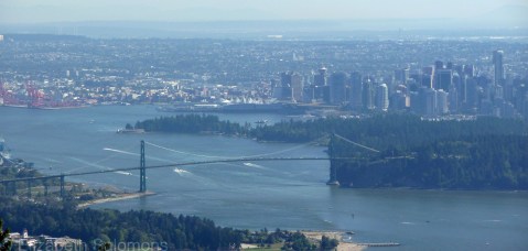
Happy Birthday, Lions Gate Bridge!

The Lions Gate Bridge is having a birthday, and it’s a big one. It was on November 14, 1938 ― 75 years ago today ― that the bridge was first opened to vehicle traffic. The Guinness family (yes, that Guinness family ― the one that brews the beer) wanted a bridge across the First Narrows of Burrard Inlet to provide access to the land on the North Shore they were hoping to develop. (The area was both then and now known as the British Properties.) To help move things along, the Guinness family offered to pay for the bridge to be built, and the City of Vancouver found itself with an offer it could not refuse.

It took 18 months to build the Lions Gate Bridge, its construction came in under budget, and, at the time of its opening, its 1.8 km length made it the longest suspension bridge in the British Empire. It is named after the Lions, the twin mountain peaks on the North Shore that face the city. Two Art Deco–style lions guard the approach to the bridge’s south end.
In 1955, the Guinness family sold the bridge to the province for exactly the same amount that they spent on building it ― a mere $6 million. The Guinness family also paid for the lights that have adorned the bridge’s cables since 1986, as a gift to commemorate Expo 86.

More than 60,000 cars cross the Lions Gate Bridge each day, a number it was never designed to accommodate and which has often led to it being called “Canada’s most scenic traffic jam.” By the 1990s, the bridge was showing its age and serious consideration was given to replacing it. Instead, it was restored and given a seismic retrofit, and its deck was replaced, all at a cost of more than $100 million. All work was done in 12 months between 2000 and 2001 without any disruption of daytime traffic ― no small feat in a city where traffic is easily snarled when any one of its bridges is closed. In 2004, the Lions Gate Bridge was designated a National Historic Site of Canada.
Amtrak Cascades
In my last post, I told you how my friends and I travelled to Seattle. Wanna know how we got home?
We took the train.
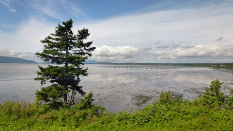
Semiahmoo Bay
I’ve been down Interstate 5 to Seattle more times than I care to count, both by car and by bus. The I-5 extends from the American–Canadian border all the way down the West Coast of the United States to Mexico. If you’re inclined to drive that far, it would be quite the road trip.
But, as efficient as they are, American interstates aren’t known for their beauty. I’ve always felt that taking the I-5 was a bit of an endurance test to get through before the prize: your final destination (in my case, usually Sea-Tac Airport). And thanks to the collapse three days ago of the Skagit River Bridge on the I-5 just north of Seattle, that will most definitely be true for many months to come until the bridge is repaired or replaced.
But the train! What a revelation that was.
The Amtrak Cascades is the name of the Amtrak route from Eugene, Oregon, to Vancouver, Canada. The northbound leg from Seattle to Vancouver hugs the Pacific shoreline for the first while, moves inland for a bit through some of Washington’s fertile farmland, and then heads back to the coast and crosses the Canadian border at White Rock, BC. Unless you’re paying close attention, you don’t even realize you’ve crossed the border. (All passengers, both northbound and southbound, go through customs in Vancouver.)
After rounding Boundary Bay, the train takes you across the municipality of Delta (named after the Fraser River delta) and east along the Fraser to New Westminster, where you cross the rail bridge beside the Pattullo Bridge. Then it’s a quick ride northwest through Burnaby to Pacific Central Station near downtown Vancouver.

Pattullo Bridge, with the Skytrain Bridge behind
If you book your tickets far enough in advance, the train costs about half of the bus fare. It’s a far prettier route than the I-5, and the wait to go through customs is far shorter. My second travel tip of the week? Take the train.

Pacific Central Station
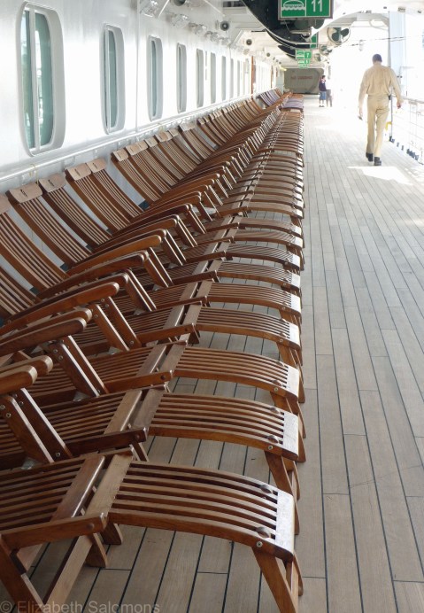
Repositioning Cruises

Those in the know (which, believe you me, is seldom yours truly) know that “repositioning cruises” can offer some of the best deals on cruise fares. What’s a repositioning cruise, you ask?
A repositioning cruise is when a ship based at one port sails to another port where it will be based for the next season. Typically, repositioning cruises take place on ships relocating from northern-hemisphere ports to southern-hemisphere ports, or vice versa, and they occur at the beginning or end of a season.
Twice a year, in May and September, there are repositioning cruises that stop to pick up passengers in Vancouver. These ships sail all the way to … Seattle. Yup, these would be the shortest of all repositioning cruises.
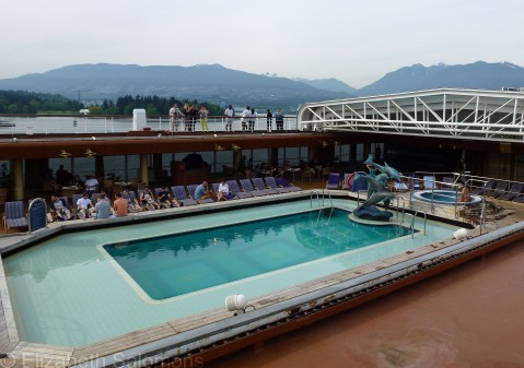
I’ve taken a couple of these cruises. One was a few years ago in the fall, when a ship was relocating from its base in Vancouver to the South Pacific after a summer of cruising up and down BC’s Inside Passage to Alaska. A friend and I boarded the ship in Vancouver. After we got off the next day in Seattle, the ship sailed on to Hong Kong and Australia.

The other was just two weekends ago, when my friends and I were on a ship that was repositioning from San Diego to Seattle, but made stops in Victoria and Vancouver along the way.
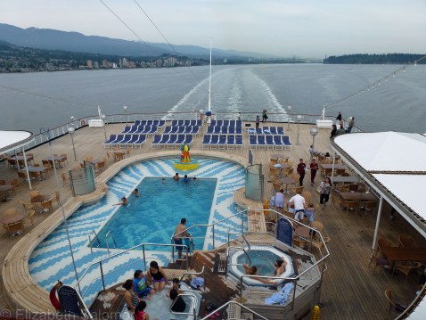
Mini-cruises are a great deal. Included in the fare are three meals, transportation from Vancouver to Seattle, and a night’s accommodation for less than you’d pay for one night in a Vancouver hotel. While on board, we saw couples, groups of couples, groups of friends, and entire multi-generation families who, like us, were enjoying all the amenities these ships have to offer.
The cruises are also a great way to get a wee taste of cruising life before you commit the time and money to a longer cruise. For Vancouverites who are looking for something different to do on a weekend, but don’t have the time or inclination to go far, take a cruise to Seattle.

