
Through My Lens: Stanley Park in Fall
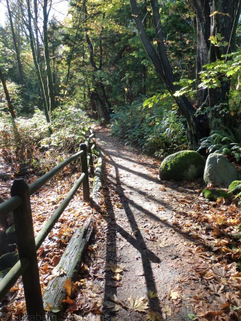
It’s well and truly fall again. Here is a photo I took this past week while walking through Stanley Park. The path is called Ravine Trail, and it gets you from the seawall by Burrard Inlet to Beaver Lake. I think it’s one of the prettiest walks in the park.
Road Trip: Crowsnest Highway
I’ve written before how my road trips are few and far between, but that every once in a while I do switch it up and get behind the wheel of a rental car to admire the scenery through a windshield. Such was the case last summer when I chose to drive from Vancouver to Alberta and back. There were a number of reasons why I decided to drive, but not the least of which was that I’ve never driven the Crowsnest Highway. I was eager to explore a new corner of my home province.
And you know what? The Crowsnest Highway is unbelievably beautiful. Totally. Blew. My. Mind.
When I have an experience like that in my own backyard, I always have to ask myself: why ever do I travel outside of Canada when there is so much beauty right here?
Rhetorical question, people. Moving right along …
The Crowsnest Highway takes its name from the Crowsnest Pass, which is a valley that crosses the Rockies just north of the US–Canada border. The pass got its name from Crowsnest Mountain, which the Plains Cree named after the many large black birds nesting in the area. They were likely ravens, though, not crows.
The Crowsnest Highway is also known as Highway 3. Back in the nineteenth century, there was a gold rush trail through the Kootenay Mountains and a highway ― the Crowsnest ― was built along the remnants of that trail in 1932.
I got on the Crowsnest Highway near Pincher Creek, Alberta, after my visit to Head-Smashed-In Buffalo Jump, and I followed it, mouth agape in a state of constant awe, all the way west to Osoyoos, British Columbia. Here is a quick photo tour. (Click on the first photo at top left to open the slide show.)


Most folks, including myself, usually take the Trans-Canada Highway from Calgary to Vancouver. It, too, is a scenic drive ― one of the best on the planet, in my humble opinion. But if you have the time and the inclination to go slow,* check out the Crowsnest Highway. It’s well worth a look.
*The Crowsnest is about 250 km longer than the Trans-Canada, and, unlike the Trans-Canada, is not twinned, so it is a longer and slower route.
Yoho National Park
Here’s the thing I discovered about Banff National Park during my visit last month.

It’s operating at capacity.
I don’t mean it’s super crowded and chock-full of tourists. I mean there is, quite simply, no more room. Every campsite is filled, every hotel room is booked, and the streets of Banff townsite are gridlock by noon, as are the access roads to Lake Louise and Moraine Lake.
So what solution to the madness does someone who has just driven from Vancouver to Banff suggest to her family?
That they head across the Alberta–BC border to Yoho National Park.
Yoho was created a national park in 1886, just a year after Banff. It’s slightly over 500 square miles, about a fifth of the size of Banff, but it packs just as much awe and wonder ― in fact, its name, Yoho, is a Cree expression of wonder.
Just like in Banff, there is a wide assortment of hiking to do in Yoho, both short day hikes and longer overnight hikes in the back country.
And, just like in Banff, there are photo ops. Gazillions of photo ops.
Here is one. This is Takakkaw Falls. Takakkaw is another Cree expression ― it means “it is magnificent.” (My brother and sisters and I had a lot of fun with the word “takakkaw” back in the last century when we were little kids.)

Here’s another. This is the Natural Bridge, which straddles the Kicking Horse River. I also remember coming here when I was little, and I remember how fascinated I was by the origin of the name “Kicking Horse River.” James Hector named it that after getting kicked by his pack horse. Hector was a member of the Palliser Expedition, a group of men surveying possible routes for the Canadian Pacific Railway. They reached the Kicking Horse River in 1858.
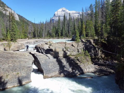
Here’s a look at the Natural Bridge from another angle.

And here’s a closer look at the mighty Kicking Horse River. That’s Mount Stephen behind.

Just down the road from the Natural Bridge is what’s known as the Meeting of the Waters. It’s the confluence of the Yoho River (at left, in the photo below) and the Kicking Horse River (dead ahead). You only need to stand here for a second or two to be overwhelmed by the power of these two rivers.
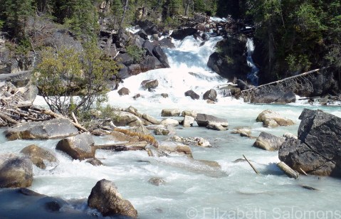
Turn to the right, and you have this view.

So, here’s my tip of the summer: the next time you can’t get close to Lake Louise, get back on the Trans-Canada Highway and drive another twenty minutes west to Yoho National Park. You won’t regret it.
Through My Lens: Water Lily
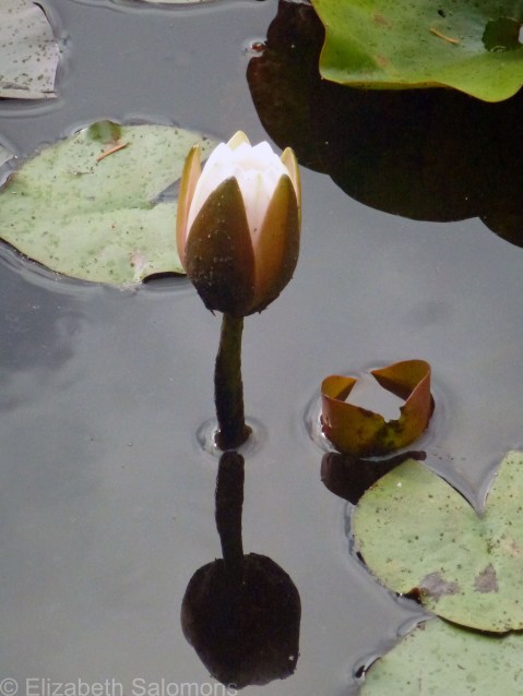
I took this photo of a water lily last weekend while walking around Stanley Park’s Beaver Lake with some friends.
As beautiful as they are, water lilies are threatening the lake’s biodiversity. Beaver Lake is slowing filling in with sediment, thanks in no small part to the fast-growing invasive species. Plans to dredge the lake are in the works.
Through My Lens: Cheakamus Lake
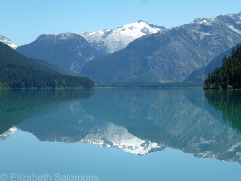
Today’s photo is of another lake, but this one is much closer to home. I hiked out to Cheakamus Lake just this afternoon. It’s located in Garibaldi Provincial Park, just outside of Whistler.
What a view.
Team USA
There are an awful lot of Americans wandering around town this weekend.
How do I know they’re Americans?
Well, they are wearing a lot of Stars and Stripes. On their T-shirts. On their caps. Even on their footwear. That American flag is everywhere. And if they aren’t sporting a flag on their clothing, they’re dressed in red, white, and blue.
Why so many more American tourists in town than is usual for a July 4 holiday weekend?
It likely had to do with a certain soccer match that Vancouver hosted today at BC Place.
Yup, it’s a World Cup summer once again. Congratulations, USA!
To commemorate the victory of Team USA, here’s a photo of the biggest American flag I have ever seen. I photographed this one hanging on the building that houses the New York Stock Exchange on my last visit to New York.

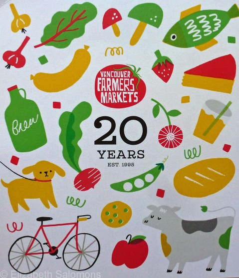
West End Farmers Market
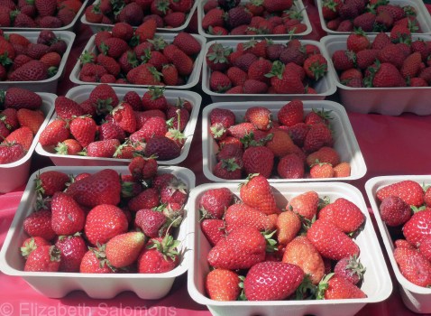
I know summer has well and truly arrived when the West End Farmers Market returns.

As it did today.
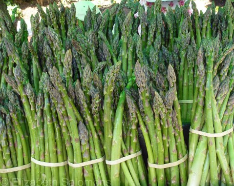
And it’ll be here, every Saturday, until the end of October.
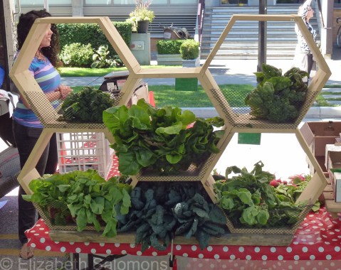
Oh joy, oh bliss. Shopping at your local farmers market is the best way to maintain a 100-mile diet.

Besides the West End Farmers Market where I shop (located alongside Nelson Park), Vancouver has six other summer markets. (There are also two winter markets.) You can buy fresh produce, cheese, baked goods, meat, poultry, and fish, and artisan products such as olives or fruit jams or soap. Vancouverites spend $8 million a year at their farmers markets and support 265 local farmers and artisans in doing so.

The best part? Everything tastes like summer. Truly.
Go on. What are you waiting for?
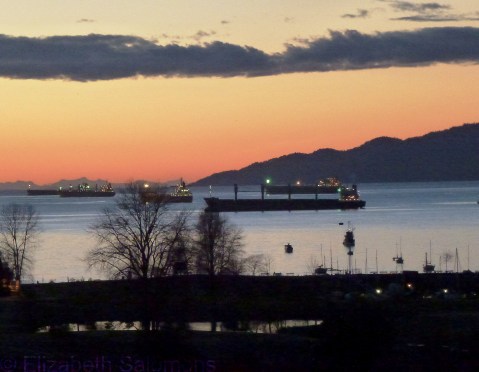
Freighters in English Bay
English Bay (aka the waiting room to Canada’s largest and busiest port) always has a dozen or more freighters anchored in it. The ships wait there, sometimes for days, until it’s their turn to load or unload their cargo.
Because they are always there, I think of the freighters in English Bay as part of my landscape. I don’t pay much attention to them other than sometimes using them to add interest to a photo.
Until this week. On Wednesday night the M/V Marthassa, a Greek-owned bulk carrier on its maiden voyage from Korea, was anchored in the bay waiting to take on a load of grain when it began leaking bunker fuel. More than two tonnes of the stuff would go into the water before the leak was stopped. Within hours, some of that oil had reached the beaches.
I took a long walk along those beaches today to get a closer look at what was going on and to reassure myself that everything was all right.
It’s not.
But it will be.
This week was a wake-up call for me. I will never again take my beach and my bay ― or the freighters in the bay ― for granted.
Through My Lens: Vancouver in February

I feel a bit cruel posting this photo, but, well, it does reflect the reality of what it’s like to live in Vancouver.
Vancouver in February = crocuses.
I feel cruel because my friends in Halifax and Boston are struggling to keep up with all the snow shovelling and my friends in Toronto and New York are facing endless days of sub-Arctic temperatures ― all while Vancouver is experiencing a non-winter.
And now, on top of all that, we get an early spring.
I saw daffodils in bloom in Stanley Park on New Year’s Day. The snow drops made their first appearance about ten days later. The crocuses have been up for weeks, and I saw the first cherry blossoms on February 11 ― about two weeks earlier than most years ― and they’re now in full bloom. Last weekend I even saw a flowering rhododendron.
And all this past week I’ve noticed the magnolia trees are starting to blossom. I have never seen magnolia flowers appear so early ― the trees typically bloom in April.
It doesn’t seem fair, given the winter the rest of the continent is having (and it definitely doesn’t seem Canadian).
But, hey, whoever said life is fair?
Someone has to live in Vancouver. Might as well be me.
Through My Lens: Foggy Lost Lagoon

I took this photo about a month ago at Lost Lagoon in Stanley Park. I was there specifically to photograph ducks. That takes patience, always, and concentration, sometimes, but my focus was interrupted by the fellow beside me.
“Did you see the Pied-billed Grebe?” he said, rather excitedly. I looked in the direction he was pointing and saw the duck.
And then, as we stood there, the fog rolled in in about the same amount of time as it took me to get my camera out of my pocket. I saw the shot (his Pied-billed Grebe was flanked by two Common Mergansers), took the photo, and then, well, I couldn’t help myself. I turned to him and said, “I can’t believe I get to live here!”
He smiled.
“It’s a $10-billion dollar backyard,” he said.
That it is. But moments like those are priceless.
