
Fort McHenry and Fort York
This year being the bicentennial of the War of 1812, we Canadians have been bombarded with what strikes me as an odd media campaign celebrating our nationhood. Odd, because we Canadians don’t typically yell and shout out our patriotism. Odd, because videos like this one
seem to be doing a pretty good job at celebrating our nationhood at the expensive of the other guys. You know, the ones who are suppose to be Canada’s Best Friend. Longest undefended border and all that.
Truth is, I don’t remember ever being taught anything in school about the War of 1812. That might be because I was (mostly) educated in Alberta, and the war took place in Upper Canada (what we now call Ontario), Lower Canada (what we now call Quebec), and the United States. Or maybe it’s because we Canadians don’t really give that war much thought.
What little I know about the War of 1812 is that it had something to do with the British boarding American merchant ships and drafting American sailors into the British Navy. (Britain was busy fighting Napoleon at the time and needed all the sailors it could get its hands on.) The Americans didn’t like that much (who would?) and they declared war on the British.
What little I have read about the War of 1812 says that nobody actually won. It more or less came to a stalemate, and sometime in 1814 the powers that be worked out an agreement called the Treaty of Ghent that more or less left everything pre-war as the status quo. And ― oh yeah ― we burned the White House. That was in retaliation for the Yanks burning our Parliament Buildings in York (what we now call Toronto), which was then the capital of Upper Canada.
(As an aside: burning government houses was considered bad form back then, and trashing non-military targets simply wasn’t done in the age of the Gentlemen’s War. Which is why the Brits got a tad upset and why they turned around and burned the White House. I find it ironic that everybody remembers the Brits burned the White House, but nobody seems to remember that the Americans burned York.)
(And, just one more aside: I found out during my visit to Washington DC last summer that the White House came to be called that because, after said burning, it was painted white to cover up all the soot marks. President Theodore Roosevelt made it official almost a hundred years later by having stationery printed with the words “The White House” at the top.)
Back to the war: a more accurate assessment of the War of 1812 might be that we both won. The Americans call it their “second war of independence,” and after it was over we Canadians began to think of ourselves as a nation, and not just some fur trading post for the British.
And so (finally!), to the main topic of this blog post. On my visits last summer to Baltimore and Toronto, with the War of 1812 being foremost in my mind due to our tax dollars hard at work, I decided to visit Fort McHenry and Fort York.
 Fort McHenry, I discovered, is not just a National Historic Monument, but a National Monument and Historic Shrine. That was pretty much evident during the video presentation I watched at the Visitors’ Center. The last image of the video, with the American anthem playing after the voice-over ends, is of the American flag. At the same time, the screen rises so that you are looking outdoors at the American flag flying over Fort McHenry. I tried not to snicker, but it was a bit hokey.
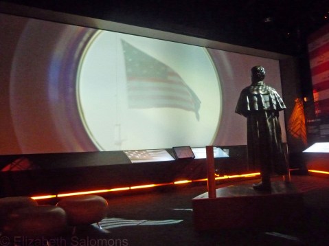
The end of the video presentation at the Fort McHenry Visitor’s Center. The statue is of Francis Scott Key, and he’s watching the Star Spangled Banner, still waving strong after the British bombarded the fort with rockets and guns for 25 hours.
Back to the War of 1812: the British knew they needed to capture Fort McHenry if their campaign against Baltimore was to succeed. They attacked the fort at dawn on September 13, 1814, bombarding the fort for a day and a night, but eventually they gave up and stopped the bombardment. The problem was, the American guns had a range of 1.5 miles, and the British guns had a range of two miles. The British navy parked itself just out of range of Fort McHenry’s guns, but that meant the shells from their guns couldn’t reach Fort McHenry accurately. Only two shells out of over 1500 fired actually hit the fort. Talk about a waste of ammunition.

Battery of guns overlooking the Patapsco River, with Francis Scott Key Bridge in the distance. During the Battle of Fort McHenry, the British fleet parked itself well past where that bridge now spans the river.

Another gun overlooking the Patapsco River

And yet another gun pointed at the Patapsco River
After the bombardment stopped, Francis Scott Key, an American lawyer who was being held by the British on a ship out in the Patapsco River, looked towards the fort and saw the large flag still flying. That told him the Americans were still in control of the fort. That same flag ― which measures an incredible 42 by 30 feet ― is now on display at the Smithsonian’s National Museum of American History.

When weather permits, an American flag the same dimensions of the original Star Spangled Banner is flown over Fort McHenry.
Francis Scott Key wrote the words to “The Star Spangled Banner” after the British released him and while he was on his way back to Baltimore. The “bombs bursting in air” line in the anthem refers to the British shells that were fired at Fort McHenry.
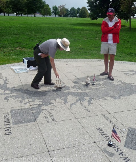
The national park ranger gives us a history lesson. I liked her model ships.
There isn’t much to see in Fort McHenry itself as it’s fairly small and there aren’t many buildings still standing. But you certainly get a feel for why its location was so important: it sits at the end of a narrow peninsula right at the entrance to Baltimore’s harbour, and is in a perfect position to defend the city. I took a water taxi out to the fort from Baltimore’s Inner Harbor, and it was a lovely, breezy way to see the harbour.

The barracks at Fort McHenry

Another view of the barracks. The barn-shaped building is the powder magazine.
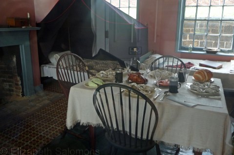
The junior officers’ quarters. Note the plates of oysters. Clearly the junior officers ate well.
Fort York, on the other hand, is located in the midst of a bustling, growing city, right beside Toronto’s Gardiner Expressway. This made for some intriguing photos as I looked for interesting angles.


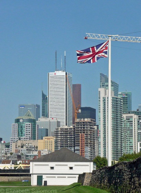


The museum displays at Fort York could use some updating, but it had many more rooms furnished in period pieces than did Fort McHenry, which makes a visit much more interesting. (Click on any of the photos below to open a slide show.)


The Americans attacked Fort York on April 27, 1813. The British were vastly outnumbered (750 British troops, 50 Mississauga and Ojibway warriors, and 12 guns vs. 2550 Americans, 15 naval vessels, and 85 cannon), and lost the battle, but the Americans suffered almost double the casualties of the British when the British blew up their own gunpowder magazine. The battle lasted six hours and cost 157 British lives and 320 American lives, including the American field commander. Afterwards, the Americans burned and looted the city of York, including the Government House and the Parliament Buildings (see above), and occupied the town for six days.

The Blue Barracks were built in 1814 to house the junior officers. These are a reconstruction.

The Brick Barracks and Mess, built in 1815, housed the unmarried officers and served as the mess for all of the garrison’s officers.

The Stone Magazine was built in 1815 and had room for 900 barrels of gunpowder. Its walls are two metres thick.
The Battle of York was a clear victory for the Americans, and marked their first invasion of British territory since the start of the war. But the battle itself wasn’t considered crucial to the outcome of the war and the Americans saw taking York merely as a stepping stone to the real prize: the Niagara Peninsula and, eventually, Kingston.
The Battle of Fort McHenry, on the other hand, was considered a turning point in the war, saved Baltimore from British invasion, and contributed to the early mythology of a nation still trying to forge its identity.
As for me, a gap in my Canadian history education has been filled, and my knowledge about the War of 1812 is now more complete. My government would be proud of me.
Staten Island Ferry
Looking at TV and Internet images of natural disasters is always tough, but never more so when you’re familiar with the region or you know people in the disaster zone. Such was the case for me this week. Hurricane Sandy ran right over the cities I visited last summer and I nervously waited to hear from people near and dear to me in Baltimore and New York City who both, thankfully, made it through to the other side of Sandy unscathed.
I was talking about the hurricane with a colleague on Tuesday morning, and I tried to explain to her the geography of New York City as she doesn’t know the city. That conversation made me think of the video I shot last summer from the Staten Island Ferry.
The Staten Island Ferry runs between the boroughs of Manhattan and Staten Island. It’s a free service, and I love ferry boats, so I hopped on one morning to get a good look at Lower Manhattan and the Statue of Liberty from the water. It’s about a 30-minute ride for the five-mile trip. On the Staten Island side, most tourists ― as did I ― turn around and hop right back on the ferry for the return trip to Manhattan.
The ferry connects with the subway on the Manhattan side. As you’ll see in the video, it was a bit of a blustery day when I took my ferry ride. After I disembarked, I stood at the subway entrance for a few minutes, debating whether to head Uptown on the train (much faster) or the bus (much better view). The subway station where I stood that morning (South Ferry – Whitehall Street) had water up to its ceiling on Monday night, and as far as I understand is still flooded.
I decided on the bus just as the skies opened up. It turned out to be a bit of a wild ride because of the weather. At each stop, New Yorkers poured onto the bus holding newspapers over their heads, and through the open bus doors I could see water gushing down the street.
But back to the video. The reason I wanted to show it to you is so you can see just how low Lower Manhattan is. Much of the southern tip of the island is, in fact, reclaimed land. (The Dutch were the first Europeans to settle on Manhattan, and they know a thing or two about reclaiming land.) You can see Battery Park in the video ― it’s those trees to the left. That’s the park I so enjoyed walking through last summer, and it too was badly flooded on Monday night. It’s not hard to imagine how much damage the record-breaking 13-foot storm surge could cause in this city. The East River is to the right, spanned by the Brooklyn Bridge, and the river to the far left is the Hudson.
Both ferry terminals of the Staten Island Ferry were damaged by Hurricane Sandy. As of this writing, partial service is expected to resume on Friday.
Franklin Delano Roosevelt Memorial

The Franklin Delano Roosevelt Memorial is quite different from the other presidential memorials I’ve already posted about.
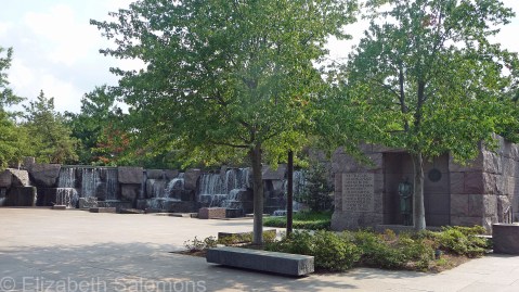
For one thing, there are no columns!
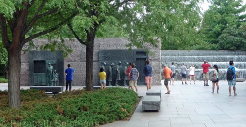
For another, it’s made not of white marble, but of red granite from South Dakota.

And, lastly, it’s spread out over 7.5 acres, half-hidden by a small copse of trees. It’s not a DC landmark in the way the other memorials are.
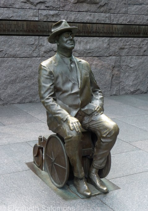
The memorial was designed to be accessible to people with disabilities, out of respect for FDR’s paralysis from polio. There are no steps or stairs anywhere.
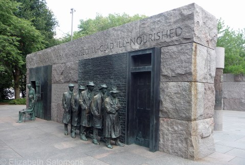
It’s also a new monument. Designed by a landscape architect named Lawrence Halprin, it took three years to build and was dedicated in 1997.
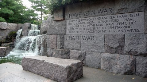
Franklin Delano Roosevelt, 32nd President of the United States, was in office from 1933 to 1945, for a total of twelve years, one month, one week, and one day. The memorial consists of a series of outdoor “rooms,” one for each of his four terms in office.

Each room contains a waterfall, and each waterfall is progressively larger and more complex to represent the increasingly difficult problems FDR faced during his presidency. I entered the memorial from the “wrong” side, however, so the symbolism was lost on me.

In addition to the waterfalls are various sculptures of FDR …
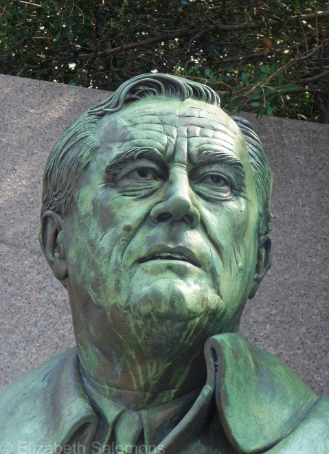
… and of significant events during his time in office, such as …

… the Fireside Chats (the radio addresses FDR made between 1933 and 1945) …

… and bread lines.

Scattered amongst the sculptures, carved into the granite walls, are words spoken by FDR. The above quotation is my favourite.

There is also a monument to the First Lady. Eleanor Roosevelt stands before the United Nations emblem to honour her role as one of the first delegates to the UN.

FDR served his country during one of the most turbulent decades of the 20th century. Ironically, I found his memorial to be the most peaceful of the presidential memorials I saw in DC.
Lincoln Memorial
The Lincoln Memorial made a strong impression on me, but it wasn’t the kind of impression I was expecting. Of all the presidential memorials, it was the one I was most anticipating ― and the one I found the most unsettling.
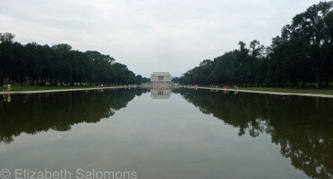
I visited the memorial on the Sunday morning of Labour Day weekend. Whereas I had had DC to myself a few days earlier, on this long-weekend Sunday, the place was crawling with people. As I walked towards the Mall from the Foggy Bottom metro station, and witnessed the first of many tantrums I would see that day from a child too young to appreciate the sights of DC, I should have realized it might be a frustrating day.

The thing is, I have a hard time with crowds. Especially when I come across them unexpectedly. I didn’t approach the memorial from the Reflecting Pool side (see above photos). I approached it from the Potomac River side. There was no one there, as you see in this photo.

So to come around the memorial and suddenly be surrounded by so many people ― well, it took me by surprise.

I felt uncomfortable mounting the steps with the hoards of other tourists ― it certainly felt like we were pilgrims entering a place of worship. It’s even called that― a temple. Says so right there on the wall, above the statue of Lincoln.

And the statue! At 19 feet tall, it’s more than overwhelming ― it’s overpowering. If he were standing, Lincoln would tower 28 feet above us mortals standing below. The original design called for a slightly larger-than-life-size statue, but then the sculptor, Daniel Chester French, and the architect, Henry Bacon, realized that a statue only 10 feet tall would be dwarfed by the surrounding structure. They made the decision to go larger, but the result is this imposing likeness of the man Americans consider a martyr and whom they call the saviour of the Union.
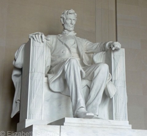
I have no issues with honouring the memory of a great man. Sixteenth President of the United States, Lincoln was in office from 1861 to 1865. The Civil War began a month after he took office; it ended a month after his assassination. I doubt there is a politician in office today who has any inkling of how tough his job was.

It’s the religious symbolism I’m not comfortable with. He was, after all, just a man. But as I was editing the photos for this blog post, I studied Lincoln’s face long and hard. I didn’t get a good look while I was there ― the statue is just too high and the place was just too crowded. And I thought about that crowd and wondered if my experience hadn’t been affected by how many people were there with me, sharing what I thought would be a special moment for me alone.
I know. I’m being selfish.
There were many people posing for the obligatory photo in front of Lincoln’s statue. But there were many more people talking to their children, who were listening carefully― no tantrums here. I hope those children remember what their parents taught them that day.

The Lincoln Memorial took eight years to build and was completed in 1922. It’s modelled after a Greek temple, with 36 Doric columns (more columns!) ― one for each state in the Union at the time of Lincoln’s death. Inside, in addition to the mega-statue of Lincoln, are inscriptions of the Gettysburg Address and Lincoln’s Second Inaugural Speech.
I’d like to go back and visit the memorial again someday. I’ll just time it a little better and avoid the place on the Sunday of a long weekend.
Jefferson Memorial
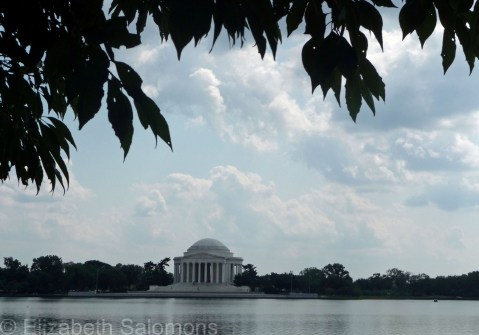
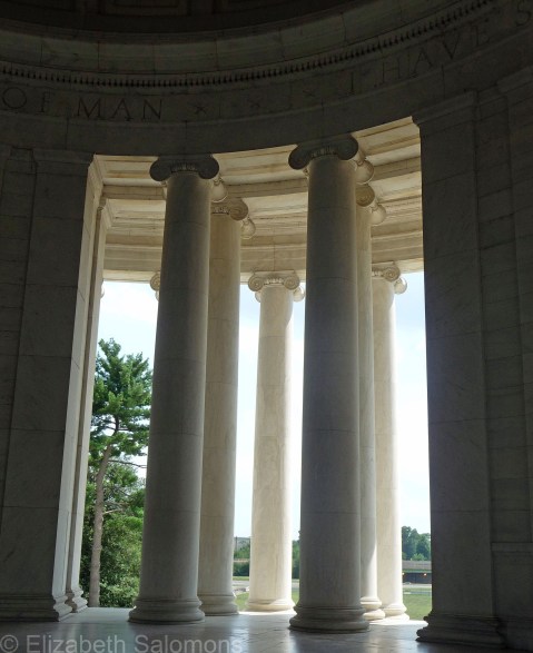
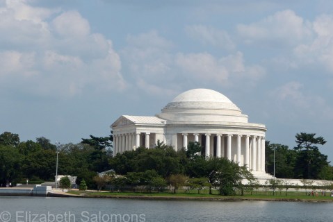
“We hold these truths to be self-evident, that all men are created equal, that they are endowed by their Creator with unalienable Rights, that among these are Life, Liberty and the pursuit of Happiness.”
So wrote Thomas Jefferson, third President of the United States. These words form the beginning of the Declaration of Independence. (The original is on display in the Rotunda at the National Archives, which I ducked in to see on my last day in DC. Bit faded, and impossible to read in the dim light of the Rotunda ― the low light is necessary to preserve the document ― but it’s thrilling to see the original, none the less.)
The Jefferson Memorial is on the far side of the Tidal Basin from the National Mall. Jefferson was in office from 1801 to 1809, but his memorial (which took five years to build) wasn’t completed until 1943. The architect, John Russell Pope, also designed the National Archives. Both have lots of columns. What is it with columns in this town?


Washington Monument
I have a whole whack of photos of the presidential monuments that surround the National Mall, which I will be doling out over the next few posts.
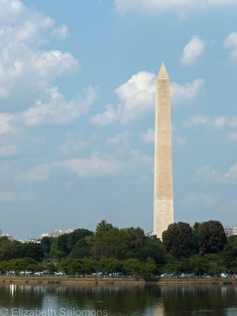
First up is the Washington Monument honouring George Washington, first President of the United States. He was in office from 1789 to 1797.
Made of marble, this obelisk stands at the mid-point of the National Mall, halfway between the Capitol and the Lincoln Memorial. Its construction was begun in 1848, but the Civil War and other squabbles interfered with its completion, and it wasn’t finished until 1884. For a few years, it held the record as the world’s tallest structure (it’s 555 feet high), until the Eiffel Tower overtook it. It still holds the record as the world’s tallest obelisk.
Normally you can go up inside the monument for what must be a nice view over DC, but an earthquake in 2011 damaged the structure, and it’s closed pending the necessary repairs. The scaffolding is scheduled to go up sometime this fall, but luckily I was able to take my photos sans scaffolding.
The Washington Monument doesn’t look like much in photographs, but when you get up close, it’s rather impressive.




Washington DC

Washington DC was a bit of a surprise to me. In some ways, it was exactly what I expected it would be. But in other ways, it was so much … more.

East Side of the Capitol
The landmarks were familiar, of course. We see them all the time on the news when TV reporters do their standups in front of the White House or the Capitol. Lots of white marble in those buildings. And columns. So many columns.
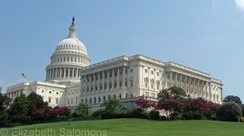
South Side of the Capitol
It was the scale of the place that took me by surprise. I thought it would be a short walk along the Mall from the Capitol to the Lincoln Memorial. But with all the stops I made along the way, it took me the better part of a day to make that walk.
As I walked, I kept muttering to myself, “So this is what a world capital looks like.” Later the word came to me: imperial. The place is rife with imperialism.
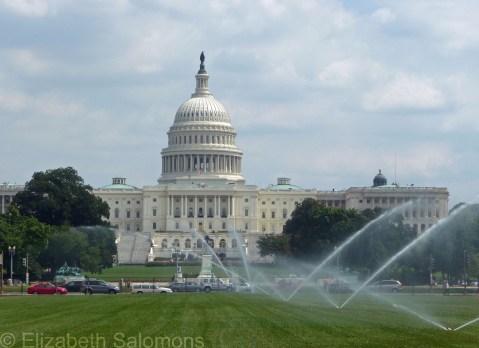
West Side of the Capitol
I kept comparing the buildings in DC to the ones in other world capitals I’ve been to (London, say, or Paris). The buildings in Europe are just as grand and just as impressive. But across the pond, there is far less open space, and the grand buildings often catch you by surprise as you turn a corner.

Washington Monument and the Mall as seen from the Capitol
In DC, you have this massive front lawn they call the National Mall that lets you take in all the key sights in one glance. From the Capitol, you look down the Mall directly at the Washington Monument. Beyond that, there’s the Lincoln Memorial. When you stand at the Washington Monument, you turn one way and have an unobstructed view of the White House, but when you turn the other way, the Jefferson Memorial leaps out at you.
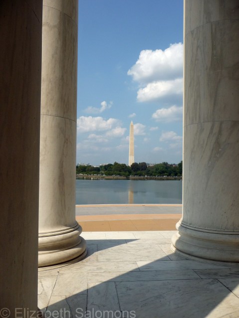
Washington Monument from the Jefferson Memorial
Washington DC is a city well-planned. Like other world capitals, DC was selected to be the capital of a young country some years after its founding. But what’s unique about DC among world capitals is that it was built from scratch. George Washington selected Pierre Charles L’Enfant, a French-born American, to design the city. L’Enfant envisioned a city centred around three points: the government house (which eventually came to be called the Capitol), the president’s house (what we now call the White House), and a monument to George Washington. Grand streets and avenues intersected at grand circles and squares. The Mall, in L’Enfant’s mind, would be the grandest avenue of them all. A narrower avenue (Pennsylvania Avenue) ran between the Capitol and the White House.

Pennsylvania Avenue
Visionary that he was, L’Enfant was no project manager, and he was soon fired by George Washington. He died in poverty, but eventually was honored with a re-internment in Arlington National Cemetery. His true epitaph, though, is the city he designed.

Arlington Memorial Bridge
I spent two days in DC and was able to check off most everything (but not quite everything) on my to-do list. It was the Smithsonian that caught me up; I was barely able to make a start on it.
For more on that, stay tuned.
St. Paul’s Chapel

One of the most impressive buildings I saw during my recent visit to New York City was St. Paul’s Chapel in Lower Manhattan. The Twin Towers used to stand next door to this tiny church, and One World Trade Center is now under construction across the street from it.

St. Paul’s Chapel was built in 1766 and is the only Colonial-era church left in Manhattan. George Washington worshipped here on April 30, 1789, after he took the oath of office to become the first President of the United States.

The building survived the Great Fire of New York in 1776. It also survived the September 11 attacks, and suffered no damage at all other than being covered with dust and debris. It is now known as “the little chapel that stood.”

St. Paul’s became a place of refuge and rest in the days and months following the destruction of the Twin Towers, offering round-the-clock care for the thousands of volunteers working at Ground Zero. Massage therapists, podiatrists, and chiropractors, as well as parish staff, ministered to the firefighters, police, and construction workers. Today the chapel contains several memorials to those first responders and volunteers.
Charm City
I’m going to leave New York for a while, and move on to Baltimore, which is where I was for most of last week. Baltimore, I discovered, has the dubious moniker of “Charm City.” Apparently the mayor of Baltimore asked some advertisers to come up with a marketing slogan to help the city improve its image (this was back in the mid-1970s when Baltimore’s image badly needed improving) and that’s what they came up with. Somehow, it stuck.
My introduction to Baltimore wasn’t quite so charming. As I was thinking about what to write for this post, I realized it’s been a while since I’ve experienced a first impression of a city. Most of my travels lately have been to cities or countries I’ve been to before, some of them multiple times. Impressions then are as much about memory (of previous visits) as they are about new experiences.
There is nothing, however, like the first impression. Impressions can and do change the longer you spend in a place, or the more times you return. But you can never again have a first look at a city once you’ve been there.
In short: I’m no longer a Baltimore virgin.
My first glimpse of Baltimore on the bus from New York was of streets after streets of “the vacants” — the boarded-up row houses you see on the TV show The Wire. It’s one thing to see images like that on a TV show; it’s a kick in the gut to see them in real life, and to see real people (as opposed to actors) sitting on the stoops of those boarded-up houses as you drive by. I don’t know that I’ve seen similar neighbourhoods anywhere in Canada. Maybe they exist, and I’m just ignorant about the realities of poverty in Canada. But I don’t think so. Not that many houses and not that many streets.
Baltimore is south of the Mason-Dixon line. (Although Maryland was part of the Union during the Civil War, it contributed troops to both the Union and the Confederate armies.) So … that puts Baltimore pretty far south. The climate is hot, humid, and pretty uncomfortable in August. (And that was after it had cooled down from earlier in the summer, my sister informed me.)
The only reason I was in Baltimore was to visit my sister, and the only reason she lives in Baltimore is to study at Johns Hopkins University. She lives near the university, which is slightly north of downtown Baltimore. Navigating Baltimore’s public transit system once you’re out of range of the Charm City Circulator, the bus that travels around the downtown core and into select neighbourhoods (Fast! Friendly! FREE!), can be frustrating. It strikes me that life in Middle America if you’re below a certain income level can be really, really difficult.
Sports draw a lot of tourists to Baltimore, I’m told. Boston fans come down for the Orioles–Red Sox games, and the Preakness Stakes is run every May at Pimlico. The Inner Harbor has a wide variety of activities and restaurants to suit a wide variety of tastes, and there are some interesting neighbourhoods outside of the downtown core, such as hipsterish Hampden, and historic Fells Point along the waterfront. The local microbrew (Dogfish Head) is very hoppy, the local specialty (crab cakes) is very tasty, and Bawlmorians put Old Bay Seasoning on everything.
I don’t know if I’ll ever make it back to Baltimore, so my first impressions of the city might end up being my only impressions. But it was good to see where my sister has been hanging out these last few years, and it was good to see a part of the United States that was new to me.


Central Park
I’m sure you are beginning to wonder if all I did in New York was explore its parks — and I assure you I did a whole lot more — but I have to finish this series of posts about New York parks with just one more. Then I will move on. Promise.
Central Park is the jewel of New York’s parks, and one of my favourite places in New York. Each time I visit the city, I make sure to save an afternoon to wander about the park.
At 843 acres and with a perimeter of six miles, it covers six percent of the island of Manhattan. There are 21 playgrounds, 36 bridges and arches, 9000 benches, and 24,000 trees. It opened in 1857, and is the most visited city park in the United States, with 38 million people visiting it every year. (That’s 38 million, folks. Every year.)
This year, I was one of them.


