
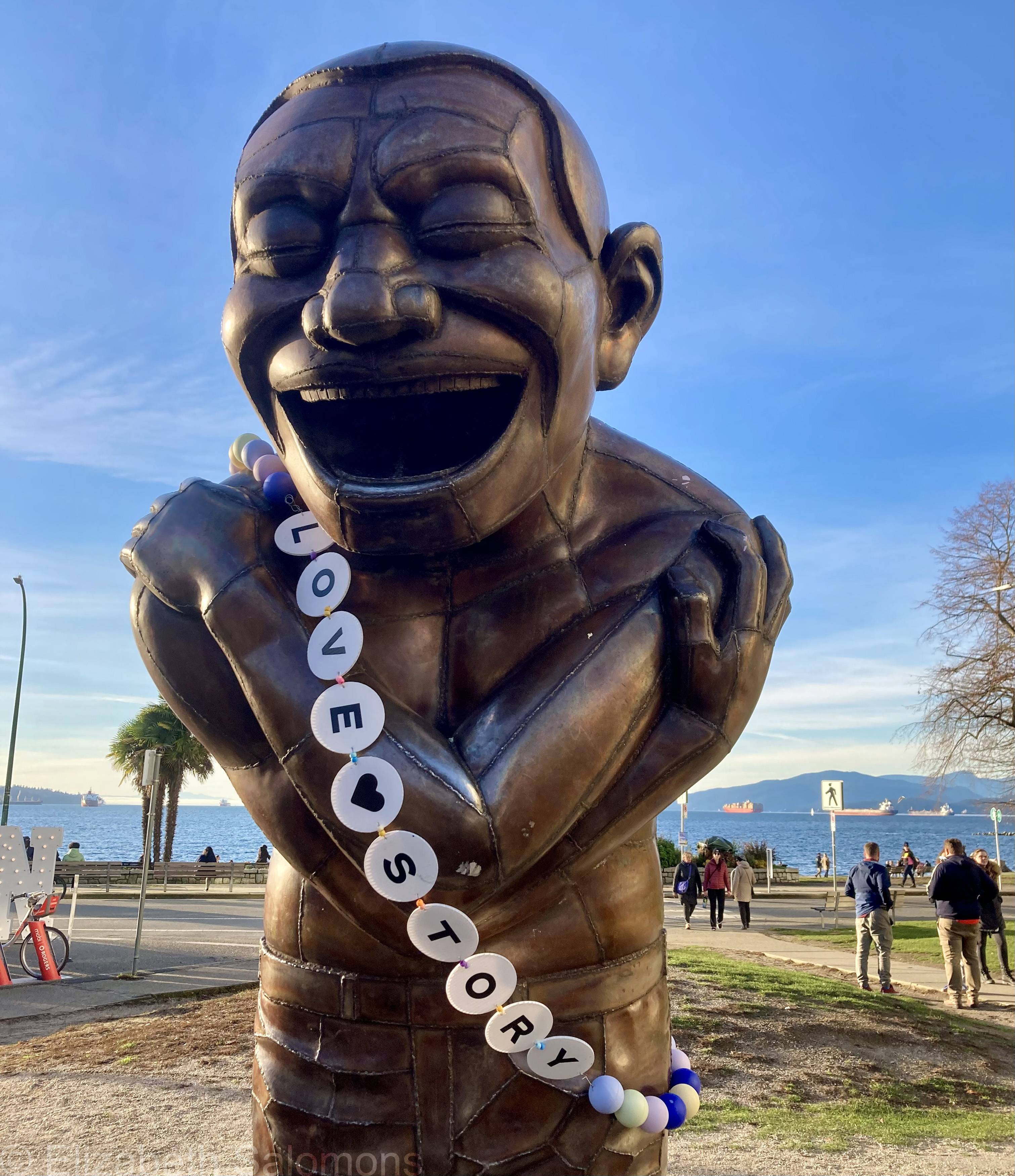
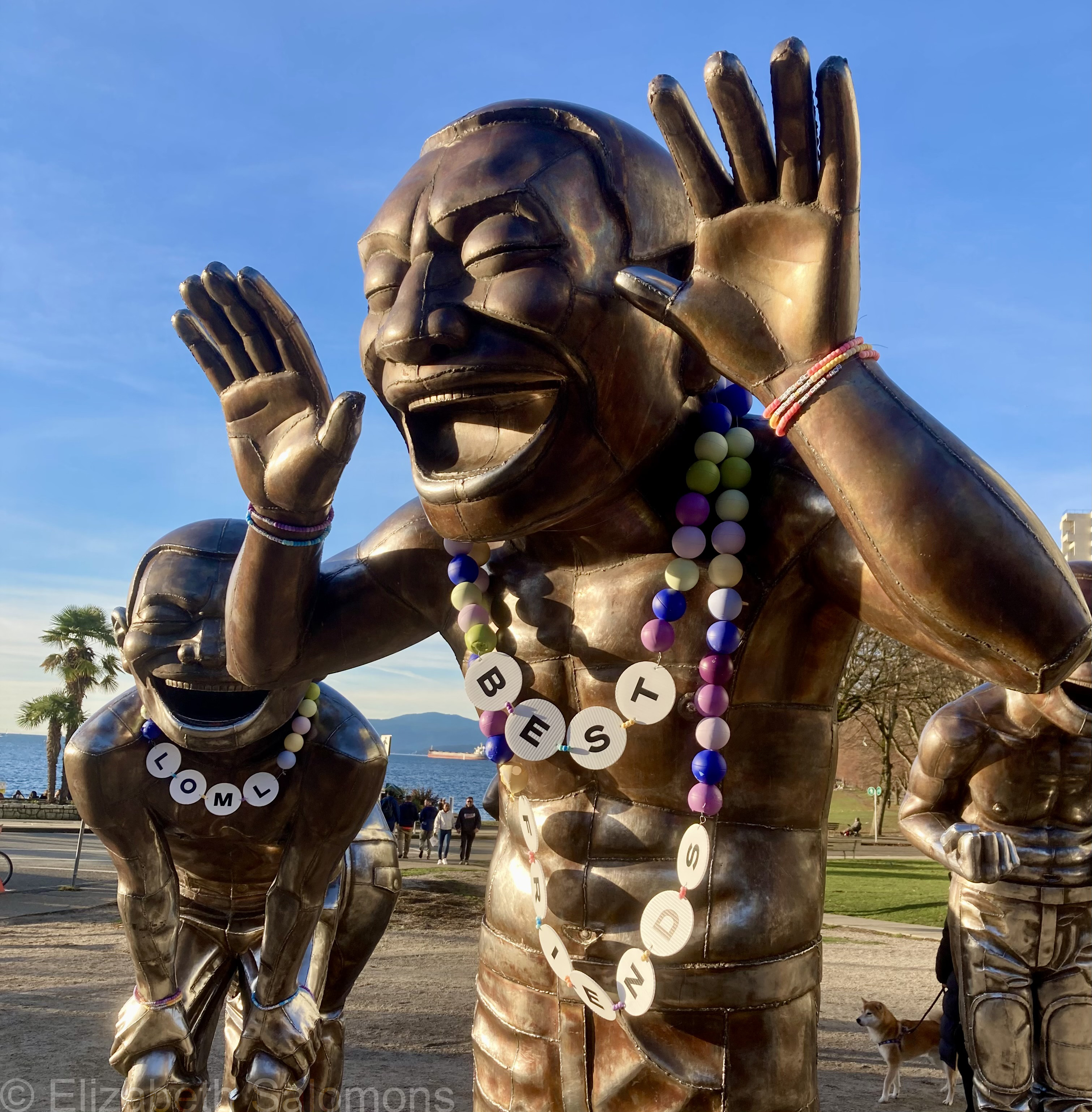
The End of the Eras Tour
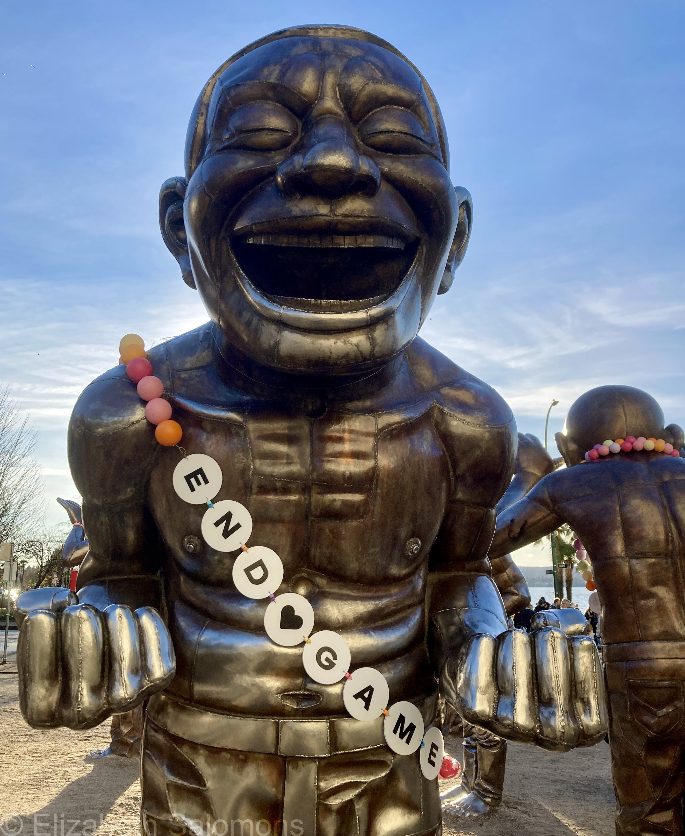
The hype is real, folks.
Honestly, I don’t think I have ever seen as much anticipation over a bunch of concerts. Yes, it’s Taylor Swift. Yes, she is a megastar. Yes, it’s the end of her tour. But this city has lost its mind.
And I love it.
It’s been a long time since we all came together over a cultural event of this magnitude. It reminds me a lot of when we hosted the Olympics.
For weeks now, we’ve been warned about the upcoming traffic chaos. Three concert nights, two Canucks’ home games, and, oh yeah, Cirque du Soleil is in town. These venues are all within spitting distance of each.
But hey, we’re among friends, right? It should all be fine.
Where the Streets Have Names
Here we are, finally. Last month of the year, last post on Hawaii.
One thing you notice as soon as you start moving around Oahu are the unique street names. Unique to English speakers, that is. For the most part, they are all in Hawaiian. I absolutely love it.
There are plenty of places in Canada with Indigenous names. Kitsilano is a Vancouver neighbourhood that takes its name from the Squamish Chief Jack Khatsahlano. Chilliwack, Kamloops, and Saanich are BC cities with names that have Indigenous origins. And Canada is from the Haudenosaunee word “kanata,” which means village.
And yet … Vancouver streets are predominately named for dead white guys. True fact: there are more streets in Vancouver named after golf courses than women or people of colour combined. My own street is the anglicized name of a chief of the Okanagan people, something I found out only while researching this post. Wouldn’t it be much more interesting if the nsyilxcən spelling was used instead of English?
In Canada, land acknowledgements before public events are routinely recited to recognize those who have lived here since time immemorial. Here’s the one I use on my work email signature:
I acknowledge that I am privileged to live and work on the unceded traditional territories of the Coast Salish Nations, including the xwməθkwəy̓əm (Musqueam), Skwxwú7mesh (Squamish), and səl̓ilwətaɁɬ (Tsleil-Waututh) Nations.
Land acknowledgements are all well and good, but maybe it is far past time that we begin replacing the names of some of the many, many streets currently named after insignificant European men with Indigenous names. The Hawaiians have done it. Why can’t we?
Just a thought.

Royal Hawaiian Mai Tai
Speaking of historical Hawaii, one of the places I insisted we go while on Oahu was the Royal Hawaiian Hotel. This illustrious hotel, now part of the Marriott chain, has stood on Waikiki Beach since 1927. It’s one of those hotels you can only dream about ever staying at. Happily, though, the dining options were within our budget and we enjoyed mai tais and poke at the outdoor Mai Tai Bar overlooking the beach.
Full disclosure: I don’t even like rum, but I lost count of how many mai tais I enjoyed during our week in Hawaii.
(What can I say? When in Rome … )

Historical Hawaii
Remember James Michener? Author of super long books with super short titles that were on all the bestseller lists? Many years ago, I got about a third of the way through one of his books, Hawaii. It was a valiant effort, but ultimately I was defeated by its 1130 pages.
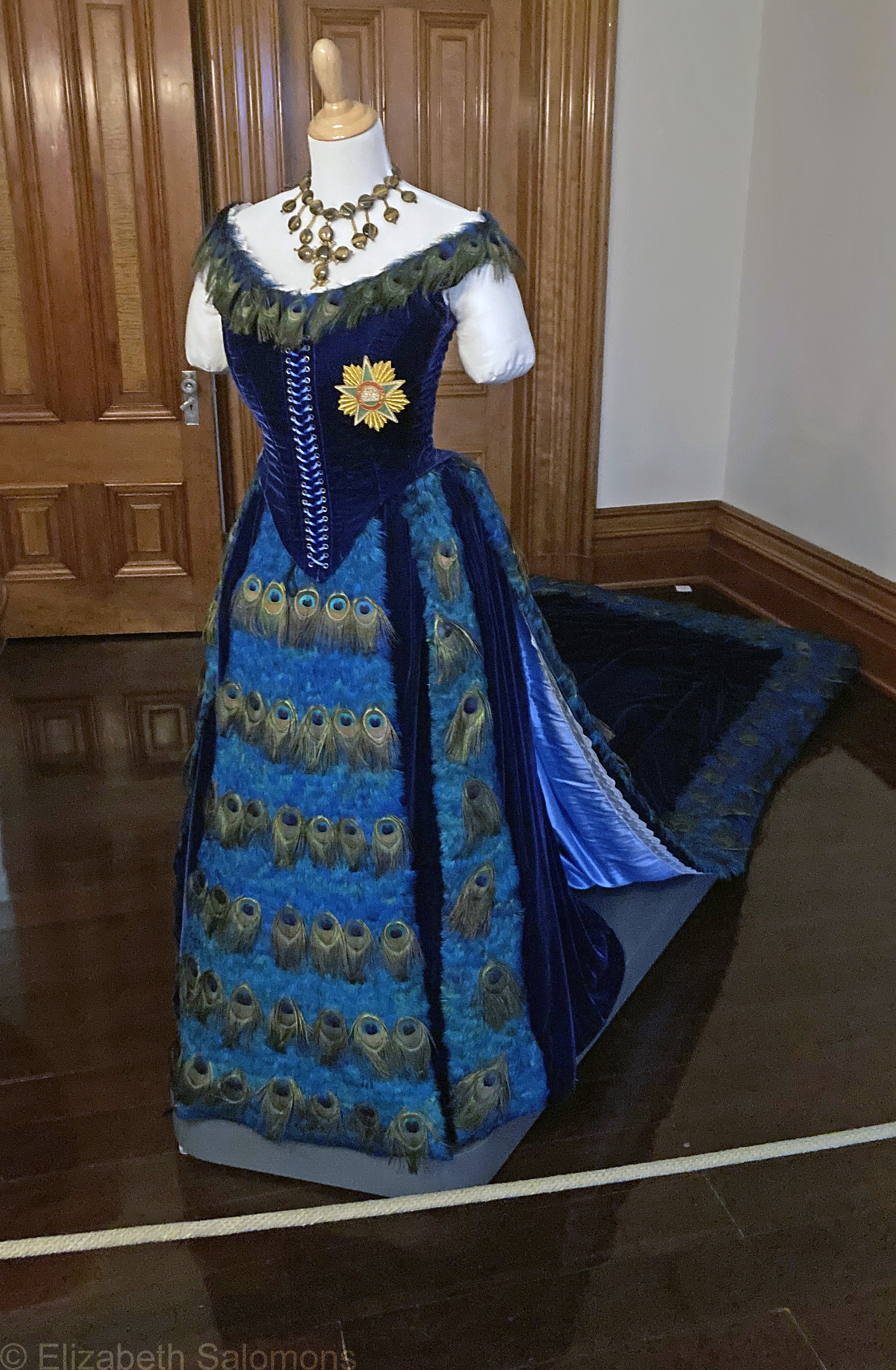
My mom finished the book, though. I have a distinct memory of her rant about the some of the characters in Michener’s novel — the American missionaries, to be precise. How stupid, she said, that they insisted on wearing fashions more suited to New England than the hot, tropical climate of Hawaii.
So imagine my surprise, as I took a deep dive into Hawaii’s colonial history last winter, when I learned that the Hawaiian royals also preferred Victorian fashion. This dress, for example. It’s a replica of the Peacock Gown that Queen Kapi‘olani wore to Queen Victoria’s Golden Jubilee in 1887.
I was also surprised to learn that Hawaii came this close to becoming a part of the British Empire. The first European to sail to the islands was the English explorer James Cook — he arrived in 1778. We’ll skip over the part where he was killed by the Hawaiians and jump ahead to George Vancouver, a member of Cook’s crew who returned with his own expedition in 1792, and again in 1793 and 1794. Vancouver became good friends with King Kamehameha I, and Hawaii became the base for British trade in the Pacific. It was Kamehameha who wanted the Union Jack as part of the Hawaiian flag that was adopted in 1816.
However, around this time, an assortment of missionaries was making advances in the Pacific. Amongst themselves, the British and American missionaries divided the Pacific between them: the British would restrict their evangelistic efforts to the south of the Equator, and the Americans went north. The Hawaiians would have preferred the reverse arrangement; Kamehameha II even went to England to arrange for a formal agreement with the King.
But as time went on, Hawaiian trade was increasingly linked to the US economy. Hawaiian independence suffered a fatal blow when a group of white planters and businessmen overthrew the last Hawaiian monarch, Queen Lili’uokalani, in January of 1893. She was held prisoner in her own palace for eight months. Formal annexation with the US took place in 1898 when the Spanish–American War made Hawaii a critical base for the American military while they were fighting in the Philippines, and the islands attained statehood in 1959.
About that deep dive into Hawaii’s colonial history: it took place here, at Honolulu’s Bishop Museum.

And also here, at Iolani Palace.

Bishop Museum was established in 1889 by Charles Reed Bishop to house objects and heirlooms of his wife, Princess Bernice Pauahi Bishop, last heir of the royal Kamehameha family. It is now considered the best collection of natural and cultural history in the Pacific, and it’s a great way to get a crash course in Hawaiian history in just a few hours.
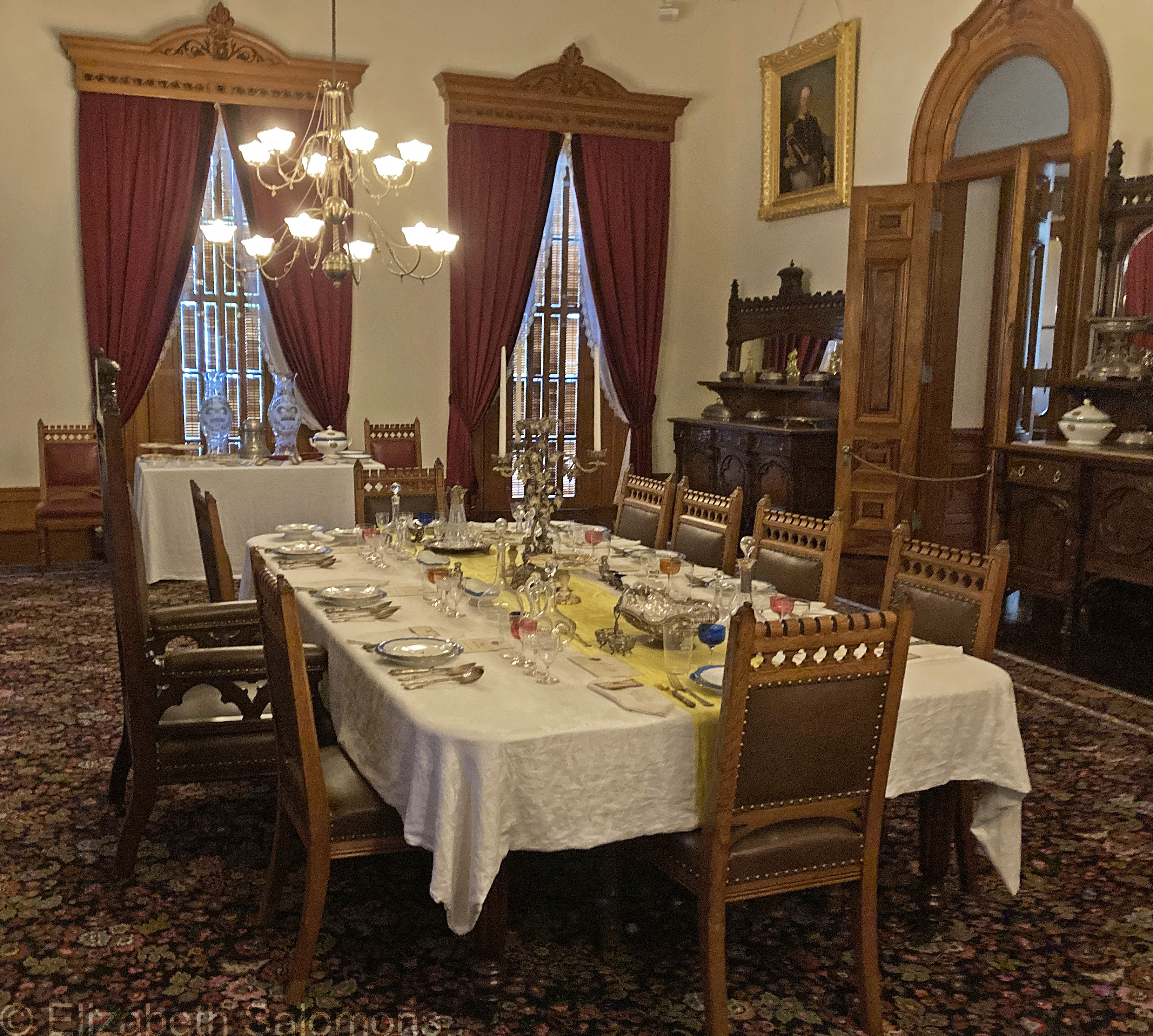
Iolani Palace, located in downtown Honolulu, served as the State Capital until 1969. When it was built in the 1880s, it was fitted out with electric lights, indoor plumbing, and telephones — all modern conveniences far ahead of their time. It is the only official residence of royalty in the United States.
I still have my mother’s copy of Hawaii. And one of these days, I will finish the novel, now that I have a better and more complete understanding of the history of Hawaii.
Museum of Anthropology

One of Arthur Erickson’s most iconic buildings, completed in 1976, is the Museum of Anthropology at the University of British Columbia. It sits on traditional and unceded territory of the Musqueam people, at the tip of Point Grey, facing the Salish Sea.
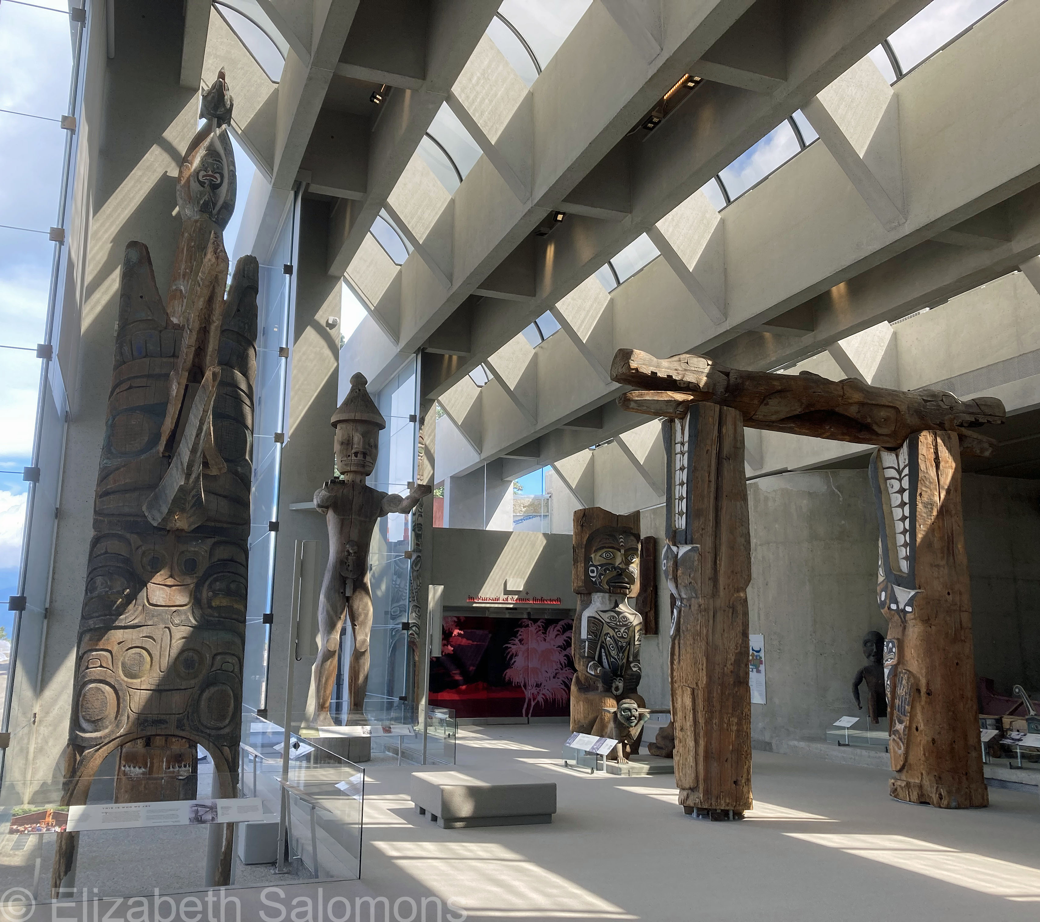
I’m told that the post-and-beam construction was inspired by the architecture of the Northwest Coast First Nations. The floor-to-ceiling windows of the Great Hall let in all the light. And when you stand outside and look back at the museum, you see the sky reflected back at you.

The building incorporates several World War II gun placements. Rather than ripping them out, Erickson incorporated them into the building’s design. One has been repurposed as the base for Raven and the First Men, a sculpture by Haida artist Bill Reid.
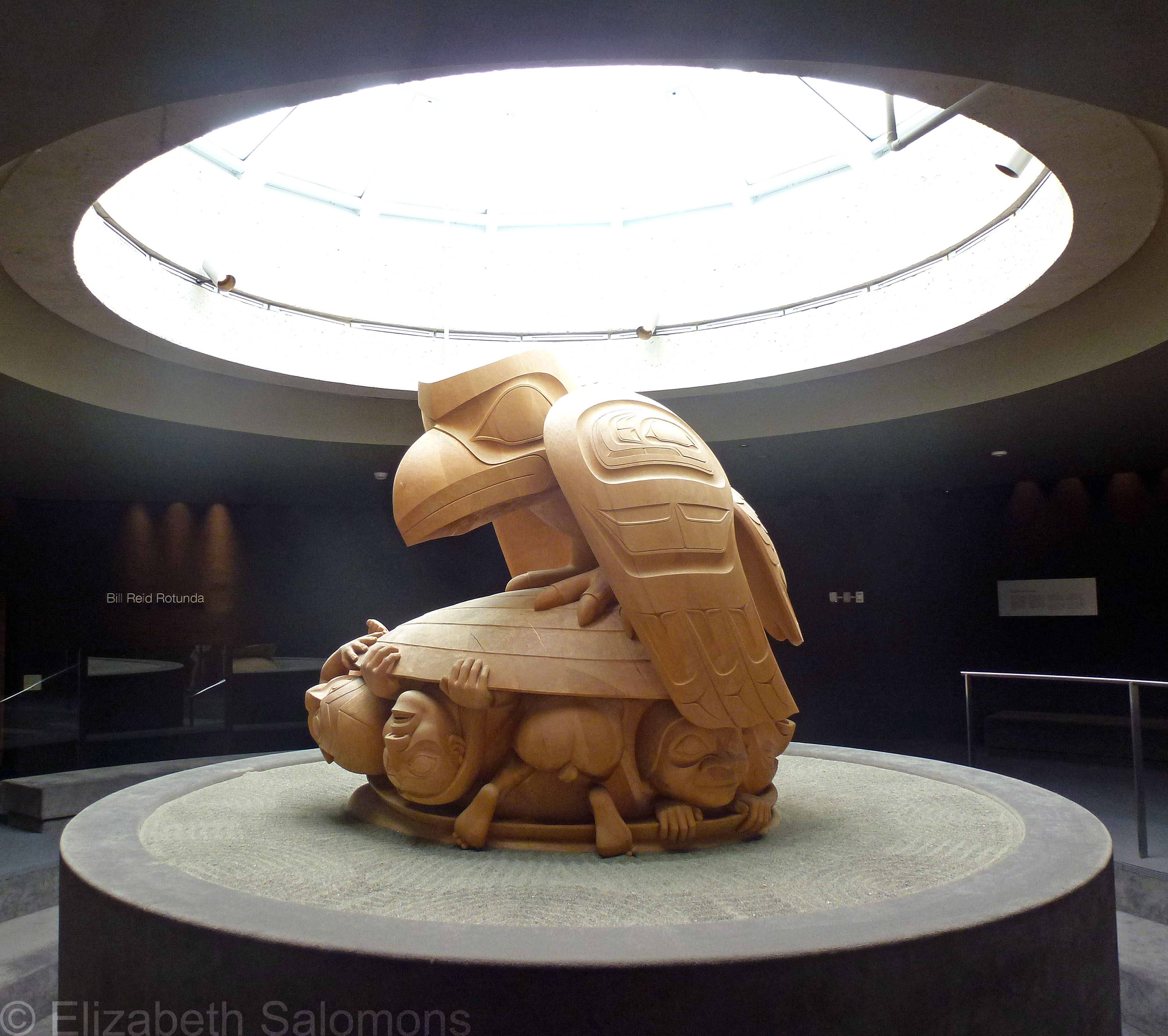
The Museum of Anthropology began in 1949 as a department of the Faculty of Arts at UBC. It has one of the world’s best collections of Indigenous art and is particularly known for its Northwest Coast collection. In 2023, the museum closed to undergo a seismic upgrade that involved completely rebuilding the 25 concrete pillars of the Great Hall. It reopened again last June in time for the centenary of Erickson’s birth.

Trees of Oahu

As remarkable as the flowers of Oahu are, I find the trees almost more so.

Why is that? Simply because they are so different from the trees you see in Canada.
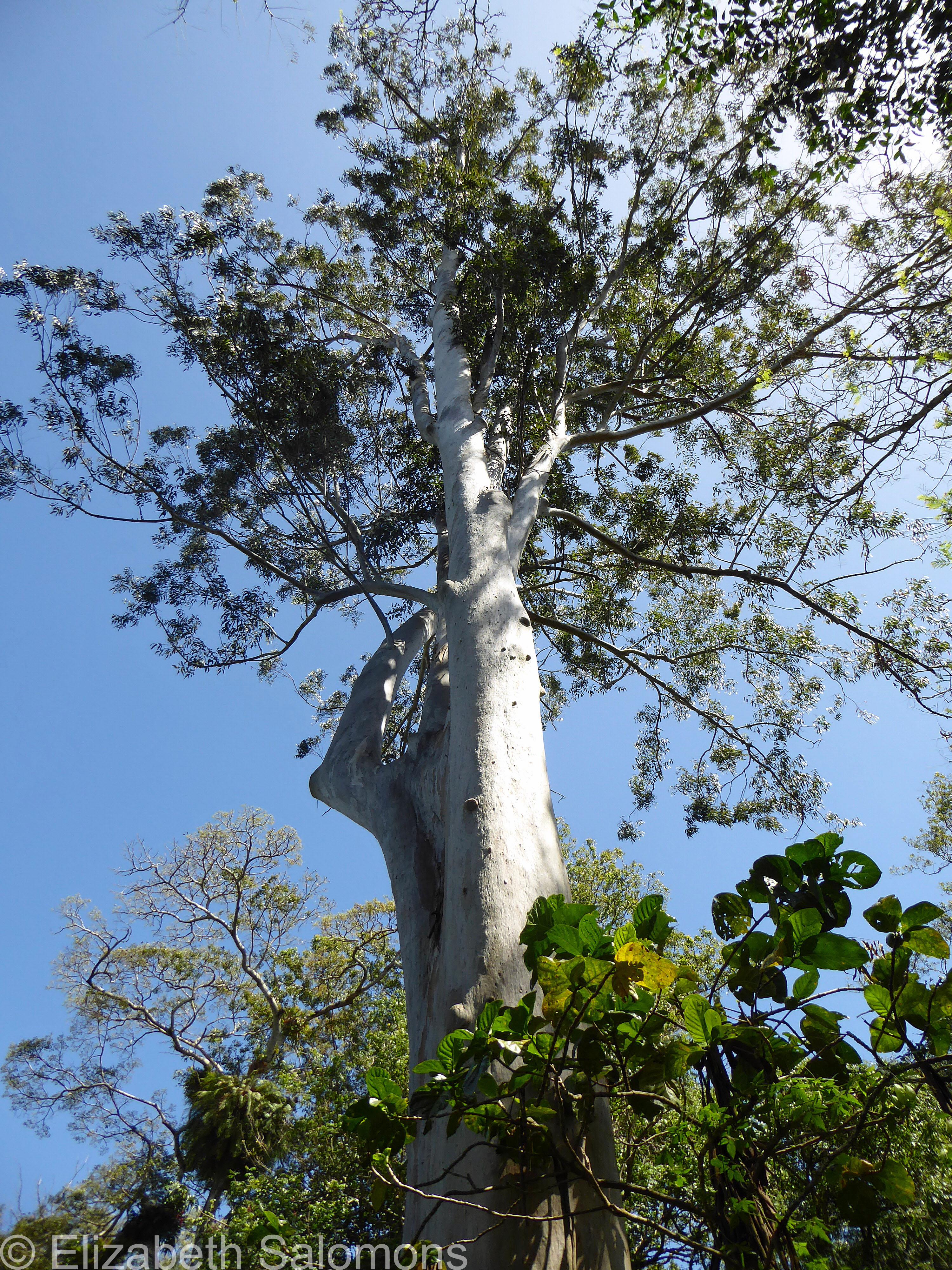
I don’t know all the names of the ones I’m showing you here, but I do know the name of this flowering tree.

The ʻōhiʻa lehua is the most widespread of Hawaii’s native trees. It’s an evergreen in the myrtle family, comes in both shrub and tree form, and is one of the first plants to grow over lava flows. As such, it’s an important plant for rebuilding the ecosystem after a volcanic eruption. The most common type has bright red flowers, but there are also varieties with orange or yellow flowers.

There is a legend associated with this tree’s name. ʻŌhiʻa and Lehua were lovers, but Pele, the goddess of fire and volcanoes, demanded that ʻŌhiʻa abandon Lehua and declare his love for her instead. ʻŌhiʻa refused. Furious at his rejection, Pele turned herself into a column of fire and ʻŌhiʻa into a twisted ugly tree. Lehua burst into tears in front of the tree that used to be Ōhiʻa and begged Pele to turn her into a tree as well. Pele ignored her, but the other gods took pity on Lehua and transformed the sparks of fire in her hair into bright red flowers, which they placed on the tree. It is said that if you pick the flowers of the ōhiʻa lehua tree, it will rain. The raindrops are Lehua’s tears, because she cannot bear to be separated from Ōhiʻa.
Flowers of Oahu

You’ve seen it, I’m sure, in old movies. The traditional Hawaiian greeting upon arrival, where a garland of flowers, called a lei, is placed around the neck of the person arriving. The practice dates back to the early Polynesians who came by boat from Tahiti to Hawaii.
A lei can be made from any object — leaves, shells, feathers — but the one we all think of is made with flowers. The lei is a symbol of love and friendship and aloha. Although used as a casual greeting in the Hawaiian Islands, aloha has a much more spiritual meaning for native Hawaiians.
The flowers of Hawaii are everywhere. Here, have a look. I have no idea if all of these are native to Hawaii, but they sure do make it beautiful.


Cinque Terre

Here in Vancouver, we’re going through the first atmospheric river of the season this weekend, and I’m finding it hard not to feel green with envy toward anyone who might be vacationing in much more pleasant climes right now.
Like, oh, I dunno, Italy?
Except, it turns out that the folks I know who are vacationing in Italy right now aren’t immune to bad weather either.
Cinque Terre (literally “five lands”) is a collection of villages along Italy’s northwest coast. Connected by train and hiking trails, Monterosso al Mare, Vernazza, Corniglia, Manarola, and Riomaggiore are collectively one of the most stunning areas of Italy.
My people had gone to Cinque Terre on my recommendation, but no sooner had they arrived when they learned that the trails, the restaurants, and the shops were closing the next day due to inclement weather.
Above is a photo I took some years ago of Vernazza, Corniglia, and Manarola from one of the hiking trails above Monterosso al Mare. And below is a train pulling into the station at Manarola. It’s easy to see from the terraced landscape and steep cliffs why heavy rains are a problem in Cinque Terre — in fact, floods and mudslides devastated the villages in 2011, killing nine people.
My family was able to rejig their itinerary and head to Tuscany a few days early. I felt bad they missed out on spending time in such a special part of Italy, but, as I always say, when you don’t get to see everything on your list, it just means you have a very good reason to go back.

MacMillan Bloedel Building
Ahem.
I promised you a series of blog posts about Arthur Erickson buildings that have shaped Vancouver, way back in (checks notes) June.
What can I say? A glorious BC summer got in my way and I’ve been spending as much time away from my computer as possible. I’m sure you understand.
However, I do want to showcase those buildings, and so, here we go.
First up is the MacMillan Bloedel Building that stands prominently in the centre of downtown Vancouver.

It was completed in 1968 and is a typical example of Brutalism, the style of architecture the dominated the middle of the previous century.
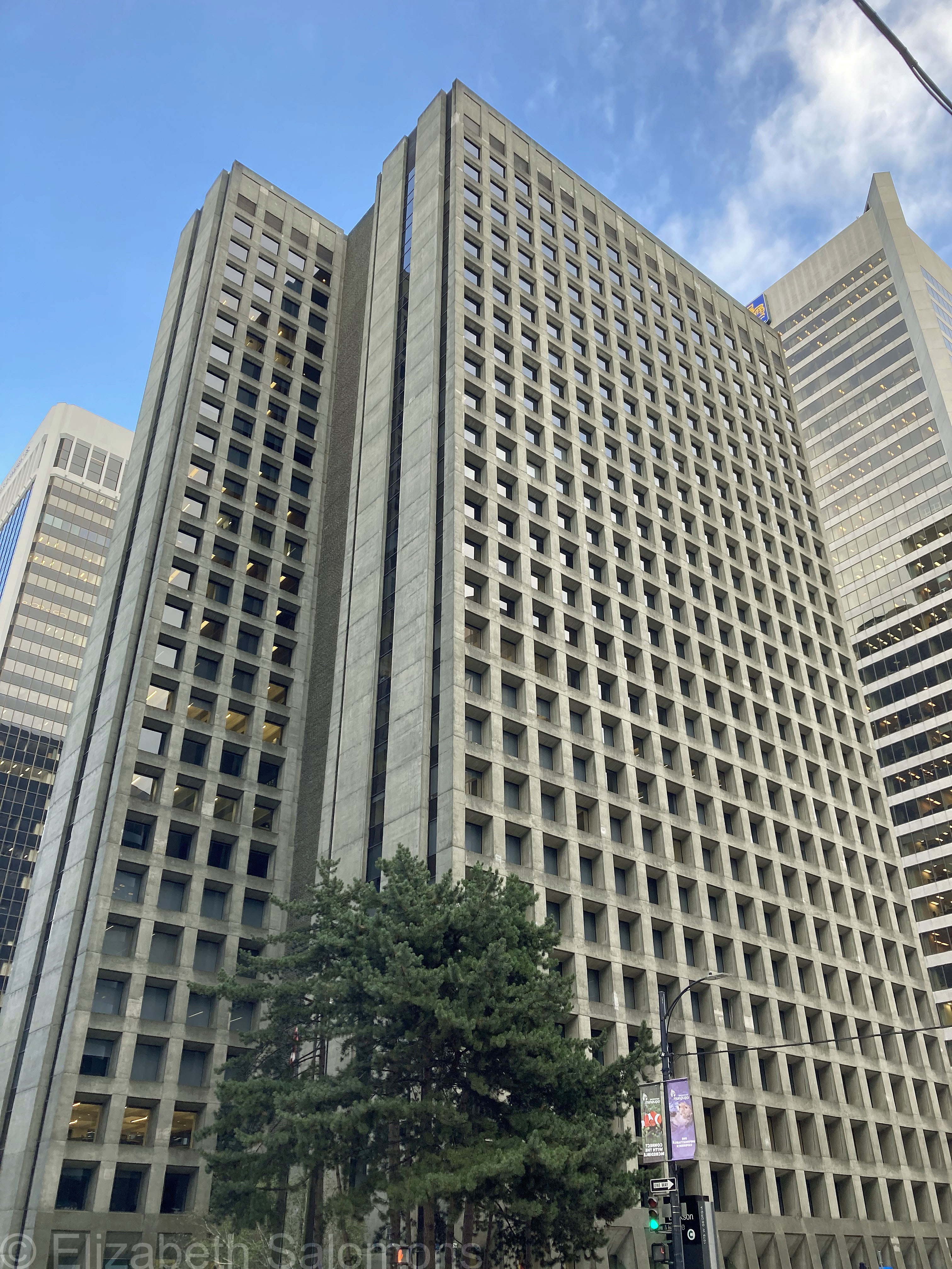
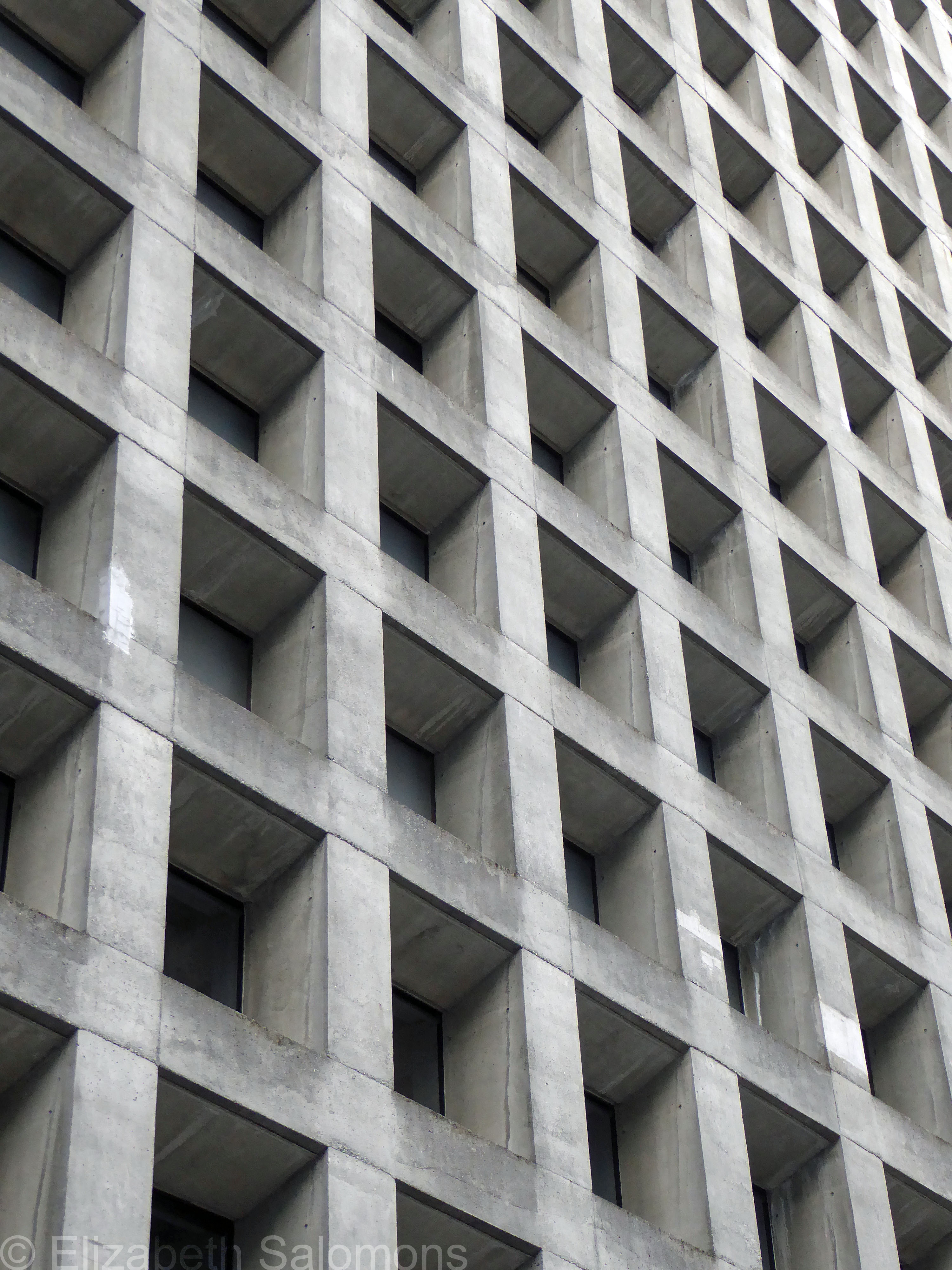
Each window measures 7 feet by 7 feet and is a single pane of glass. The lobby is separated from the street by a series of sunken pools and concrete planters filled with trees and other vegetation.
Standing 27 storeys tall, the MacMillan Bloedel Building was the tallest in Vancouver when finished. It was built to house the headquarters of MacMillan Bloedel, a forestry company that hasn’t existed for 25 years. Although it was renamed Arthur Erickson Place in 2019, it’s still commonly referred to as the MacBlo Building.

Through My Lens: Beech Tree

We are well and truly into the season where we start paying attention to the trees around us, and what will be eventually be some pretty spectacular colours.
Until then, here’s a beech tree I photographed last weekend in Stanley Park. Also pretty spectacular, even though its leaves haven’t yet turned.
